- Nectar, Alabama
-
Nectar, Alabama — Town — Location in Blount County and the state of Alabama
Coordinates: 33°58′9″N 86°38′11″W / 33.96917°N 86.63639°W Country United States State Alabama County Blount Area – Total 1.8 sq mi (4.7 km2) – Land 1.8 sq mi (4.7 km2) – Water 0 sq mi (0 km2) Elevation 512 ft (156 m) Population (2000) – Total 372 – Density 206.7/sq mi (79.1/km2) Time zone Central (CST) (UTC-6) – Summer (DST) CDT (UTC-5) FIPS code 01-53448 GNIS feature ID 0123668 Nectar is a town in Blount County, Alabama, United States. At the 2000 census the population was 372.
Contents
Geography
Nectar is located at 33°58'8.846" North, 86°38'10.522" West (33.969124, -86.636256)[1].
According to the U.S. Census Bureau, the town has a total area of 1.8 square miles (4.7 km2), of which, 1.8 square miles (4.7 km2) of it is land and 0.55% is water.
Demographics
As of the census[2] of 2000, there were 372 people, 141 households, and 110 families residing in the town. The population density was 204.8 people per square mile (78.9/km²). There were 158 housing units at an average density of 87.0 per square mile (33.5/km²). The racial makeup of the town was 97.31% White, 1.88% from other races, and 0.81% from two or more races. 2.69% of the population were Hispanic or Latino of any race.
There were 141 households out of which 39.7% had children under the age of 18 living with them, 68.8% were married couples living together, 7.1% had a female householder with no husband present, and 21.3% were non-families. 19.1% of all households were made up of individuals and 9.2% had someone living alone who was 65 years of age or older. The average household size was 2.64 and the average family size was 3.02.
In the town the population was spread out with 25.3% under the age of 18, 10.2% from 18 to 24, 26.9% from 25 to 44, 26.9% from 45 to 64, and 10.8% who were 65 years of age or older. The median age was 37 years. For every 100 females there were 103.3 males. For every 100 females age 18 and over, there were 112.2 males.
The median income for a household in the town was $44,167, and the median income for a family was $49,250. Males had a median income of $31,563 versus $24,583 for females. The per capita income for the town was $16,408. About 14.0% of families and 11.5% of the population were below the poverty line, including 18.0% of those under age 18 and 13.2% of those age 65 or over.
References
- ^ "US Gazetteer files: 2010, 2000, and 1990". United States Census Bureau. 2011-02-12. http://www.census.gov/geo/www/gazetteer/gazette.html. Retrieved 2011-04-23.
- ^ "American FactFinder". United States Census Bureau. http://factfinder.census.gov. Retrieved 2008-01-31.
External links
Coordinates: 33°58′09″N 86°38′11″W / 33.969124°N 86.636256°W
Municipalities and communities of Blount County, Alabama Cities 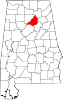
Towns Allgood | Altoona‡ | Blountsville | Cleveland | County Line‡ | Garden City‡ | Hayden | Highland Lake | Locust Fork | Nectar | Rosa | Snead | Susan Moore
CDP Unincorporated
communitiesBalle Mobile Home Park | Bangor | Hopewell | Mount High
Footnotes ‡This populated place also has portions in an adjacent county or counties
Categories:- Populated places in Blount County, Alabama
- Towns in Alabama
- Birmingham–Hoover metropolitan area


Wikimedia Foundation. 2010.