- Allgood, Alabama
:"Allgood" redirects here. This is also a common name of
Smearwort ("Aristolochia rotunda").Infobox Settlement
official_name = Allgood, Alabama
settlement_type =Town
imagesize =
image_caption =
image_
imagesize =
image_caption =
image_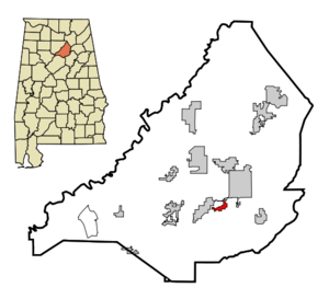
mapsize = 250px
map_caption = Location in Blount County and the state ofAlabama
mapsize1 =
map_caption1 =
subdivision_type = Country
subdivision_type1 = State
subdivision_type2 = County
subdivision_name =United States
subdivision_name1 =Alabama
subdivision_name2 = Blount
government_type =
leader_title =
leader_name =
established_date =
area_magnitude =
area_total_km2 = 2.7
area_total_sq_mi = 1
area_land_km2 = 2.7
area_land_sq_mi = 1
area_water_km2 = 0
area_water_sq_mi = 0
elevation_ft = 787
elevation_m = 240
population_as_of =2007
population_footnotes = cite web|url=http://www.census.gov/popest/cities/tables/SUB-EST2007-04-01.csv|title=Annual Estimates of the Population for Incorporated Places in Alabama|publisher=United States Census Bureau |date=2008-07-10|accessdate=2008-07-14]
population_total =712
population_metro =
population_density_km2 = 233
population_density_sq_mi = 629
timezone = Central (CST)
utc_offset = -6
latd = 33 |latm = 54 |lats = 15 |latNS = N
longd = 86 |longm = 30 |longs = 59 |longEW = W
timezone_DST = CDT
utc_offset_DST = -5
postal_code_type =ZIP code
postal_code = 35013
area_code = 205
blank_name = FIPS code
blank_info = 01-01396
blank1_name = GNIS feature ID
blank1_info = 0113021
footnotes =
website =Allgood is a town in Blount County,
Alabama ,United States . At the 2000 census the population was 629. According to the 2005U.S. Census estimates, the town had a population of 693. [http://www.census.gov/popest/cities/files/SUB-EST2005-all.csv] The mayor of Allgood, Alabama, is Nell Payne. The "Welcome to Allgood" sign on the outskirts of the town has an upside-down 'G'. This error has since been corrected by the mayor.Geography
Allgood is located at coor dms|33|54|15|N|86|30|59|W|city (33.904216, -86.516428)GR|1.
According to the
U.S. Census Bureau , the town has a total area of 1.0square mile s (2.7km² ), all of it land.Demographics
As of the
census GR|2 of 2000, there were 629 people, 189 households, and 140 families residing in the town. Thepopulation density was 606.6 people per square mile (233.5/km²). There were 198 housing units at an average density of 190.9/sq mi (73.5/km²). The racial makeup of the town was 83.94% White, 0.32% Black or African American, 0.48% Native American, 12.08% from other races, and 3.18% from two or more races. 43.40% of the population were Hispanic or Latino of any race.There were 189 households out of which 40.7% had children under the age of 18 living with them, 62.4% were married couples living together, 8.5% had a female householder with no husband present, and 25.9% were non-families. 18.5% of all households were made up of individuals and 7.4% had someone living alone who was 65 years of age or older. The average household size was 3.33 and the average family size was 3.80.
In the town the population was spread out with 30.7% under the age of 18, 14.8% from 18 to 24, 34.3% from 25 to 44, 15.4% from 45 to 64, and 4.8% who were 65 years of age or older. The median age was 28 years. For every 100 females there were 109.0 males. For every 100 females age 18 and over, there were 116.9 males.
The median income for a household in the town was $29,583, and the median income for a family was $30,750. Males had a median income of $31,058 versus $25,486 for females. The
per capita income for the town was $11,729. About 23.4% of families and 27.3% of the population were below thepoverty line , including 33.9% of those under age 18 and 8.7% of those age 65 or over.References
External links
Wikimedia Foundation. 2010.