- Cwmfelin Mynach
-
Cwmfelin Mynach is a tiny Carmarthenshire village. It has a population of only 64 residents.
The river Gronw runs through the centre of the village under a stone bridge. In the medieval period the river was used to drive a corn mill. 'Cwmfelin Mynach' means Valley (cwm) of the Monks' (Mynach) Mill (Felin). It was founded in the 6th century by the Cistercian monks or Whitefriars. These monks gave their name to the nearby town, Whitland. Outside Whitland, it is the oldest Cistercian monastery in the UK. Sadly much of the limestone has been looted or used for other buildings after Henry VIII's dissolution of the monasteries. Some of the stone from Whitland Priory is suspected to have been used for the building of St. Brynach's Church, Llanboidy.
Notable curiosities in this bilingual Welsh and English speaking village include the practice of baptising in the river. The river Gronw which starts at Blaenwaun (one of the highest inhabited villages in the West Wales peninsula) runs through Cwmfelin Mynach. At the lowest point in the village, persons are brought down stone steps and immersed in the river. The steps, quarried from local slate, can still be seen near the apex of the 'U' bend on a minor country lane heading north east (co-oridinates aproxminately lat 51°53'44.11"N. Long 4°34'20.75"W).
Remnants of two small disused slate quarries can still be seen, hidden within trees and vegetation.
The remains of a cock-fighting bunker is visible deep in a beechwood. This practise has not gone on for many years.
Notable residents include Andy 'Heavy Beard' Walton - Lifelong resident and extreme woodland enthusiast.
Facilities
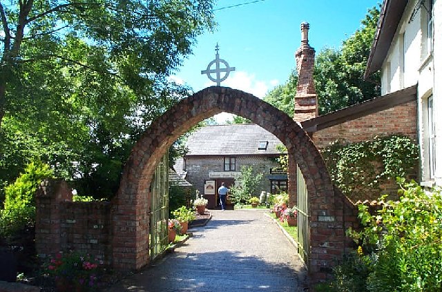
 "Pemberton's Chocolate Farm", farm buildings converted into a place were luxury chocolates are made
The village has no public house or post office. It has a small garage repair business.
A Welsh-speaking chapel has regular services in the village. Carmarthenshire County Council holds regular meetings at the chapel. The present chairman of Carmarthenshire County Council
Some of the cottages in the village date back to the 19th century. They are remarkable in the sense that they are built with the same form of slate that is reminiscent of the underlying geology. A blue 'Llandovery' slate in geological terms. The stone for cottage building came from three, now dis-used, quarries in the village.
In recent years there have been new developments which threaten the village's unique character. Bungalows of concrete block formation have been approved by the council's planning department.
The village has recently had underground fibre-optic cables laid. This is ready for television when the large TV mast at Crymych is dismantled.
There is no mains gas in the village or sewage treatment. Every home uses septic tanks. The water is pumped to the village from the reservoir underneath the Preseli Mountains.
Flora and fauna
The village boasts an array of flora and fauna. Most notable is a pair of red kites that lives near the village. Buzzards are seen everyday and nest by the river on tall trees. Tawny owl call at night and sparrowhawk roam through woodland. Wood pigeon, rock dove, heron and jackdaws are common. The latter are particularly adept at nesting in the chimneys of old cottages. Siskin are autumn visitors. Bullfinch and brambling can be seen. Grey wagtail can be seen fishing by the river.
A profusion of daffodils in early spring is welcomed by the residents. Marsh marigold by the river, wood sorrel and wood avens on the river bank. The Caraway flower comes in summer in damp pasture near the river. The Caraway is the county flower of Carmarthenshire and is similar in appearance to the lady's smock, or cuckoo flower. Purple orchid near some silver leaf limes at the top of the village. The dominant trees are beech and ash. Some sycamore and oaks to a lesser degree. Yellow pimpernel can be seen for short periods in shady banks under ash trees. Red campion, stitchwort and bluebell create a magnificent Red, White and Blue to the hedgerows in spring. Dog violet and birds foot trefoil grow for shorter periods.
Categories:- Villages in Carmarthenshire
Wikimedia Foundation. 2010.