- Netherlee
-
Coordinates: 55°47′N 4°17′W / 55.79°N 4.28°W
Netherlee 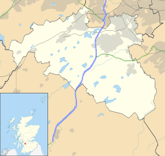
 Netherlee
Netherlee shown within East RenfrewshirePopulation 4,741 OS grid reference NS575585 - Edinburgh 43 mi (69 km) ENE - London 342 mi (550 km) SSE Council area East Renfrewshire Lieutenancy area Renfrewshire Country Scotland Sovereign state United Kingdom Post town GLASGOW Postcode district G44 Dialling code 0141 Police Strathclyde Fire Strathclyde Ambulance Scottish EU Parliament Scotland UK Parliament East Renfrewshire Scottish Parliament Eastwood List of places: UK • Scotland • Netherlee is a small, affluent residential area (population 4,741) within East Renfrewshire, Scotland. Netherlee's close proximity to Glasgow effectively makes it a suburb of the city, though it remains administratively separate.
Its residents have a mainly professional background, and it is increasingly attracting wealthy young families. Both are attracted by the area's proximity to Glasgow city centre, 15 minutes by train from Muirend or Clarkston stations (on each side of the area) and around 25 minutes by bus (routes 66 and 44).
Local businesses and amenities include clothing stores, newsagents, hairdressers and florists. The area borders Linn Park, a popular and pretty mainly wooded area which includes walking trails, football pitches, and a public golf course. The district includes Williamwood Golf Club, which is private.
Contents
History
Up until the latter part of the 19th century, Netherlee was a small rural village along the main road from Glasgow to Clarkston (the present day Netherlee Road). Many local residents were employed in the printworks on the bank of the River Cart.[1]
The early years of the 20th century saw the first phase of urbanisation, with the development of the present line of Clarkston Road and the shifting of the settlement's focus westwards along this new route from Cathcart and Muirend to Clarkston. From this time onwards, new housing developments, typically red sandstone terraces, began to eat up former agricultural land. Due to building restrictions as a result of the First World War, however, it was not until the 1920s that the majority of residential streets off the main artery were fully developed as they appear today.[1]
Governance
Although now contiguous with Glasgow, Netherlee remains outwith the city's boundary in the unitary authority area of East Renfrewshire. For local electoral purposes, Netherlee was formerly a ward electing a single councillor to East Renfrewshire Council, however it has now been grouped with Stamperland and Williamwood as a larger multi-member ward electing three councillors.
Historically, the Netherlee area was part of the county of Renfrewshire. Although Renfrewshire was abolished as an area of local government in 1975, it continues to exist as both a Lieutenancy area and registration county, with Netherlee included in both. At a lower level, Netherlee also formed part of the ancient parish of Cathcart, which formed the lowest tier of local government between 1845 and 1930.
Following the abolition of the counties in 1975, Netherlee became a part of the new Eastwood District within Strathclyde Region under the two tier system of local government which lasted until the creation of the present unitary authorities in 1996.
In the Parliament of the United Kingdom, Netherlee is represented in the House of Commons as part of the county constituency of East Renfrewshire. The current Member of Parliament (MP) is Jim Murphy of the Labour Party. For the Scottish Parliament, Netherlee forms part of the Eastwood constituency within the West of Scotland electoral region. As such it is currently represented by Kenneth Macintosh (also Labour) as the constituency Member of the Scottish Parliament (MSP) in addition to the seven regional list MSPs.
Geography

Merrylee Muirend White Cart Water / Cathcart Giffnock 
White Cart Water / Castlemilk  Netherlee

Stamperland Carmunnock Education
There is one non-denominational primary school in the area, Netherlee Primary School. It was opened in 1933 to serve the growing population and was extensively modernised and expanded in the 1990s. It currently has 25 classes and a roll of around 730. It is one of the highest ranked public primary schools in Britain following their HMIE Report. It acts as a feeder for Williamwood High School in Clarkston. St Ninian's High School in Giffnock is the closest secondary school for Roman Catholic education.
Notable people
The ex-Celtic, and now, Spartak Moscow player and Republic of Ireland International, Aiden McGeady, grew up in the area.
The Scottish folk singer, Alastair McDonald lives in the area.
External links
- White Cart Walkway - Section of walk from Cathcart to Netherlee.
- Portal to the Past - Netherlee
- Netherlee Primary School
References
- ^ a b "Netherlee". Portal to the Past. East Renfrewshire Council. http://www.portaltothepast.co.uk/heritage/heritage_places/heritage_netherlee.htm. Retrieved 2008-05-19.
East Renfrewshire Towns Villages Other settlements and suburbs See also Website: www.eastrenfrewshire.gov.uk Categories:- Suburbs in East Renfrewshire

Wikimedia Foundation. 2010.