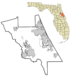
- Creighton, Florida
-
Creighton — unincorporated community — Coordinates: 28°53′15″N 80°55′19″W / 28.8875°N 80.92194°WCoordinates: 28°53′15″N 80°55′19″W / 28.8875°N 80.92194°W Country  United States
State  Florida
County Volusia Settled Elevation 30 ft (9 m) Time zone Eastern (EST) (UTC-5) - Summer (DST) EDT (UTC-4) enter ZIP code 32141 Area code(s) 386 GNIS feature ID 295226[1] Creighton is an unincorporated community in Volusia County, Florida, United States. It is situated on a former railroad station near the Farmton State Wildlife Management Area. Today, it is a rural community near Interstate 95. There are two roads that lead there; Volco Road and Cow Creek Road, accessible from ether CR 4147 or SR 442.
History
The community was named after E. R. Creighton who owned a mill there in 1911.[2]
References
- ^ "US Board on Geographic Names". United States Geological Survey. 2007-10-25. http://geonames.usgs.gov. Retrieved 2008-01-31.
- ^ Morris, Allen Covington; Joan Perry Morris (1995). Florida Place Names: Alachua to Zolfo Springs. Sarasota, Florida: Pineapple Press. http://books.google.com/books?id=dp5kwOwlBeYC&pg=PT20&dq=alamana+florida&hl=en&ei=CVpZTtzrNKTr0gGur4ioDA&sa=X&oi=book_result&ct=result&resnum=5&ved=0CEEQ6AEwBA#v=onepage&q&f=false.
Municipalities and communities of Volusia County, Florida Cities Daytona Beach | Daytona Beach Shores | DeBary | DeLand | Deltona | Edgewater | Flagler Beach‡ | Holly Hill | Lake Helen | New Smyrna Beach | Oak Hill | Orange City | Ormond Beach | Port Orange | South Daytona
Towns CDPs Unincorporated
communitiesAlamana | Allandale | Barberville | Bethune Beach | Boden | Cassadaga | Cow Creek | Creighton | Eldora | Emporia | Enterprise | Farmton | Fort Florida | Lemon Bluff | Maytown | Osteen | Pennichaw | Senyah | Seville | Volusia | Wilbur-By-The-Sea
Footnotes ‡This populated place also has portions in an adjacent county or counties
Categories:- Unincorporated communities in Volusia County, Florida
- Florida geography stubs
Wikimedia Foundation. 2010.


