- Pierson, Florida
Infobox Settlement
official_name = Pierson, Florida
other_name =
native_name =
nickname =
settlement_type =Town
motto =
imagesize =
image_caption =
flag_size =
image_
seal_size =
image_shield =
shield_size =
image_blank_emblem =
blank_emblem_type =
blank_emblem_size =
imagesize =
image_caption =
flag_size =
image_
seal_size =
image_shield =
shield_size =
image_blank_emblem =
blank_emblem_type =
blank_emblem_size =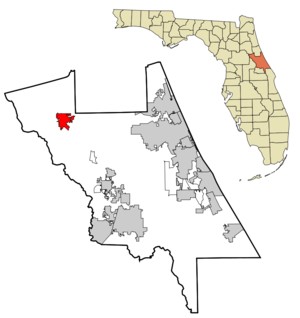
mapsize = 250x200px
map_caption = Location in Volusia County and the state ofFlorida
mapsize1 =
map_caption1 =
image_dot_
dot_mapsize =
dot_map_caption =
dot_x =
dot_y =
pushpin_
pushpin_label_position =
pushpin_map_caption =
pushpin_mapsize =
subdivision_type = Country
subdivision_name = flag|United States
subdivision_type1 = State
subdivision_name1 = flag|Florida
subdivision_type2 = County
subdivision_name2 = noflag|Volusia
subdivision_type3 =
subdivision_name3 =
subdivision_type4 =
subdivision_name4 =
government_footnotes =
government_type =
leader_title =
leader_name =
leader_title1 =
leader_name1 =
leader_title2 =
leader_name2 =
leader_title3 =
leader_name3 =
leader_title4 =
leader_name4 =
established_title =
established_date =
established_title2 =
established_date2 =
established_title3 =
established_date3 =
area_magnitude =
unit_pref =
area_footnotes =
area_total_km2 = 22.7
area_land_km2 = 21.1
area_water_km2 = 1.6
area_total_sq_mi = 8.7
area_land_sq_mi = 8.1
area_water_sq_mi = 0.6
area_water_percent =
area_urban_km2 =
area_urban_sq_mi =
area_metro_km2 =
area_metro_sq_mi =
area_blank1_title =
area_blank1_km2 =
area_blank1_sq_mi =
population_as_of = 2000
population_footnotes =
population_note =
population_total = 2596
population_density_km2 = 114.4
population_density_sq_mi = 298.4
population_metro =
population_density_metro_km2 =
population_density_metro_sq_mi =
population_urban =
population_density_urban_km2 =
population_density_urban_sq_mi =
population_blank1_title =
population_blank1 =
population_density_blank1_km2 =
population_density_blank1_sq_mi =
timezone = Eastern (EST)
utc_offset = -5
timezone_DST = EDT
utc_offset_DST = -4
latd = 29 |latm = 14 |lats = 30 |latNS = N
longd = 81 |longm = 27 |longs = 24 |longEW = W
elevation_footnotes =
elevation_m = 23
elevation_ft = 75
postal_code_type =ZIP code
postal_code = 32180
area_code = 386
blank_name = FIPS code
blank_info = 12-56425GR|2
blank1_name = GNIS feature ID
blank1_info = 0288798GR|3
website =
footnotes =Pierson is a town in Volusia County,
Florida ,United States . The population was 2,596 at the 2000 census. As of2004 , the population recorded by theU.S. Census Bureau is 2,606 [http://www.census.gov/popest/cities/tables/SUB-EST2004-04-12.xls] .About Pierson
*Pierson is the northernmost incorporated town in
Volusia County .
*"Fern Capital of the World"
*Pierson is heavily reliant on agriculture which mainly consists offern growing. Its ferns are exported worldwide for use in floral arrangements and other decorations.
*Pierson is the hometown ofAtlanta Braves starChipper Jones .
*Historic US 17 runs through the town.Geography
Pierson is located at coor dms|29|14|30|N|81|27|24|W|city (29.241713, -81.456594)GR|1.
According to the
United States Census Bureau , the town has a total area of 22.6km² (8.7 mi²). 21.1 km² (8.1 mi²) of it is land and 1.6 km² (0.6 mi²) of it (6.86%) is water.Demographics
As of the
census GR|2 of 2000, there were 2,596 people, 484 households, and 378 families residing in the town. Thepopulation density was 123.1/km² (319.1/mi²). There were 514 housing units at an average density of 24.4/km² (63.2/mi²). The racial makeup of the town was 81.93% White, 4.93% African American, 0.27% Native American, 0.08% Asian, 11.48% from other races, and 1.31% from two or more races. Hispanic or Latino of any race were 62.44% of the population.There were 484 households out of which 43.2% had children under the age of 18 living with them, 61.2% were married couples living together, 10.5% had a female householder with no husband present, and 21.9% were non-families. 18.0% of all households were made up of individuals and 9.5% had someone living alone who was 65 years of age or older. The average household size was 3.35 and the average family size was 3.71.
In the town the population was spread out with 21.7% under the age of 18, 18.7% from 18 to 24, 38.4% from 25 to 44, 14.2% from 45 to 64, and 6.9% who were 65 years of age or older. The median age was 28 years. For every 100 females there were 142.6 males. For every 100 females age 18 and over, there were 149.9 males.
The median income for a household in the town was $26,773, and the median income for a family was $27,461. Males had a median income of $30,247 versus $14,605 for females. The
per capita income for the town was $12,450. About 22.8% of families and 33.6% of the population were below thepoverty line , including 39.9% of those under age 18 and 21.8% of those age 65 or over.References
External links
Wikimedia Foundation. 2010.