North Branch Pawtuxet River
- North Branch Pawtuxet River
-
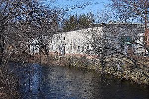
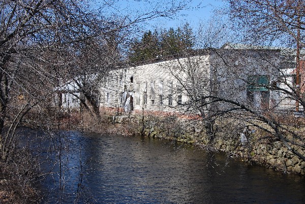
North Branch Pawtuxet River at Harris Mill Village
The North Branch Pawtuxet River is a river in the U.S. state of Rhode Island. It flows approximately 8.9 miles (14.3 km).[1] There are 9 dams along the river's length.[2]
Course
The river is formed by the confluence of the Ponaganset and Moswansicut rivers in the area that is now flooded by the Scituate Reservoir, the primary drinking water supply for the city of Providence and surrounding towns. From the reservoir, it flows southeast through the historic textile mill villages of Hope, Arkright, Harris, Phenix, Lippitt and then into River Point, West Warwick where it converges with the South Branch Pawtuxet River to form the main branch of the Pawtuxet River.
Crossings
Below is a list of all crossings over the North Branch Pawtuxet River. The list starts at the headwaters and goes downstream.
- Scituate
- Scituate Avenue (RI 12) (Historic R.I. Bridge)
- Main Street (RI 116)
- Colvin Street
- West Warwick
- Lincoln Avenue
- Fairview Avenue
- Main Street (RI 115)
Tributaries
In addition to many unnamed tributaries, the following brooks also feed the North Branch Pawtuxet:
- Burlingame Brook
- Clarke Brook
- Lippitt Brook
See also
References
- ^ U.S. Geological Survey. National Hydrography Dataset high-resolution flowline data. The National Map, accessed April 1, 2011
- ^ Governor's Task Force on Dam Safety and Maintenance – Final Report, January 2001
Categories: - Rivers of Providence County, Rhode Island
- Rivers of Kent County, Rhode Island
Wikimedia Foundation.
2010.
Look at other dictionaries:
South Branch Pawtuxet River — The South Branch Pawtuxet River is a river in the U.S. state of Rhode Island. It flows approximately 12 km (8 mi). There are 11 dams along the river s length. [ [http://www.dem.ri.gov/programs/benviron/compinsp/pdf/damrep01.pdf Governor s Task… … Wikipedia
Pawtuxet River — The Pawtuxet River is a river in the U.S. state of Rhode Island. It flows approximately 18 km (11 mi) and drains a watershed of convert|231.6|sqmi|km2. There are four dams along the river s length. [http://www.dem.ri.gov/programs/benviron/compinsp… … Wikipedia
Moshassuck River — The Moshassuck River at the North Burial Ground in Providence. View is downstream as the river is about to head into a concrete channel underneath Interstate 95. The Moshassuck River is a river in the U.S. state of Rhode Island. It flows 8.9… … Wikipedia
Pettaquamscutt River — The Pettaquamscutt River (also known as Narrow River) is a tidal extension of the Mattatuxet River in the U.S. state of Rhode Island. It flows approximately 6.3 miles (10.1 km).[1] There are no dams along the river s length. Contents 1… … Wikipedia
Mattatuxet River — The Mattatuxet River is a river in the U.S. state of Rhode Island. It flows approximately 3 km (2 mi). There are two dams along the river s length.[1] Contents 1 Course 2 Crossings 3 Tributaries … Wikipedia
Moswansicut River — The Moswansicut River is a river in the U.S. state of Rhode Island. It flows approximately 6.2 miles (10.0 km), including its portion within the Scituate Reservoir.[1] There are two dams along the river s length.[2] Contents 1 Course 2 … Wikipedia
Mishnock River — The Mishnock River is a river in the U.S. state of Rhode Island. It flows 3.1 miles (5.0 km).[1] There are two dams along the river s length.[2] Contents 1 Course 2 Crossings … Wikipedia
Chipuxet River — The Chipuxet River is a river in the U.S. state of Rhode Island. It flows approximately 8.5 miles (13.7 km).[1] There are two dams along the river s length.[2] The river is used as the main drinking water supply for the University of Rhode… … Wikipedia
Clear River (Rhode Island) — The Clear River is a river in the U.S. state of Rhode Island. It flows approximately 10.1 miles (16.3 km).[1] There are five dams along the river s length.[2] Contents 1 Course 2 Crossings … Wikipedia
Chepachet River — The Chepachet River is a river in the U.S. state of Rhode Island. It flows 5.2 miles (8.4 km).[1] There are eight dams along the river s length.[2] Contents 1 Course 2 Crossings … Wikipedia