Chockalog River

Chockalog River
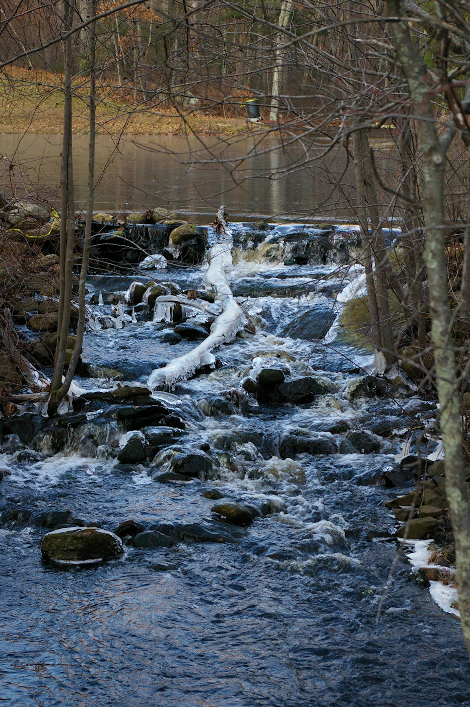
Chockalog
Chockalaug
River
Brook Road crossing upstream view
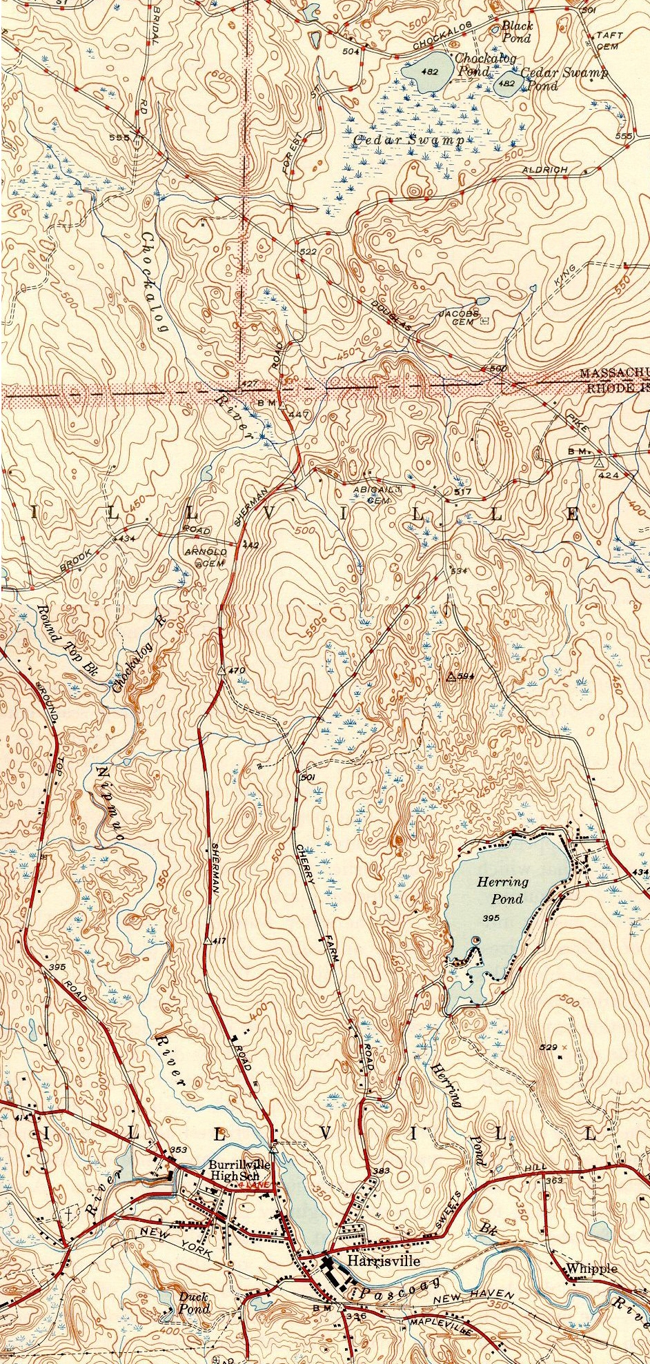
Name origin: Algonquian for fox place
Country United States
States Massachusetts, Rhode Island
Source confluence Greene and Cedar Swamp Brooks
 - elevation 439 ft (134 m)
 - coordinates 42°1′4″N 71°41′11″W / 42.01778°N 71.68639°W / 42.01778; -71.68639
Mouth Nipmuc River
 - elevation 377 ft (115 m)
 - coordinates 41°59′45″N 71°41′24″W / 41.99583°N 71.69°W / 41.99583; -71.69
Length 2.2 mi (4 km)
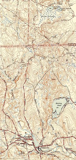
Chockalog River and environs

The Chockalog River is a river in the U.S. states of Massachusetts and Rhode Island. It flows approximately 4 km (2 mi). Its name is said to mean "fox place".

Contents

Course

The river is formed in Douglas, Massachusetts by the confluence of Greene and Cedar Swamp brooks. From there, it flows south to Burrillville, Rhode Island where it converges with Round Top Brook to form the Nipmuc River.

Crossings

Brook Road in Burrillville is the only crossing over the Chockalog River due to its short length.

Tributaries

The Chockalog River has no named tributaries, though it has many unnamed streams that also feed it.

See also

  • List of rivers in Rhode Island

References


Wikimedia Foundation. 2010.

Игры ⚽ Нужно сделать НИР?

Look at other dictionaries:

  • Nipmuc River — The Nipmuc River is a river in the U.S. state of Rhode Island. It flows 2.7 miles (4.3 km).[1] There are no dams along the river s length. Contents 1 Course 2 Crossings 3 Tributaries …   Wikipedia

  • Moshassuck River — The Moshassuck River at the North Burial Ground in Providence. View is downstream as the river is about to head into a concrete channel underneath Interstate 95. The Moshassuck River is a river in the U.S. state of Rhode Island. It flows 8.9… …   Wikipedia

  • Pettaquamscutt River — The Pettaquamscutt River (also known as Narrow River) is a tidal extension of the Mattatuxet River in the U.S. state of Rhode Island. It flows approximately 6.3 miles (10.1 km).[1] There are no dams along the river s length. Contents 1… …   Wikipedia

  • Nooseneck River — The Nooseneck River is a river in the U.S. state of Rhode Island. It flows approximately 5.5 miles (8.9 km).[1] There are three dams along the river s length.[2] Contents 1 Course 2 Crossings …   Wikipedia

  • Moswansicut River — The Moswansicut River is a river in the U.S. state of Rhode Island. It flows approximately 6.2 miles (10.0 km), including its portion within the Scituate Reservoir.[1] There are two dams along the river s length.[2] Contents 1 Course 2 …   Wikipedia

  • Moosup River — The Moosup River is a river in the U.S. states of Rhode Island and Connecticut. It flows approximately 23.7 miles (38.1 km).[1] Contents 1 Course 2 Crossings 3 Tributaries …   Wikipedia

  • Mishnock River — The Mishnock River is a river in the U.S. state of Rhode Island. It flows 3.1 miles (5.0 km).[1] There are two dams along the river s length.[2] Contents 1 Course 2 Crossings …   Wikipedia

  • Millers River (Rhode Island) — The Millers River near its headwaters in Cumberland, Rhode Island. The Millers River is a river in the U.S. state of Rhode Island. It flows approximately 3 km (2 mi). There are no dams along the river s length. Contents …   Wikipedia

  • Mattatuxet River — The Mattatuxet River is a river in the U.S. state of Rhode Island. It flows approximately 3 km (2 mi). There are two dams along the river s length.[1] Contents 1 Course 2 Crossings 3 Tributaries …   Wikipedia

  • Maskerchugg River — The Maskerchugg River is a river in the U.S. state of Rhode Island. It flows approximately 6 km (4 mi). There are four dams along the river s length.[1] Contents 1 Course 2 Crossings 3 Tributaries …   Wikipedia

Share the article and excerpts

Direct link
Do a right-click on the link above
and select “Copy Link”