- Duck Mountain Provincial Park (Manitoba)
-
Duck Mountain Provincial Park Provincial park Country Canada Province Manitoba City Near Swan River Coordinates 51°39′58″N 100°54′52″W / 51.66611°N 100.91444°W Highest point - location Baldy Mountain - elevation 832 m (2,730 ft) Area 600 km2 (232 sq mi) Plants white spruce, black spruce, tamarack larch, Jack pine, quaking aspen, balsam poplar, paper birch Animals wapiti, moose, American black bear, lynx, bobcat, grey wolf, white-tailed deer, coyote Duck Mountain Provincial Park is a 600 square kilometre forest in western Manitoba. It is not to be confused with Saskatchewan's Duck Mountain Provincial Park, located just across the Manitoba/Saskatchewan boundary.
The Duck Mountains are a rise of forested (formerly glaciated) land between the Saskatchewan prairie to the west and the Manitoba lowlands to the east. They are some 200m higher than the floor of the Assiniboine River valley to the west, and some 400m higher than the Manitoba lowlands. The highest point of the Duck Mountains is Baldy Mountain, which is also the highest point in Manitoba.
Geologically, the Duck Mountains are part of the Manitoba Escarpment, along with the Turtle Mountains, the Riding Mountains, and the Porcupine Hills. Their underlying rocks are Cretaceous shales and (below that) sandstone, which overlie deeper deposits of Devonian limestone, which in turn overlie Precambrian granite.[1] The vertical relief of the mountains is the result of erosion of the Cretaceous shale by the ancestral (pre Ice Age) Red River to the east, and by the ancestral Assiniboine River to the west, and so the Duck Mountain's apparent height is the result of a lowering of the surrounding prairie, rather than any orogen. Glacial scouring exaggerated the vertical relief of the mountains, and the glaciers deposited thick beds of glacial till that now overlay the bedrock. The post-ice age Duck Mountains then formed the western shore of Lake Agassiz. The flat bottom of Lake Agassiz now forms the Manitoba lowlands, and it is from these lowlands that the vertical relief of the Duck Mountains is most impressive (indeed, really the only place from which it is even readily noticeable), as the mountains provide an obvious contrast to the monotonous flat of Manitoba's prairie.
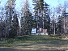
The area represents the southern limit of the boreal forest in its transition zone to aspen parkland. The forest soils are stony and the landscape is rolling, with numerous ponds and creek channels. The forest trees include white spruce, black spruce, tamarack larch, balsam fir, jack pine, quaking aspen, balsam poplar, and paper birch.
The flatter land areas surrounding the forest have almost entirely been converted to cereal-grain farmland, making the forest (and the contiguous Saskatchewan Duck Mountain Provincial Park) an environmental refuge for such large animals as wapiti, moose, black bear, lynx, bobcat, and grey wolf. The existence of a breeding population of cougars is suspected but unconfirmed.[2] It is likewise not known whether or not a breeding population of wolverines is present in the park, but the park is within that species' historical range.[3] The park is also within the historical range of grizzly bears, but they are no longer found in the area. Other animals, such as the white-tailed deer and coyote, are found in abundance in the park, but roam more freely into the surrounding agricultural lands and are thus less reliant on it.
Duck Mountain Provincial Park is contained wholly within a larger protected area called Duck Mountain Provincial Forest; however, neither the Provincial Park nor the Provincial Forest are completely protected from resource extraction industries such as logging and hunting.
Child's Lake, East Blue Lake, Glad Lake, and Wellman Lake all have tourist facilities. These facilities may include boat launches, campgrounds, rental cottages, and privately owned vacation homes.
External links
References
- ^ "The Pembina Escarpment". http://www.dmr.nd.gov/ndgs/ndnotes/pembina/Pembina.htm.
- ^ "Cougars Confirmed in Manitoba". http://web2.gov.mb.ca/conservation/cdc/pdf/cougars_mb.pdf.
- ^ "COSEWIC Assessment and Update Status Report on the Wolverine Gulo gulo". http://dsp-psd.pwgsc.gc.ca/Collection/CW69-14-329-2003E.pdf.
Categories:- Parks in Manitoba
Wikimedia Foundation. 2010.


