- Dyserth
-
Dyserth (Welsh: Diserth) is a village in Denbighshire, Wales. Population : 2,566 (United Kingdom Census 2001). Its main features are the extensive quarrying remains, its waterfalls, railway line (former LNWR, closed in 1930, and now footpath), and mountain (Moel Hiraddug).
Overview
It has a long history and is mentioned in the Domesday book of 1086 as follows, it being at the time listed under Cheshire [1] :
“ Ad hoc manerium ROELENT jacent hae berewiches, DISSAREN BODUGAN CHILVEN et MAENEVAL. In his est terra i carrucata tantum et silva i leuva longa et dimidia lata. Ibi est francigena et ii villani habent i caracutas.
To this manor of Rhuddlan belong these berewicks, DYSERTH BODEGAN (1.5 m ENE of St Asaph) CHILVAN (?) and MAENEFA (?). In these the land is 1 carucate only, and there is a wood 1 league long and a half wide. One foreign woman and 2 villeins have 1 carucate there.” Dyserth also had a castle which suffered at the hands of Llywelyn ap Gruffydd and destroyed after a six-week siege in 1263. The remains of the castle were quarried away during World War I.
The oldest industry in the village and surrounding area is mining, with lead, copper and limestone just some of the minerals being mined locally in the past. These quarries are still visible and form a major part of the village's geography, though mining ceased when Dyserth Quarry closed in 1981.
Traditionally, there has been a very strong Welsh language speaking community in the village and until recent times many families and village folk knew, or knew of, each other. This is typical of a rural community whose life often centred around the many churches and chapels in the village. Many of the village's families have their roots in agriculture, with many notable farms in or around Dyserth; these include Hottia, Bryn Cnewyllyn and Ty Newydd.
A recent drive to reawaken a feeling of village pride has had some success, due in part to the heavy promotion of Dyserth people, and village-based events and organisations. In addition, the excellent work of some village folk in securing the sprucing up of parts of the village, notably the High Street, parks and entrances to Dyserth has been welcome. The village has a large number of active community and environmental organisations some with a long history (for example the Dyserth & District Field Club founded in 1911).
It has also recently received a grant from the National Lottery Heritage Lottery Fund to refurbish the community hall which has proven a great success in the rejuvenation of the village.
References
External links
- St Bridget and St Cwyfan Parish Church, Dyserth
- http://www.dyserth.com
- Journal newspaper covering Dyserth
- www.geograph.co.uk : photos of Dyserth and surrounding area
Denbighshire Principal settlements 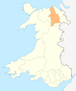
Towns and villages Aberwheeler · Berwyn · Betws Gwerfil Goch · Bodelwyddan · Bodfari · Bontuchel · Bryneglwys · Bylchau · Carrog · Castell · Cefnmeriadog · Cerrigydrudion · Clocaenog · Corwen · Crogen · Cwm · Cyffylliog · Cynwyd · Derwen · Druid · Dyserth · Efenechtyd · Gellifor · Gellioedd · Glasfryn · Glyndyfrdwy · Gronant · Gwaenysgor · Gwyddelwern · Henllan · Hirwaen · Llanarmon-yn-Iâl · Llanbedr-Dyffryn-Clwyd · Llandegla · Llandrillo · Llandyrnog · Llanefydd · Llanelidan · Llanferres · Llanfwrog · Llangar · Llangwyfan · Llangyhafal · Llanrhaeadr-yng-Nghinmeirch · Llansanffraid Glyndyfrdwy · Llantysilio · Llanychan · Llanynys · Llwynmawr · Maerdy · Meliden · Nantglyn · Prion · Pentrecelyn · Rhewl · Rhuallt · Saron · Tafarn Y Gelyn · Trefnant · Trelawnyd · Tremeirchion
Oldest inhabited location Moors Categories:- Villages in Denbighshire

Wikimedia Foundation. 2010.