- Mynydd Hiraethog
-
Mynydd Hiraethog (also known as the Denbigh Moors) is an upland region in Conwy and Denbighshire in north-east Wales. It includes the large reservoir Llyn Brenig and the Clocaenog Forest, which has one of Wales's last populations of red squirrels. Its highest point is Mwdwl-eithin, at 532 metres (1,745 ft) above sea level, making it higher than Exmoor. On its western edge, overlooking the Conwy Valley, lies the Moel Maelogan wind farm.
Denbighshire Principal settlements 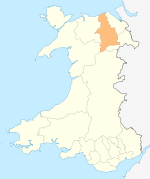
Towns and villages Aberwheeler · Berwyn · Betws Gwerfil Goch · Bodelwyddan · Bodfari · Bontuchel · Bryneglwys · Bylchau · Carrog · Castell · Cefnmeriadog · Cerrigydrudion · Clocaenog · Corwen · Crogen · Cwm · Cyffylliog · Cynwyd · Derwen · Druid · Dyserth · Efenechtyd · Gellifor · Gellioedd · Glasfryn · Glyndyfrdwy · Gronant · Gwaenysgor · Gwyddelwern · Henllan · Hirwaen · Llanarmon-yn-Iâl · Llanbedr-Dyffryn-Clwyd · Llandegla · Llandrillo · Llandyrnog · Llanefydd · Llanelidan · Llanferres · Llanfwrog · Llangar · Llangwyfan · Llangyhafal · Llanrhaeadr-yng-Nghinmeirch · Llansanffraid Glyndyfrdwy · Llantysilio · Llanychan · Llanynys · Llwynmawr · Maerdy · Meliden · Nantglyn · Prion · Pentrecelyn · Rhewl · Rhuallt · Saron · Tafarn Y Gelyn · Trefnant · Trelawnyd · Tremeirchion
Oldest inhabited location Moors Coordinates: 53°05′N 3°35′W / 53.09°N 3.58°W
Towns Other Settlements Betws-y-coed • Caerhun • Dolgarrog • Eglwysbach • Glan Conwy • Henryd • Llanbedr-y-cennin • Llanddoged • Llangelynnin • Llanrhychwyn • Maenan • Rowen • Tal-y-bont • Tal-y-Cafn • Trefriw • Tyn-y-groes •
Rivers & Streams Afon Conwy • Afon Crafnant • Afon Geirionydd • Afon Hiraethlyn • Afon Machno • Afon Lledr • Afon Llugwy • Afon Gallt y Gwg • Nant y Goron • Afon Ddu (1) • Afon Porth-llwyd • Afon Dulyn • Afon Ddu (2) • Afon Garreg-wen • Ffrwd Cerriguniawn • Afon Melynllyn • Afon Roe • Afon Tafolog • Afon Gyffin •
Lakes Llyn Crafnant • Llyn Elsi • Llyn Geirionydd • Llyn y Parc •
Waterfalls Grey Mare's Tail • Fairy Falls •
Hills & Mountains Mynydd y Dref • Tal y Fan • Bwlch-y-Ddeufaen • Cefn Cyfarwydd • Mynydd Hiraethog •
Castles & Forts Canovium • Conwy Castle • Gwydir Castle • Pen y Gaer •
Other Features Bodnant Garden • Conwy RSPB reserve • Gwydir Forest • Moel Maelogan • Snowdonia National Park •
Transport A470 • B5106 • Conwy Valley Line •
Railway Stations Categories:- Denbighshire
- Wales geography stubs

Wikimedia Foundation. 2010.