Cowley County, New South Wales
- Cowley County, New South Wales
-

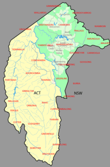
Map showing parishes in the ACT area. Cowley County shown in yellow.
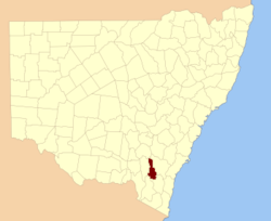
Cowley County is one of the 141 Cadastral divisions of New South Wales. It contains the locality of Cavan. It was originally bordered on the north, east and part of the south by the Murrumbidgee River, and on the west by the Goodradigbee River. A large part of the county was transferred to the Commonwealth to make the Australian Capital Territory in 1909, with the remaining part the area to the north-west of the ACT as far north as the Burrinjuck Dam, and thin strips of land along the western, southern and south-eastern borders of the ACT.
Cowley County is named in honour of Henry Richard Charles Wellesley, First Earl Cowley (1804-1884).[1]
Parishes within this county
A full list of parishes found within this county including the 15 former parishes which are now part of the ACT; their current LGA and mapping coordinates to the approximate centre of each location is as follows:
References
Categories:
- Counties of New South Wales
Wikimedia Foundation.
2010.
Look at other dictionaries:
Wallace County, New South Wales — Infobox Australian cadastral name = Wallace state = New South Wales caption = Location in New South Wales near nw = Buccleuch near n = Cowley near ne = Beresford near e = Beresford near se = Wellesley near s = Wellesley near sw = Tambo (Vic) near … Wikipedia
Beresford County, New South Wales — Infobox Australian cadastral name = Beresford state = New South Wales caption = Location in New South Wales near nw = Cowley near n = Murray near ne = Murray near w = Wallace near e = Dampier near sw = Wallace near s = Wellesley near se =… … Wikipedia
Buccleuch County, New South Wales — Infobox Australian cadastral name = Buccleuch state = New South Wales caption = Location in New South Wales near nw = Clarendon near n = Harden near ne = Harden near e = Cowley near se = Wallace near s = Wallace near sw = Selwyn near w =… … Wikipedia
Murray County, New South Wales — Map of all coordinates from Google Map of all coordinates from Bing Export all coordinates as KML … Wikipedia
Cowley County — may refer to: Cowley County, Kansas Cowley County, New South Wales This disambiguation page lists articles about distinct geographical locations with the same name. If an internal link led you here, you … Wikipedia
Cadastral divisions of New South Wales — refers to the 141 counties within the Australian state of New South Wales, which are further subdivided into 7,459 parishes. There are also three Land Divisions, around 100 Land Districts, and several other types of districts as well as land… … Wikipedia
Lands administrative divisions of New South Wales — The 141 counties of New South Wales, with the original Nineteen shown in pink … Wikipedia
Cowley — may refer to: Places In Australia: Cowley County, New South Wales In Canada: Cowley, Alberta In England: Cowley, Derbyshire Cowley, Devon Cowley, Gloucestershire Cowley, London Cowley, Oxford Cowley, Staffordshire In the United States: Cowley,… … Wikipedia
Cavan, New South Wales — Infobox Australian Place | type = town name = Cavan state = nsw caption = lga = Yass Valley postcode = 2582 pop = est = elevation= maxtemp = mintemp = rainfall = county = Cowley stategov = Burrinjuck fedgov = dist1 = 302 location1= Sydney dist2 … Wikipedia
Cowley, Oxfordshire — Coordinates: 51°43′59″N 1°12′54″W / 51.733°N 1.215°W / 51.733; 1.215 … Wikipedia
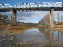
 Looking south near the Tharwa Bridge; the Murrumbidgee River formed the boundary between Murray, on the left and Cowley on the right. This land is now part of the Australian Capital Territory and not in any county.
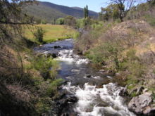
 The Goodradigbee River in the Brindabella Ranges; the river was the western boundary between Cowley (left) and Buccleuch (right)


