Goodradigbee River

Goodradigbee River

Infobox_River
river_name = Goodradigbee River


image_size =
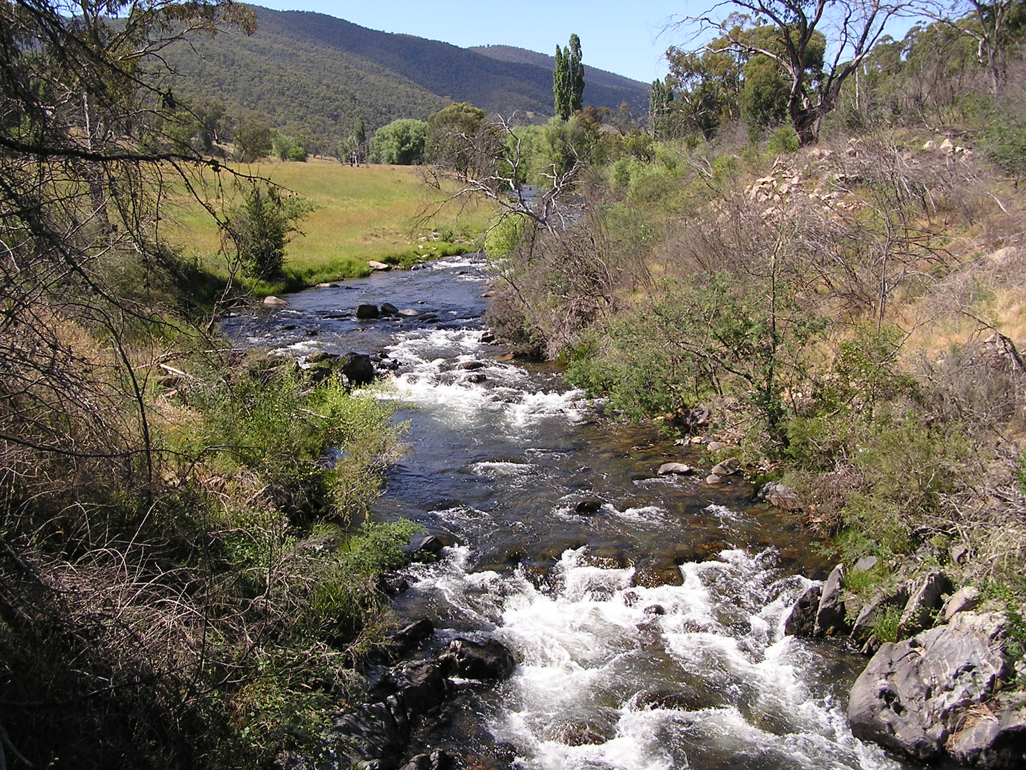
caption = Goodradigbee river in the Brindabella valley
origin = Snowy Mountains
mouth =
basin_countries = Australia
length =
elevation =
mouth_elevation =
discharge =
watershed = 110,100 ha

The Goodradigbee River is in south-eastern New South Wales, Australia. It flows into Burrinjuck Dam and thus is a tributary of the Murrumbidgee River.

The Goodradigbee River originates near Tantangara Reservoir at an altitude of 1,260 m and flows north into the Burrinjuck Reservoir. The majority of the catchment (95%) is forested with the upper catchment within the Kosciuszko National Park. The catchment is 110,100 ha in area. Some water from the upper reaches of the river is diverted into Tantangara Reservoir via an aqueduct, but otherwise the river is not dammed.cite web | last = Lintermans | first = Mark | authorlink = | coauthors = | year = 2002 | url = http://www.environment.act.gov.au/__data/assets/pdf_file/13142/fishintheuppermurrumbidgeechapter2.pdf
title = Fish in the Upper Murrumbidgee Catchment: A Review of Current Knowledge - Methods | format = pdf
work = | publisher = Envirionment ACT (ACT Government) www.environment.act.gov.au | accessdate = 2007-02-01
] In 1968 the National Capital Development Commission considered building a dam at Brindabella Valley for the purpose of sending water into the Cotter River via a tunnel. [ "Augmentation of Canberra Water Supply - proposals to utilise the Murrumbidgee and Goodgradigbee Rivers", August 1968 - SMEC ]

The bridge over the Goodradigbee at Wee Jasper was completed in 1896. It is heritage listed as being an early example of an Allan type timber truss road bridge. [ [http://www.rta.nsw.gov.au/cgi-bin/index.cgi?action=heritage.show&id=4300140 RTA information on heritage listing] ]

ee also

*List of rivers of Australia

References


Wikimedia Foundation. 2010.

Игры ⚽ Поможем сделать НИР

Look at other dictionaries:

  • Goodradigbee River — im Brindabella ValleyVorlage:Infobox Fluss/KARTE fehlt …   Deutsch Wikipedia

  • Murrumbidgee River — im Murray Darling System DatenVorlage …   Deutsch Wikipedia

  • Cowley County, New South Wales — Map of all coordinates from Google Map of all coordinates from Bing Export all coordinates as KML …   Wikipedia

  • Expedition von Hume und Hovell — Die Expedition von Hume und Hovell fand in den Jahren 1824 und 1825 unter Führung von Hamilton Hume und William Hovell statt und gehört zu den bedeutendsten Entdeckungsreisen, die im östlichen Australien unternommen wurden. Es war die erste… …   Deutsch Wikipedia

  • Brindabella Ranges — p1p3p5 Brindabella Ranges Goodradigbee River im Brindabella Valley Lage …   Deutsch Wikipedia

  • Buccleuch County — Map of all coordinates from Google Map of all coordinates from Bing Export all coordinates as KML …   Wikipedia

  • Murrumbidgee District — New South Wales Murrumbidgee District in the 1860s Area: 48562 km² …   Wikipedia

  • Liste der Flüsse in Australien — Die Liste der Flüsse in Australien gibt eine Übersicht über alle Flüsse im Staat Australien einschließlich Tasmanien: Inhaltsverzeichnis A B C D E F G H I J K L M N O P Q R S T U V W X Y …   Deutsch Wikipedia

  • Murray-Darling basin — Map of the Murray Darling Basin The Murray Darling basin is a large geographical area in the interior of southeastern Australia, whose name is derived from its two major rivers, the Murray River and the Darling River. It drains one seventh of the …   Wikipedia

  • Murray-Darling Basin — The Murray Darling Basin is 3,375km long, drains one seventh of the Australian land mass, and is currently by far the most significant agricultural area in Australia. The name of the basin is derived from its two major rivers, the Murray River… …   Wikipedia

Share the article and excerpts

Direct link
Do a right-click on the link above
and select “Copy Link”