- Gissing, Norfolk
-
Coordinates: 52°25′33″N 1°09′19″E / 52.4257°N 1.15516°E
Gissing 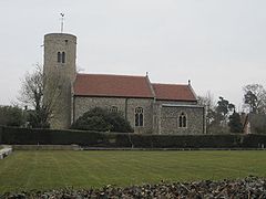
St Mary, Gissing
 Gissing
Gissing shown within NorfolkArea 8.11 km2 (3.13 sq mi) Population 254 - Density 31 /km2 (80 /sq mi) OS grid reference TM146855 Parish Gissing District South Norfolk Shire county Norfolk Region East Country England Sovereign state United Kingdom Post town DISS Postcode district IP22 Police Norfolk Fire Norfolk Ambulance East of England EU Parliament East of England List of places: UK • England • Norfolk  Gissing St Mary
Gissing (
 /ˈɡɪsɪŋ/) is a village and civil parish in Norfolk, England, about six miles (10 km) north of Diss. It covers an area of 8.11 km2 (3.13 sq mi) and had a population of 254 in 95 households as of the 2001 census.[1] The village is the location of Gissing Hall, a fifteenth century mansion which is now operated as an hotel.
Church of St Mary
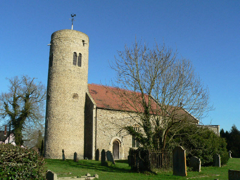
The church, St Mary, is one of 124 existing round-tower churches in Norfolk. It is a Grade I listed building.[2] In 1209 there was a rectory; in 1271, vicarage was endowed with "all the offerings, the tithes of the mills, a vicarage-house and meadow, and an acre of land adjoining, and twenty acres more of the church's free land, and all other small tithes, except hay, which, with all the corn tithes, and the rest of the glebe, together with the rectory manor, and all its appurtenances, were to belong to the prior himself."[3]
Notes
- ^ "Gissing parish information". South Norfolk Council. 22 March 2006. http://www.south-norfolk.gov.uk/democracy/Gissing_parish.asp. Retrieved 20 June 2009.
- ^ "Images of England". http://www.imagesofengland.org.uk/details/default.aspx?id=225431.
- ^ Blomefield, Francis (c.1736, published c.1806). History of Norfolk. 1. London.
External links
Categories:- South Norfolk
- Villages in Norfolk
- Civil parishes in Norfolk
- United Kingdom church stubs
- Norfolk geography stubs


Wikimedia Foundation. 2010.