- Kilkieran
-
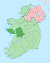
Cill Chiaráin — Village — Location in Ireland Coordinates: 53°19′33″N 9°44′07″W / 53.3258°N 9.7353°WCoordinates: 53°19′33″N 9°44′07″W / 53.3258°N 9.7353°W Country Ireland Province Connacht County County Galway Elevation 0 m (0 ft) Irish Grid Reference L844319 Cill Chiaráin is the only official name. The anglicized spelling Kilkieran has no official status. Cill Chiaráin (anglicized as Kilkieran) is a village in County Galway, Ireland. The R340 road along the coast from Galway city passes through Cill Chiaráin.
Cill Chiaráin is a Gaeltacht area of Ireland. It is linked to the nearby town of Carna by the Irish college of Coláiste Sheoisaimh, which runs courses during the summer and mid-term breaks.
Cill Chiaráin is Irish for "Ciarán's church" and is named after Saint Ciarán, who spent many years living in the village. There is a National School, a Church and a Holy Well named after him. Also, up on the hill overlooking the whole of Cill Chiaráin there is a cross erected in his honour and in front of that there is a place called "Leaba Chiaráin" ("Ciarán's bed").
Cill Chiaráin holds place for many tourists and every year it plays host to the Connemara Triathlon.
There is also a Cill Chiaráin in County Kilkenny.
See also
Categories:- Towns and villages in County Galway
- Gaeltacht places in County Galway
- Gaeltacht towns and villages
- County Galway geography stubs
Wikimedia Foundation. 2010.


