Kilcolgan

Kilcolgan

Infobox Irish Place
name = Kilcolgan
gaeilge =
crest

motto =
map

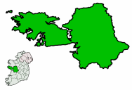
pin coords = left: 118px; top: 64px
north coord = 53.212466
west coord = 8.872433
irish grid = M409203
area =
county = County Galway
population =
census yr = 2006
province = Connacht
web = www.galway.net/directory/locality-list.jsp?code=galway.kilcolgan
|
"'Kilcolgan is a village in County Galway, Ireland. The N18 passes through the village. There are also two public houses Donoghues and Raftery's Rest a public house where the poet Raftery once stayed. The neighbouring village of Ballinaderreen is also part of its townlands.

Places of interest

* Tyrone House, a ruin

References

* [http://maps.google.com/maps?f=q&hl=en&geocode=&q=Kilcolgan&sll=37.0625,-95.677068&sspn=30.875284,69.697266&ie=UTF8&ll=53.213178,-8.872447&spn=0.011385,0.034032&z=15&om=1 Kilcolgan in Google maps]

ee also

* Galway City
* County Galway
* N18
* Clarinbridge
* List of abbeys and priories in the Republic of Ireland (County Galway)
* List of towns in the Republic of Ireland


Wikimedia Foundation. 2010.

Игры ⚽ Нужна курсовая?

Look at other dictionaries:

  • Colga of Kilcolgan — Colga of Kilcolgan, Irish saint, fl. c. 600. Colga was the founder of the first Christian settlement at Kilcolgan, County Galway. He would have been contemporary with Colman mac Duagh and Surney of Drumacoo. His siter, Feilis, also founded a… …   Wikipedia

  • Ballinderreen — (Irish place name|Baile an Doirín|) is a small little village located on the N67 route between Kilcolgan and Kinvara in south County Galway, in The Republic of Ireland. Overview Ballinderreen village is approximately 22 km south of Galway City.… …   Wikipedia

  • Moran's Oyster Cottage — Restaurant information Established 1760s Food type Irish seafood Street address The Weir City Kilcolgan, Co. Galway …   Wikipedia

  • Килколган — Деревня Ирландии Килколган англ. Kilcolgan, ирл. Cill Cholgáin Страна …   Википедия

  • County Galway — Galway County redirects here. For the UK Parliament constituency, see Galway County (UK Parliament constituency). County Galway Contae na Gaillimhe …   Wikipedia

  • Ferbane — Infobox Irish Place name = Ferbane gaeilge = Féar Bán crest motto = map pin coords = left: 35px; top: 31px north coord = 53.64722 west coord = 7.208201 irish grid = area = elevation = 128m province = Leinster county = County Offaly town pop = 785 …   Wikipedia

  • N18 road (Ireland) — N18 road Part of Location …   Wikipedia

  • Tyrone House — was described in the Bulletin of the Irish Georgian Society 1976: Volume XIX JUL DEC: Tyrone House, (Kilcolgan) County Galway by Gordon St. George Mark. Since this was published the house has deteriorated Fact|date=November 2007, but still stands …   Wikipedia

  • N67 road (Ireland) — N67 road Location Primary destinations: (bypassed routes in italics) County Galway Kilcolgan Kinvarra Co …   Wikipedia

  • Coastal landforms of Ireland — Ireland is an island surrounded by water,[1] with a 7,500 kilometre coastline.[2] This list catalogues about 400 of the coastal landforms of the island including bays, estuaries, harbours, headlands, and many others.[3][4][5] Most offshore… …   Wikipedia

Share the article and excerpts

Direct link
Do a right-click on the link above
and select “Copy Link”