North Howden

North Howden

Coordinates: 53°45′55″N 0°51′37″W / 53.765202°N 0.860298°W / 53.765202; -0.860298

North Howden
North Howden is located in East Riding of Yorkshire
North Howden

 North Howden shown within the East Riding of Yorkshire
OS grid reference SE752304
Parish Howden
Unitary authority East Riding of Yorkshire
Ceremonial county East Riding of Yorkshire
Region Yorkshire and the Humber
Country England
Sovereign state United Kingdom
Post town GOOLE
Postcode district DN14
Dialling code 01430
Police Humberside
Fire Humberside
Ambulance Yorkshire
EU Parliament Yorkshire and the Humber
UK Parliament Haltemprice and Howden
List of places: UK • England • Yorkshire

North Howden is a hamlet in the East Riding of Yorkshire, England. It is situated approximately 1.5 miles (2.4 km) north of the town of Howden. It lies on the B1228 road where it crosses the Hull to York railway line and where Howden railway station is located.
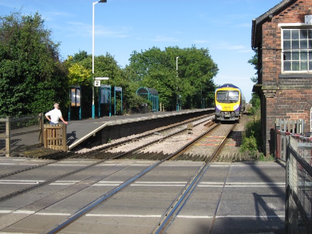
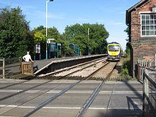
Howden Station

It forms part of the civil parish of Howden.

References

  • Gazetteer — A–Z of Towns Villages and Hamlets. East Riding of Yorkshire Council. 2006. p. 9. 


Wikimedia Foundation. 2010.

Игры ⚽ Поможем сделать НИР

Look at other dictionaries:

  • Howden — Infobox UK place country = England official name = Howden latitude = 53.744111 longitude = 0.863416 civil parish = Howden work = Neighbourhood Statistics population = 3,810 (2001 Census) unitary england = East Riding of Yorkshire region =… …   Wikipedia

  • Howden Edge — (gbmapping|SK187943) is a peak which lies in the north east of the Upper Derwent Valley area of the Peak District National Park in England. At 545m (1787ft) it is the second highest point in South Yorkshire, after Margery Hill. It is situated to… …   Wikipedia

  • North Island (Houtman Abrolhos) — North Island Aerial photograph of the southern half of North Island, looking west …   Wikipedia

  • North West Durham (UK Parliament constituency) — North West Durham County constituency for the House of Commons Boundary of North West Durham in County Durham …   Wikipedia

  • North Hobart, Tasmania — North Hobart Hobart, Tasmania Postcode: 7000 Coordinates …   Wikipedia

  • North Ferriby — For the football club, see North Ferriby United A.F.C.. Coordinates: 53°43′12″N 0°30′28″W / 53.720029°N 0.507805°W / 53 …   Wikipedia

  • Howden, Tasmania — Infobox Australian Place name = Howden caption = coordinates = coord|43|1|36|S|147|17|34|E|display=inline,title state = tas type = suburb lga = Kingborough city = Hobart postcode = 7054 fedgov = Franklin near nw = Huntingfield near n = Maranoa… …   Wikipedia

  • Howden Moor Incident — The Howden Moor Incident or Sheffield Incident, which took place over the Dark Peak between Manchester and Sheffield on March 24, 1997, is an alleged encounter between a UFO and Royal Air Force Tornado aircraft, scrambled from RAF Coningsby in… …   Wikipedia

  • North Cave — Coordinates: 53°46′55″N 0°38′40″W / 53.781906°N 0.644574°W / 53.781906; 0.644574 …   Wikipedia

  • North Newbald — Coordinates: 53°49′07″N 0°36′56″W / 53.818537°N 0.615655°W / 53.818537; 0.615655 …   Wikipedia

Share the article and excerpts

Direct link
Do a right-click on the link above
and select “Copy Link”