- Bridges of York
-
There are nine bridges across the River Ouse within the city of York, England, and sixteen smaller bridges across the narrower River Foss.
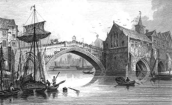
 An engraving of the fourth Ouse Bridge (1565-1810)
Contents
Bridges over the Ouse
The earliest bridge, built by the Romans, linked Stonegate (the via praetoria of the Roman fortress) and Micklegate, and crossed the river approximately where the Guildhall now is. Its replacement, Ouse Bridge, was a wooden bridge built about 350 metres downstream by the Vikings. It has been rebuilt three times, most recently between 1810 and 1820. The Scarborough Railway Bridge of 1845 was the second bridge to be built, and it was followed by two more road bridges, Lendal Bridge in 1863 and Skeldergate Bridge in 1882. The Millennium Bridge, a footbridge, was added in 2001. There are also Clifton Bridge in the northern suburbs of the city, two modern fly-overs carrying the outer ring road, and the former railway bridge at Naburn, which is now part of the York-Selby cycle path.
North to south, the bridges are:
- The A1237 road (York Outer Ring Road Western and Northern)
- Clifton Bridge (1963)
- Scarborough Railway Bridge (1844)
- Lendal Bridge (1863)
- Ouse Bridge (1821)
- Skeldergate Bridge (1881)
- Millennium Bridge (2001)
- The A64 Outer Ring Road Southern and Eastern (1976)
- Naburn railway bridge (now a cycle and pedestrian path)
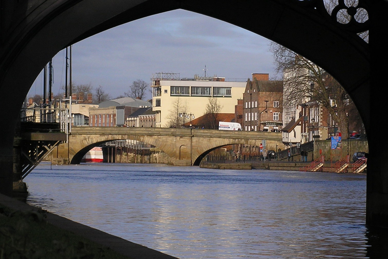
Ouse Bridge
 Ouse Bridge from the South Bank, looking upstream through Skeldergate Bridge
The original Roman bridge over the Ouse was eventually replaced by a wooden bridge built further downstream by the Vikings. In 1154, it collapsed under the weight of a crowd which had gathered to greet St William of York on his return from exile. It was replaced by a stone bridge. In 1367 the first public toilets in Yorkshire, and likely England, were opened on the bridge.[1] Part of the bridge was swept away by floods in the winter of 1564-5. The repaired bridge of 1565 had a new central arch spanning 81 ft, and was described by Defoe as "...near 70 foot [21 m] in diameter; it is, without exception, the greatest in England, some say it's as large as the Rialto at Venice, though I think not." This bridge was dismantled between 1810 and 1818 in order to make way for the New Ouse Bridge, designed by Peter Atkinson the younger, completed in 1821.[2][3]
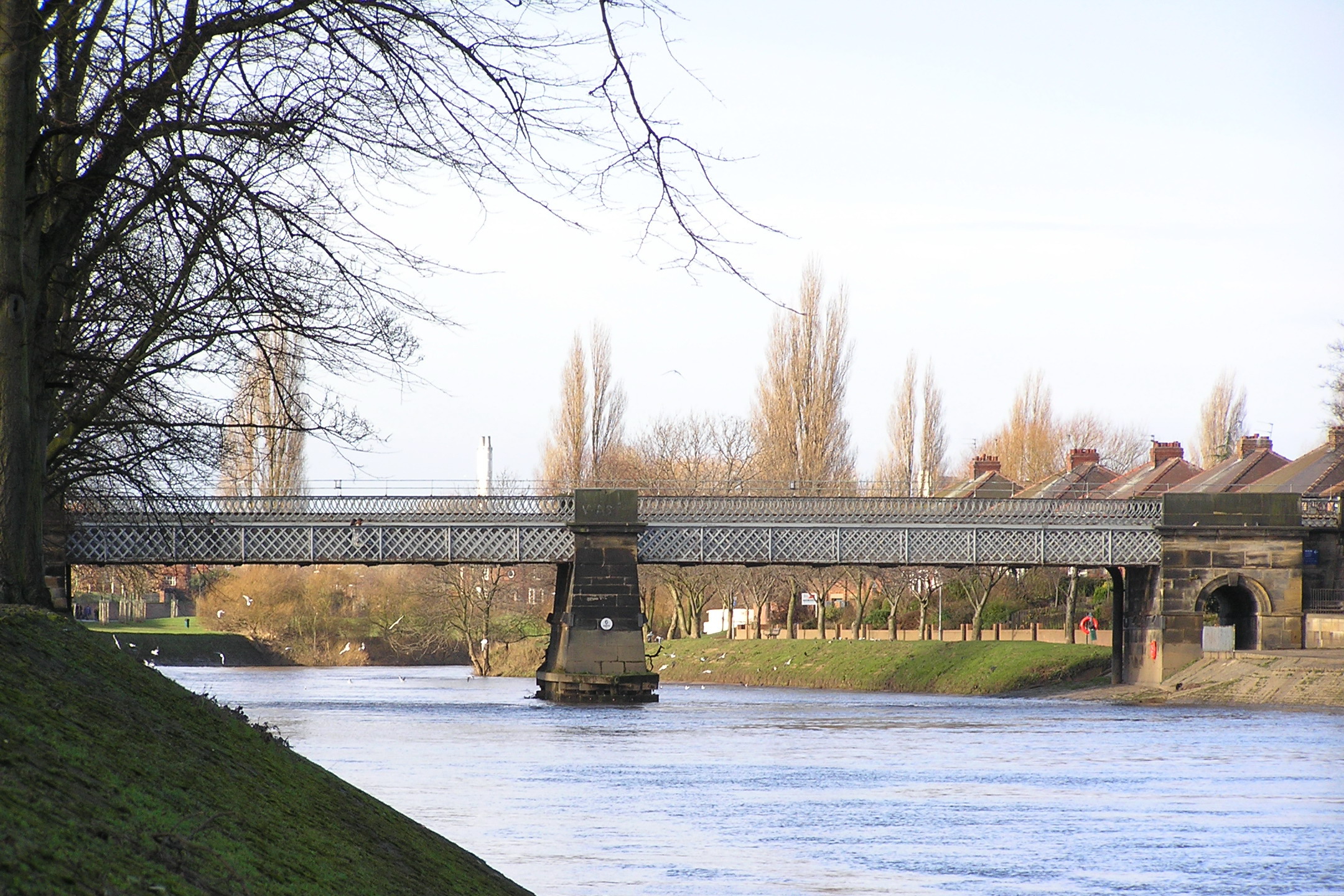
Scarborough Railway Bridge
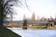 Scarborough Railway Bridge from the South Bank, looking upstream
The second bridge across the Ouse was the Scarborough Railway Bridge, built in 1845 to carry the railway line between York and Scarborough (now the Scarborough branch of the North TransPennine route). Originally it had two tracks with a pedestrian path in between them. In 1875 the track was raised 4 feet (1.2 m) and the footpath moved to the south side, where it remains today.
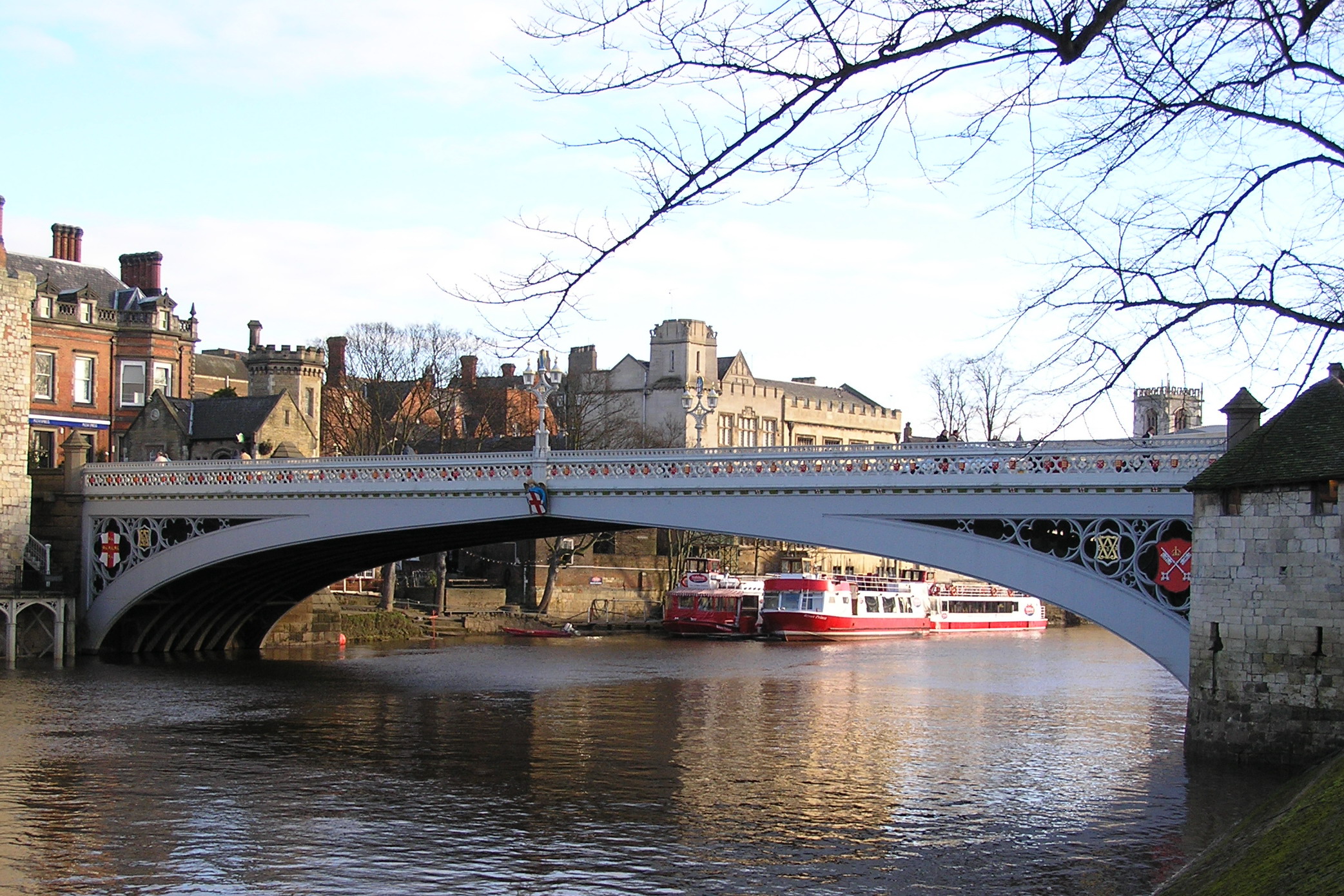
Lendal Bridge
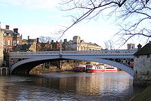 Lendal Bridge from the South Bank, looking downstream
Lendal Bridge was built by Thomas Page in 1863 and is an iron bridge with Gothic features. It links Station Road with Museum Street and thus York railway station with York Minster, and is part of York's Inner Ring Road. At both ends of the bridge stand towers, Barker Tower to the west and Lendal Tower to the east. A rope ferry previously existed at this location. Lendal Bridge was used in Damon and Debbie, a 1987 spin-off of soap Brookside for the scenes where long running charcater Damon Grant was murdered.
Skeldergate Bridge
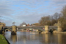 Skeldergate Bridge from the South Bank, looking upstream
Skeldergate Bridge links the York Castle area and the old bailey at Baile Hill. It was built as a toll bridge between 1878 and 1880 (architect: George Gordon Page). A small arch by the former tollhouse at the east end of the bridge was originally designed to open so that tall ships could sail up to the quays on either side of the river between Skeldergate and Ouse Bridges. Skeldergate Bridge was formally declared free of tolls on April 1, 1914.
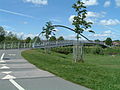
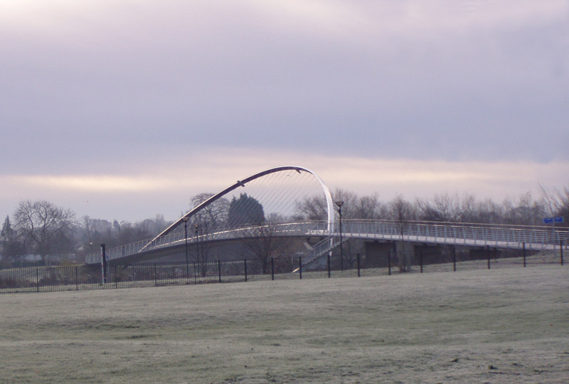
Millennium Bridge
Coordinates: 53°56′41.334″N 1°4′55.4232″W / 53.944815°N 1.082062°W
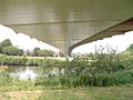
 York Millennium Bridge from the South Bank, looking downstream
The Millennium Bridge, built to a competition-winning design by Whitby Bird and Partners,[4] was opened on 10 April 2001, having cost £4.2m to build. It spans the River Ouse to the south of York, linking Hospital Fields Road and Maple Grove in Fulford with Butcher Terrace on the South Bank. The bridge carries a cycle path and a footpath, and is not open to vehicular traffic. It is a key link in the Sustrans National Cycle Routes 65/66 and will be part of the orbital route for York completed in 2011. The bridge shortened the walk or cycle for students from houses in the South Bank to the University of York (they previously had to travel via Skeldergate Bridge).
The bridge also acts a meeting place for local people, as it has a waist height shelf spanning the whole structure which facilitates sitting and admiring the view.Increasingly it is used as a circular walk from the city centre taking in the New Walk on the east bank and Terry Avenue and Rowntree Park on the west bank. While riverside paths regularly flood several times a year the bridge is higher and rarely cut off by floodwaters. Signs on approaches from Fulford Rd /Hospital Fields Rd junction and Butcher Terrace/Bishopthorpe Road warn when it may be impassible without wellies.
Supplies for Fulford Barracks were brought in by river near this location, and the remains of a narrow gauge railway may be seen on the eastern bank of the river a few metres toward the city. There used to be a rope ferry at this location as well.
-
The Millennium Bridge from Fulford.
-
Below the bridge from Fulford.
-

Millennium Bridge
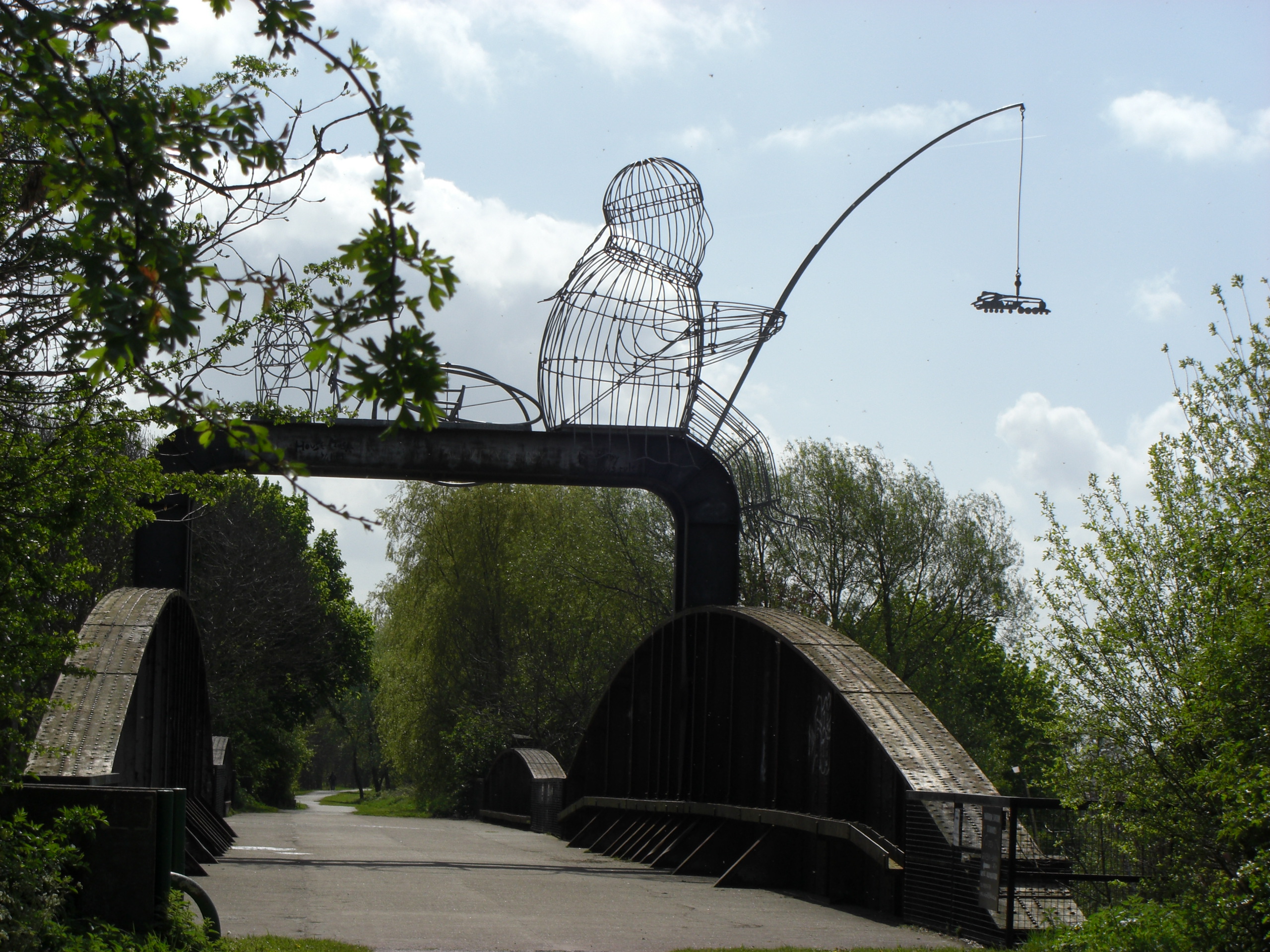
Naburn Railway Bridge
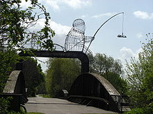 Naburn bridge and sculpture from west bank
Outside the outer ring-road, the Naburn bridge used to carry the York-Selby railway until it was diverted in 1983. It is also known as the "Fisherman Bridge" due to a large metal sculpture of a fisherman sitting on top which was added in 2000 as part of the York Council "Creative Communities 2000" scheme [1].
Clifton Bridge
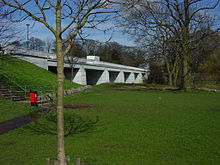 Clifton bridge
A temporary bridge at Clifton was built by the British Army in 1961 on the site of an old ferry crossing in order to handle additional vehicle traffic caused by the wedding of the Duke and Duchess of Kent at York Minster. A permanent bridge was opened officially on 28 October 1963. The bridge is built from 4,000 tons of concrete and 50 tons of reinforced steel[2], [3].
Bridges over the Foss
South to north, from the confluence with the Ouse, these are:
- The Blue Bridge (1895)
- Castle Mills Bridge (1956), part of York's Inner Ring Road
- Piccadilly Bridge (1911–14)
- Foss Bridge (1811–12)
- Pedestrian bridge linking the Shambles car-park and Rowntree Wharf (c1990)
- Pedestrian bridge north of Rowntree Wharf linking Navigation Road with the Hungate area and Peasholme Green (2011)
- Pedestrian bridge from Foss Islands Road to what is now the DEFRA site at Peasholme Green (1931)
- Layerthorpe Bridge (1998), carrying Northwestbound Inner Ring Road traffic and traffic between Peasholme Green and Layerthorpe
- Foss Bank Bridge (1998), carrying southeastbound Inner Ring Road
- Monk Bridge (1794 and later)
- Pedestrian and cycle path bridge, formerly part of the Foss Islands Branch Line of the North Eastern Railway (c1880)
- Fossway Bridge
- Huntington Road Bridge
- Link Road Bridge between Haxby and Huntington
- Church Lane Bridge, Huntington
- The A1237 Outer Ring Road
Many of these are unobtrusive modern bridges carrying main roads. The following are more notable:
Foss Bridge
 Foss Bridge from the north, looking downstream
The Foss Bridge, a single Georgian gritstone arch with balusters, links the streets Fossgate and Walmgate. It is believed that the earliest bridge on this site was constructed during the Viking period. The present bridge, designed by Peter Atkinson the younger and erected in 1811-12, replaced a wooden bridge. The bridge was once the site of a fish market.[3][5]
Pedestrian bridge from Foss island Road to DEFRA site
 Pedestrian bridge from the west, looking downstream
This cast-iron pedestrian bridge from Foss Islands Road to what is now the DEFRA site at Peasholme Green was constructed in 1931 by the Monk Bridge Construction Company to improve communications between York's power station and its cooling tower, both now demolished.[6] It is locked and not in use.
Monk Bridge
Monk Bridge is a single-arched ashlar bridge with a span of approximately six metres. It carries traffic between central York and Heworth and was built in 1794 to designs by Peter Atkinson the elder. In 1924-6, the bridge was widened and the upper part rebuilt.[3]
References
- ^ http://www.yorkhistory.org.uk/ousebridge.html York History
- ^ Structurae [en]: Ouse Bridge (1821)
- ^ a b c Pevsner, Nikolaus; and Neave, David (1995) [1972]. Yorkshire: York and the East Riding (2nd ed.). London: Penguin Books. ISBN 0-14-071061-2.
- ^ Bridge Engineering Analysis: Cast Study: York Millennium Bridge
- ^ Evans, Antonia (ed) (2002). The York Book. York: Blue Bridge. ISBN 0-9542749-0-3.
- ^ Mitchell, Vic, and Keith Smith (2003). Branch Line to the Derwent Valley, including the Foss Islands Branch (Map V). Midhurst: Middleton Press. ISBN 1 9044 74 06 3.
- The Fairest Arch in England: Old Ouse Bridge, York, and its Buildings ISBN 1-874454-26-4
External links
Categories:- Bridges in North Yorkshire
- Buildings and structures in York


Wikimedia Foundation. 2010.