- Congress Heights
-
This article is about the neighborhood. For the Metro station, see Congress Heights (WMATA station).
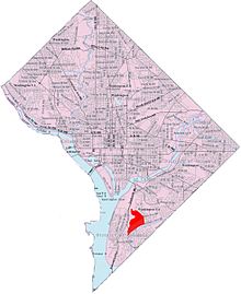 Map of Washington, D.C., with Congress Heights highlighted in red
Congress Heights is a largely residential neighborhood in Southeast Washington, D.C. Although it is in the poorest section of what is generally regarded as inner-city Washington—the area east of the Anacostia River -- it is very likely the most economically diverse, and most suburban, neighborhood in that section of the city. Congress Heights, in fact, contains the largest commercial district in Washington's Ward 8, along Martin Luther King Jr. and Malcolm X Avenues.
Congress Heights is bounded by Mississippi Avenue SE to the southeast, Wheeler Road SE to the east, Alabama Avenue SE to the north, and Martin Luther King Jr. Avenue and South Capitol Street to the northwest. It is served by the Congress Heights station on the Green Line of the Washington Metro. Most residents live in garden apartments, but there are also older single-family bungalows. Frank W. Ballou High School and Hart Middle School serve the neighborhood.
Congress Heights, which takes its name from its hilly geography that offers a view across the Anacostia to the Capitol, began development as a neighborhood in the late 1920s when it was established as the end of the Washington streetcars line. Prior to World War II the D.C. National Guard was housed at Camp Simms. The facility included firing ranges up to 1,000 yards. It was on Alabama Avenue at the intersection of Stanton Road and Barry Farms Housing Project. During WW II it had gun emplacements (Anti-Aircraft) to defend Washington from air attack. After World War II, the U.S. Army built a military reserve facility, in the central part of Congress Heights. The campus of St. Elizabeths Hospital already stood immediately northwest of the neighborhood. Many early residents worked at the U.S. Naval Gun Factory, which stopped production about 1960, or at the U.S. Naval Research Laboratory. The annual Martin Luther King Birthday parade on the avenue bearing his name, is a notable neighborhood event. Starting in 2006, the parade date was changed from January to April to accommodate for cold weather. Now, the parade is held closer to the anniversary of his death (April 4, 1968), rather than his birthday (January 15, 1929). There is a new tennis and learning center on Mississippi Avenue, combining sports and school tutoring.
Because of its location in Southeast Washington, Congress Heights had experienced great urban neglect for several decades.The reason it experienced neglect was due to the great white flight as it was termed by journalists in the middle sixties. However, in the 21st century, Congress Heights has received a great deal of attention from the city and urban developers. Nineteen development projects worth a total of $455 million are underway or completed in Congress Heights as of November 2006. Among these are a redevelopment of St. Elizabeths West Campus for federal use; a request for proposals from the Washington Metropolitan Area Transit Authority for the area around the Congress Heights Metro station; and a planned redevelopment of Camp Simms as a mixed-use project, including a new Giant Grocery Store, enhancement to an existing shopping center, and 75 new residential units. [1]
Coordinates: 38°50′35″N 77°00′00″W / 38.843°N 77°W
Nearby Neighborhoods in Washington, D.C. North
St. Elizabeths HospitalNortheast
DouglassWest
Bolling Air Force BaseCongress Heights East
Shipley TerraceSouthwest
BellevueSoutheast
Washington HighlandsCategories:- Neighborhoods in Washington, D.C.

Wikimedia Foundation. 2010.