- Jaffna Peninsula
-
For other uses, see Jaffna (dissambiguation).
 The relatively small (15 x 40 miles) Jaffna Peninsula in pink with adjoining islands, as compared to rest of Sri Lanka
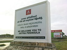 Entrance to Jaffna Peninsula
The Jaffna Peninsula is an area in Northern Province, Sri Lanka. It is home to the capital city of the province, Jaffna and comprises much of the former land mass of the ancient Tamil kingdoms of the Nagas and the medieval Jaffna kingdom. The peninsula is mostly surrounded by water, connected to the rest of the island by a small strip of land. Its shape like a cobra/serpent head was the basis of much of its description in ancient literature and folklore, as were its inhabitants of classical antiquity, known widely as snake worshippers. Its underground water is used for drinking, agriculture and industry. Paddy cultivation is rain fed but only for three months during the North East monsoon period. It is a part of the peninsula consisting of fourteen D.S Administrative Divisions. The total land area including inland water is 1,030 km². The terrain of the region is almost flat and of low elevation except in the central part of the western sector in the area around Tellippalai, where the elevation rises to 10.5 m above sea level. From there it slopes gently towards the south and south east, while to the north the elevation tends to drop abruptly. The ancient name for the Jaffna peninsula was Nāka-Tivu and Nāka-Nadu, meaning Nāka island (Tivu) or country (Nadu), mentioned in the Vallipuram gold plate inscriptions and the Manimekalai.[1] It is called Nagadipa or Naka-diva, mentioned in the Mahavamsa.[2] Cīttalai Cāttanār, the author of the Manimekalai reflected Tamilakam's perception at the time that Nāka-Nadu was an autonomous administrative entity, kingdom or nadu, distinguished and separate from Ilankatipam, (also referred to as Irattinatipam) - Lanka.[3]
Contents
Climate and Soil
The climate of Jaffna region is considered to be Tropical monsoonal with a seasonal rhythm of rainfall. The temperature ranges from 26 C to 33 C. Annual precipitation ranges from 696 mm to 1125 mm. It is evenly spread over the area. The north east monsoon rain (October to January) accounts for more than 90 % of the annual rainfall. The Jaffna peninsula is divided into two agro-ecological regions.
The soil found in Jaffna belongs to the following three major soil groups:
- Calcic Red-yellow latosols.
- Solodized solonetz and solon chaks.
- Regosols.
Water Resource
Water is extracted from open dug wells for domestic and agricultural purposes. Approximately 28,000 wells serve both domestic and agricultural purposes. Water available in these wells and its quality varies from place to place. In the majority of deep wells in the Valikamam division water is available for irrigation throughout the year. These wells are situated in the calcic red-yellow latosols and their depth varies from 20 to 25 feet (7.6 m). The wells available in other areas are shallow (10 to 15 ft).
Socio Economic Condition
The total population of the district is around 600,000. Agriculture and fisheries have been the principal economic activities of the district. Over 60 % of the work force in the district depends on agriculture for their livelihood. About 86,000 families are engaged in agriculture while 15,000 families engage in fishing. Agriculture in the district contributes substantially to the GNP of the country. The land cultivated by 48 % of the farmers does not belong to them. The average land holding area is around 0.5 to 0.75 acres (3,000 m2). Unemployment in the rural areas is 27.9 % while in the urban area it is 25.8 %.
Crop Production
The agriculture sector, including crop and livestock has contributed around 65 % of the total gross domestic product of the district. In terms of production, major cash crops like chili, onion, tobacco, potato and banana are produced in large extent to meet the substantial portion of the national requirement. Further fruit crops like mango, Grapes and jack are also produced in large quantities.
Paddy
Total paddy land available for the cultivation is 12,000 ha. Of which nearly 8000 ha (64.6 %) is being cultivated. About 2000 ha of paddy land is being identified as marginal due to the salinity problem. Paddy is cultivated as mono crop in 85 % of the paddy land and in the balance 15 % paddy is followed by vegetable and field crops with the help of available irrigation. The average yield is about 50 bushels per acre (2.5 mt/ha). However, 30 40 % of farmers who cultivate improved varieties are able to obtain yield of 70 bushels per acre (3.5 mt/ha).
Vegetables
Vegetables are being cultivated throughout the year with the help of irrigation from the dug wells. Low country vegetables such as brinjal, tomato, long bean, okra, snake gourd, bitter gourd and other leafy vegetables are being cultivated and available throughout the year. Exotic vegetables like cabbage, leeks, beet, beans, and carrots are also cultivated in large extent.
Field crops
Among the other field crops, onion, potato, tobacco, chili and banana are cultivated as cash crops because farmers obtain considerable income from these crops. Total extent of high land available for cultivation is 7,851 ha. Of which 1.642 ha (21 %) is unable to cultivate due to security reas on. At present field crops and vegetables are cultivated in 4200 ha with the help of left irrigation from the dug wells.
Perennial Crops
Perennial crops include the orchard crops like mango, jack, grapes and citrus and other crops like palmyrah and coconut. Coconut is grown in home stead in the extent of 1470 ha. Other perennial crops are grown in 1500 ha. Further nearly 3.5 million palmarah palms are available in Jaffna. Farmers generate considerable income from fruit crops, like mango, jack, grapes etc. cultivated in 1850 ha. Grapes were cultivated in 380 ha during 1985 is reduced to 55 ha in 2004.
Livestock
The livestock sector is an important component of the farming system. Up to 1950, only local cattle and goats were reared for milk and meat, with the establishment of artificial insemination in 1950 exotic cross breeds such as Jersey and Indian breeds of cattle were introduced and high milk yield was obtained. Further Jamunapari and Sannan breeds of goats were also introduced for meat and milk. With this introduction of new breeds many farmers started rearing cross breeds of cattle, goat and poultry. From 1950 to 1984 live stock enterprise developed very fast and it was a single or supplementary source of income for nearly 30 % of the district population. Backyard poultry and rearing milking cows and goat for milk and meat generate additional income for the farmers. Livestock population reduced to a considerable extent during the last two decades due to the civil war.
Tsunami Disaster
Northern and Eastern coast of the peninsula were badly affected by tsunamis, especially of the 2004 Indian Ocean earthquake; this includes the villages in the Northern coast from Thondaimanaru to Thumpalai and Eastern coast from Vallipuram to Kuddarappu. The damage to the eastern coast was higher than that of northern coast. Fisheries sectors of this district were badly affected. Estimation of damages caused to different sectors has not been completed.
Available data revealed that a total of 2,640[4][5] people lost their lives while 1,647 were injured and 1,204 are missing. 37,255 people belonging to 9,885 families were displaced, of which 15,034 people belonging to 4,038 families are living in the welfare camps and the balance 22,221 people belonging to 5,847 families are living with their friends and relatives. People displaced from the coastal villages of Kankesanthurai, Myliddy and Palali due to the formation heavy security zone were already settled in the above villages and are involved in fishing. Fisheries and agriculture sector in the above villages are affected badly.
References
- ^ Peter Shalk. SERENDIPITY - ISSUE 02 - THE VALLIPURAM BUDDHA IMAGE - AGAIN
- ^ http://www.infolanka.com/org/srilanka/hist/hist4.html
- ^ Peter Shalk. SERENDIPITY - ISSUE 02 - THE VALLIPURAM BUDDHA IMAGE - AGAIN
- ^ http://www.searo.who.int/EN/Section23/Section1108/Section1835/Section1851/Section1865_8530.htm
- ^ http://reliefweb.int/rw/rwb.nsf/0/4c0d276d4b31d00f49256f85001cf4b8?OpenDocument&Click=
External links
Coordinates: 9°41′12″N 80°06′02″E / 9.686722°N 80.100632°E
Categories:- Jaffna District
- Peninsulas of Sri Lanka

Wikimedia Foundation. 2010.