- South Oxhey
-
Coordinates: 51°37′13″N 0°23′27″W / 51.62029°N 0.39082°W
South Oxhey 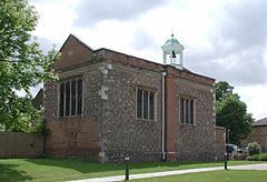
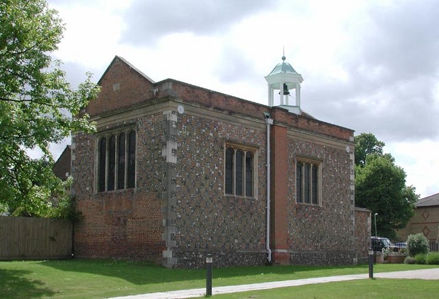
Oxhey Chapel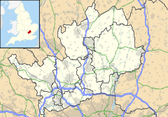
 South Oxhey
South Oxhey shown within HertfordshireOS grid reference TQ115925 Parish Watford Rural District Three Rivers Shire county Hertfordshire Region East Country England Sovereign state United Kingdom Post town WATFORD Postcode district WD19 Dialling code 020 Police Hertfordshire Fire Hertfordshire Ambulance East of England EU Parliament East of England UK Parliament South West Hertfordshire List of places: UK • England • Hertfordshire South Oxhey is a suburb of Watford in the Watford Rural parish of the Three Rivers district of Hertfordshire, England. It is located in the south western corner of Hertfordshire and close to the boundary with Greater London.
Contents
History
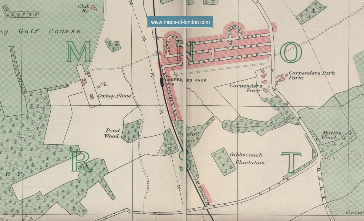
South Oxhey is a large estate built on land that was formerly part of the Oxhey Hall Estate.[1] There was a manor house here, Oxhey Place, and a chapel.[2] The manor house was owned by the Blackwell family of Crosse and Blackwell fame. It burnt down in 1955. Oxhey Chapel dates from 1612 and is still standing to the south of the parish church of All Saints.[3][4] The church was opened in 1957 to serve the new estate built after the Second World War by the London County Council. The church was demolished and rebuilt in 2000.
South Oxhey is a large estate almost exclusively made up of council built properties. This is in stark contrast to the neighbouring estate of Carpenders Park, whose dwellings were predominantly built privately.
Since the introduction of the nationwide Right to buy policy in 1980, many South Oxhey residents have bought their homes from the local council, meaning that by 2007, some 70% of houses on the estate are privately owned. The estate was built after the Second World War to help alleviate the housing pressures thrust upon London during the Blitz as well as general inadequate housing. South Oxhey was originally built and managed by the London County Council and later the Greater London Council. In 1980 the ownership and management of the estate was transferred from the GLC to Three Rivers District Council. South Oxhey is served by local Arriva Shires & Essex bus services, the number 2 and number 8. The 2 runs a circular Watford Town Centre - South Oxhey and return service, and the 8 runs from Mount Vernon Hospital to Abbots Langley.
South Oxhey Choirs
The South Oxhey Community Choir and the South Oxhey Youth Choir are two groups that were assembled by Gareth Malone as part of the BBC television series The Choir: Unsung Town [5].
As part of the TV series, the choirs performed at venues including the Watford Colosseum, St Albans Abbey, and headlining at Sox Fest '09 in May 2009.[6] In April 2009, the Community Choir made their debut recording at Abbey Road Studios.[7]
Episode one of The Choir: Unsung Town was first broadcast on BBC Two on 1 September 2009.[8]
Gareth Malone continued as choirmaster for two years following the conclusion of the TV recording and now maintains his support as patron [9]. The current musical director is Simon Wookey [10] and both the Community and Youth choirs continue to make regular performances about 3 to 4 times per year at events around Hertfordshire and the South East of England.[11]
Local facilities
- Oxhey Library (Bridlington Road) [12]
- The Centre (Gosforth Lane) - A community and leisure facility[13]
- Sir James Altham Pool (Altham Way)[14]
- Carpenders Park railway station
South Oxhey Army Cadets Detachment, 3 Coy, Gosforth Lane
- All Saints Church (Church of England)[15]
- ASCEND
- Oxhey Jets football club
- South Oxhey Baptist Church
- 2384 Bushey and Oxhey squadron (Gosforth Lane) - Air Cadets
- South Oxhey Choirs
- South Oxhey Labour Party
Education
Primary Schools
- Colnbrook (Special School)[16]
- Greenfields[17]
- Oxhey Woods[18]
- St. Josephs[19]
- Warren Dell Primary[20]
- Woodhall Primary[21]
Little Furze School (Recently Closed in about 2004/05)
- Closed due to being placed under 'Special Measures' by Ofsted in a report in November 2003, Also a decline in numbers and financial unviablility was cause for concern.
A Report (dated September 2004) on the Proposal to close the school and the reasons why can be found here: http://www.hertsdirect.org/statweb/compaperarchive/archive/older_meetings/Reports/103/636/0.pdf
Secondary Schools
South Oxhey has no secondary schools. However, from the early 1950s, there were two Secondary modern schools – Clarendon, on Chilwell Gardens, and the smaller Hampden School, on Little Oxhey Lane. Built to cater for the post war 'baby boom', both schools eventually combined to form Sir James Altham Comprehensive (upper and lower schools) and eventually closed as a result of the continual selling of public amenities to developers by Three Rivers Council.
References
- ^ Map of Oxhey, early 20th century
- ^ Watford - Manors (British History online) accessed 4 May 2008
- ^ Churches Conservation Trust accessed 4 May 2008
- ^ satellite view from Google maps accessed 4 May 2008
- ^ South Oxhey Choirs
- ^ South Oxhey Festival
- ^ .The South Oxhey Community Choir record The Beatles at Abbey Road, Watford Observer Friday 24th April 2009
- ^ "The Choir: Unsung Town". http://www.bbc.co.uk/sing/choir/. Retrieved 2009-08-24.
- ^ South Oxhey Choirs - Patron
- ^ South Oxhey Choirs - Musical Director
- ^ South Oxhey Choirs Forthcoming Events
- ^ hertsdirect.org Oxhey Library
- ^ hertsdirect.org Centre, The (South Oxhey)
- ^ hertsdirect.org Sir James Altham Pool (South Oxhey)
- ^ All Saints Church (Church of England)
- ^ Colnbrook School - Home Page
- ^ Welcome to Greenfields Primary School
- ^ Oxhey Wood Primary School - Home page
- ^ St Joseph's Catholic Primary School
- ^ Warren Dell home page
- ^ Woodhall School - Home Page
Further reading
A book South Oxhey : "a giant on their doorstep" author Rose McNamara-Wright tells a brief history of South Oxhey for children growing up during the war as told through her own experiences.
Ceremonial county of Hertfordshire Boroughs or districts Major settlements - Apsley
- Baldock
- Berkhamsted
- Bishop's Stortford
- Borehamwood
- Broxbourne
- Buntingford
- Bushey
- Cheshunt
- Harpenden
- Hatfield
- Hemel Hempstead
- Hertford
- Hitchin
- Hoddesdon
- Letchworth
- Potters Bar
- Radlett
- Rickmansworth
- Royston
- Sawbridgeworth
- St Albans
- Stevenage
- Tring
- Waltham Cross
- Ware
- Watford
- Welwyn Garden City
See also: List of civil parishes in Hertfordshire
Topics - Parliamentary constituencies
- Places
- SSSIs
- Visitor attractions
Categories:- Three Rivers (district)
- Towns in Hertfordshire

Wikimedia Foundation. 2010.