- Płonna
Infobox City
settlement_type = village
subdivision_type = Country
official_name = Płonna| native_name = Płonna| subdivision_name = Poland
image_
subdivision_type1 =Beskids | subdivision_name1 = Subcarpathian Voivodship
population_total = 20
area_total_km2 = 68.8
elevation_m = 2.6
established_date = 1433
code = 38500 (Bukowsko)
latd =
latm =
latNS =
longd =
longm =
longEW =
website =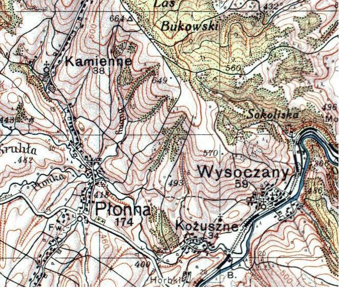
Płonna, in Plone 1433, "de Plona" 1437, "villa Plona" 1451, "Plonna" 1508, "Płonna" 1699, village in East Małopolska in the Lesser Beskid mountains,
Bukowsko rural commune, located near the towns ofMedzilaborce andPalota (in northeasternSlovakia ).Płonna is about 10 miles from
Sanok in south-easter Polands. It is situated below the main watershed at the foot of the Słonne Mountain, and has an elevation of 340 metres. Situated in theSubcarpathian Voivodship (since 1999), previously inKrosno Voivodship (1975-1998) andSanok district, (10 miles or 15 km east of Sanok),parish Bukowsko.Płonna was founded in 1433 by Bal. During 966–1018, 1340–1772 (
Ruthenian Voivodeship ) and during 1918–1939 Plonna was part of Poland. While during 1772–1918 it belonged to Austrian empire, later Austrian-Hungarian empire when double monarchy was introduced in Austria. In 1785 the village lands comprised 18.93 km². There were 710 Catholics. The village was burned by the UPA onMarch 28 ,1946 and all villagers were moved out. Their plots were joined to form a collective farm and the church was turned into a barn.The church at Płonna is right on the road an easy to get to. Filial churches were located in Wysoczany (4.5 km away) and Kożuszne (4 km). The cemetery has a few headstones in it. The rural families are poor, agriculture is rarely profitable and low income makes it difficult for farms to invest in from improvements.
Płonna was the site of a "special camp" in 1942. The camp was used to hold Jews from the
Sanok , Lesko and Dobromil powiats, that is if they weren't shot in their village or taken to the work camp in Zwangsarbeitslager Zaslaw, 30 km east ofBukowsko . Apparently at least 13,000 people were held at Zaslaw and then transported toBelzec . The old people were shot in the woods near Zaslaw. According to "The Holocaust: The Jews in the County of Cracau"On April, 1946 the village was attacked by a strong unit of UPA and some buildings were burnt. Only over a dozen years after the war the village started to rebuild. Some people left Plonna on April 29, 1947 (Akcja Wisla) andmoved to the Slupsk area of Poland. Some people went toUkraine in 1946.Population
* 1880 - 950
* 1936 - 1002
* 2001 - 20Time zone :
UTC+1 /SummerUTC+2 References
::Inline:
External links
* [http://www.zumi.pl/drukuj.html?typ=/namapie.html&qt=&loc=Karlik%F3w,%20Centrum%20miasta&Submit=Szukaj&cId=&sId=&x=56&y=16&x=22.104182&y=49.4320756&scale=2&mapKind=3 Map of Płonna]
Wikimedia Foundation. 2010.