- Osterburg, Pennsylvania
-
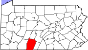
Osterburg — Unincorporated community — Location within the state of Pennsylvania
 Osterburg
Coordinates: 40°10′10″N 78°31′13″W / 40.16944°N 78.52028°WCoordinates: 40°10′10″N 78°31′13″W / 40.16944°N 78.52028°W Country United States State Pennsylvania County Bedford Time zone Eastern (EST) (UTC-5) – Summer (DST) EDT (UTC-4) ZIP codes 16667 FIPS code GNIS feature ID Osterburg is a small unincorporated community in Bedford County, Pennsylvania, United States, between Bedford, Claysburg, and Imler. The ZIP Code for Osterburg is 16667. It is part of the Chestnut Ridge School District.
Contents
Economy
Logging and dairy farming are leading parts of the economy of the Osterburg area. Local businesses include Osterburg General Store & Restaurant, Osterburg Post Office, Slick's Ivy Stone Restaurant,[1] Osterburg Diesel, First Commonwealth Bank,[2] and Osterburg Country Store.
Recreation
Although small, there are many recreational activities in the Osterburg area. Bobs Creek is 13.1 miles (21.1 km) long and has been determined by American Whitewater to be a class I-III section for rafting and kayaking.[3] Blue Knob State Park is also nearby and provides swimming, camping, hunting, fishing, hiking, snowmobiling, cross country skiing and downhill skiing.[4]
Transportation
Osterburg is a half mile from access to I-99 and US 220, with easy access to Altoona, Bellefonte, Bedford, and the Pennsylvania Turnpike.
References
Municipalities and communities of Bedford County, Pennsylvania Boroughs Bedford | Coaldale | Everett | Hopewell | Hyndman | Manns Choice | New Paris | Pleasantville | Rainsburg | St. Clairsville | Saxton | Schellsburg | Woodbury
Townships Bedford | Bloomfield | Broad Top | Colerain | Cumberland Valley | East Providence | East St. Clair | Harrison | Hopewell | Juniata | Kimmel | King | Liberty | Lincoln | Londonderry | Mann | Monroe | Napier | Pavia | Snake Spring | South Woodbury | Southampton | West Providence | West St. Clair | Woodbury
Unincorporated
communitiesBreezewood | Chaneysville | Defiance | Loysburg | Mount Dallas | Osterburg | Riddlesburg | State Line
Categories:- Unincorporated communities in Bedford County, Pennsylvania
- Western Pennsylvania geography stubs


Wikimedia Foundation. 2010.