Monte Grande (Sal), Cape Verde

Monte Grande (Sal), Cape Verde
Monte Grande

Monte Grande
Elevation 252 m (827 ft)
Listing List of mountains in Cape Verde
Location
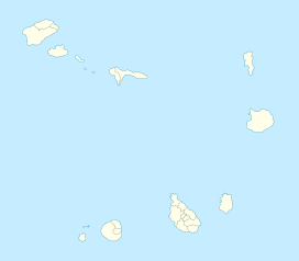
Monte Grande is located in Cape Verde
Monte Grande
northern Sal
Coordinates 16°49′15″N 22°54′45″W / 16.82083°N 22.9125°W / 16.82083; -22.9125Coordinates: 16°49′15″N 22°54′45″W / 16.82083°N 22.9125°W / 16.82083; -22.9125
Geology
Type Stratovolcano

Monte Grande (Portuguese meaning “big mountain”) is a mountain in the northern part of the island of Sal in Cape Verde.

Contents

Nearest places

  • Espargos, southwest

Geography and Information

The mountain is made up of rocks, and soil colors are orange-like, tan and light brown. The mountain contains slopes and a few ledges. The mountain features no vegetation and is surrounded by desert. The mountain is next to the crater of Pedra da Lume where it is famous for its salt mines, the rest is surrounded by a flat desert, and the nearest 2 mountains are distant, and are located approximately 5 kilometers apart.

Panorama

It offers a panoramic view of almost the entire island as well as Serra Negra to the south, several villages around the area including nearby Feijoal, Espargos, Palmeira, Fontona and Murdeira as well as its airport and roads, and the Atlantic Ocean can be seen to the west.

See also


Wikimedia Foundation. 2010.

Игры ⚽ Нужен реферат?

Look at other dictionaries:

  • Sal, Cape Verde — Geobox|Island name = Sal country = Cape Verde country highest location = Monte Vermelho highest elevation = 406 coordinates type = isle lat d = 16 |lat m = 43 |lat NS = N long d = 22 |long m = 56 |long EW = W area = 216 length = 30 length… …   Wikipedia

  • Sal (Kap Verde) — Sal Karte der Insel Gewässer Atlantischer Ozean Inselgruppe …   Deutsch Wikipedia

  • Cape Verde — This article is about the country. For the surface feature on Mars, see Cape Verde (Mars). For weather pattern, see Cape Verde type hurricane. Republic of Cape Verde República de Cabo Verde   (Portuguese) …   Wikipedia

  • Administrative divisions of Cape Verde — Cape Verde This article is part of the series: Politics and government of Cape Verde President Jorge Carlos Fonseca …   Wikipedia

  • Maio, Cape Verde — For other uses, see Maio (disambiguation). Maio Native name: Dja r’ Mai’ …   Wikipedia

  • Ponta do Norte, Cape Verde — Ponta da Norte (Portuguese for North Cape ; Cape Verdean Creole: Punta du Norti , São Vicente Creole: Ponta d Norte ) is a point located in the northeast of the island of Sal in Cape Verde. It is approximately 10 km north northeast of the island… …   Wikipedia

  • List of mountains in Cape Verde — This article is a list of mountains in Cape Verde:*Pico do Alberto on São Nicolau *Pico da Antónia on Santiago Island *Monte Batalhas on Maio *Monte Bissau on São Nicolau *Monte Cara on São Vicente *Caixa on São Vicente *Topo de Coroa on Santo… …   Wikipedia

  • Santo Antão, Cape Verde — Santo Antão (Portuguese for Saint Anthony ), or Sontonton in Cape Verdean Creole, is the westernmost and largest of the Barlavento islands of Cape Verde. The nearest main island is São Vicente to the southeast, separated by a channel named Canal… …   Wikipedia

  • Monte Vermelho — Elevation: 406 m Location: eastern Sal Length: approx. 2 km, north to south approx. 2 to 3 km from east to west Easiest route: climb Monte Vermelho (Portuguese for red mountain in contrast of its soil color) is Sal s tallest mountain located …   Wikipedia

  • Mosteiros, Cape Verde (municipality) — Mosteiros Municipality Country Cape Verde Island Fogo …   Wikipedia

Share the article and excerpts

Direct link
Do a right-click on the link above
and select “Copy Link”