- Merlin, Oregon
-
Merlin — Unincorporated community — Location within the state of Oregon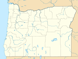
 Merlin
Coordinates: 42°31′04″N 123°25′13″W / 42.51778°N 123.42028°WCoordinates: 42°31′04″N 123°25′13″W / 42.51778°N 123.42028°W Country United States State Oregon County Josephine Elevation 907 ft (276 m) Time zone Pacific (PST) (UTC-8) – Summer (DST) PDT (UTC-7) ZIP code 97532 Area code(s) 458 and 541 FIPS code GNIS feature ID Merlin is an unincorporated community in Josephine County, Oregon, United States. The area is known for sport fishing and whitewater rafting on the Rogue River. Merlin's ZIP code is 97532.
A new railroad station in this location in 1883 was called "Jump Off Joe" for a local stream. The station was renamed Merlin in October 1886. The name came from a railroad civil engineer who named it for the Merlins he saw in the area. "McAllister" post office was established about a mile north of Merlin in 1885, then moved to the vicinity of the railroad station and renamed Merlin in 1891. [1]
Geography
Merlin is located about 10 km (6 mi) northwest of Grants Pass, Oregon.
Merlin lies at an elevation of about 277 m (907 ft) above MSL.
References
- ^ McArthur, Lewis A.; Lewis L. McArthur (2003) [1928]. Oregon Geographic Names (Seventh Edition ed.). Portland, Oregon: Oregon Historical Society Press. ISBN 0-97595-277-1.
External links
Municipalities and communities of Josephine County, Oregon Cities 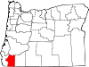
CDPs Unincorporated
communitiesGalice | Holland | Hugo | Kerby | Leland | Merlin | Murphy | New Hope | O'Brien | Placer | Selma | Sunny Valley | Takilma | Wilderville | Williams | Wolf Creek | Wonder
Ghost towns Golden | Waldo
Categories:- Unincorporated communities in Josephine County, Oregon
- Census-designated places in Oregon
- Oregon geography stubs


Wikimedia Foundation. 2010.