- Colsterdale
-
Coordinates: 54°13′39″N 1°48′08″W / 54.227500°N 1.802100°W
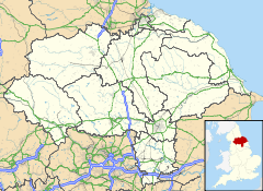
Colsterdale
 Colsterdale shown within North Yorkshire
OS grid reference SE130813 Parish Colsterdale District Harrogate Shire county North Yorkshire Region Yorkshire and the Humber Country England Sovereign state United Kingdom Post town RIPON Postcode district HG4 Police North Yorkshire Fire North Yorkshire Ambulance Yorkshire EU Parliament Yorkshire and the Humber List of places: UK • England • Yorkshire Colsterdale is the valley of the River Burn, a tributary of the River Ure, in the Yorkshire Dales in North Yorkshire, England. It gives its name to a hamlet and civil parish in the upper part of the dale. The area is in Harrogate district. The hamlet is seven miles west of Masham.
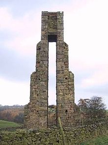
The Colsterdale towers are towers built between 1895 and 1911 to conduct surveys.
During the First World War Colsterdale was the site of a training camp for the Leeds Pals. There is now a memorial to the Leeds Pals in the dale.[1] It later became a Prisoner of War camp for German Officers.[2]
Although Colsterdale is not in Nidderdale, it lies within the Nidderdale Area of Outstanding Natural Beauty.
References
External links
 Media related to Colsterdale at Wikimedia Commons
This Harrogate location article is a stub. You can help Wikipedia by expanding it.


