- M-157 (Michigan highway)
-
M-157
Roscommon Road 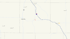
M-157 highlighted in redRoute information Maintained by MDOT Length: 1.193 mi[3] (1.920 km) Existed: 1932[1][2] – present Major junctions South end:  M-55 near Prudenville
North end:  M-18 near Prudenville
Location Counties: Roscommon Highway system Michigan State Trunkline Highway System
Interstate • US • State←  M-156
M-156M-158  →
→M-157 is a short state trunkline highway in the US state of Michigan. The highway is entirely within Roscommon County in the Lower Peninsula. It is the fourth shortest state highway in the system,[3] and it serves as a connector route between M-18 and M-55 just east of Prudenville. The current roadway was built and designated as M-157 in the 1930s.
Contents
Route description
M-157 begins at an intersection with M-55 east of Prudenville and Houghton Lake. The trunkline angles to the northwest before turning north near Ryan Lake. Serving as a short connector, the highway travels north through the Roscommon State Forest terminating just over a mile later at a junction with M-18.[4][5] M-157 has not been listed on the National Highway System, a system of highways important to the nation's economy, defense, and mobility.[6] The average annual daily traffic (AADT) in 2008 was 496 vehicles per day.[7]
History
M-157 was originally designated in 1931 as a connector route between M-55 and US 27 (present day M-18).[8][9] Just a year later, that version was decommissioned, and the road obliterated. A new alignment, the present-day routing of M-157, was then commissioned just to the east.[1][2]
Major intersections
The entire highway is in Backus Township, Roscommon County.
Mile[3] Destinations Notes 0.000 M-55 – Houghton Lake, West Branch1.193 M-18 – Prudenville, Roscommon1.000 mi = 1.609 km; 1.000 km = 0.621 mi References
- ^ a b Michigan State Highway Department (October 1, 1932). Official Highway Service Map (Map). Cartography by H.M. Gousha.
- ^ a b Michigan State Highway Department (May 1, 1933). Official Highway Service Map (Map). Cartography by H.M. Gousha.
- ^ a b c Michigan Department of Transportation (2009). Control Section/Physical Reference Atlas (Map). http://mdotwas1.mdot.state.mi.us/public/maps/pr/. Retrieved July 26, 2009.
- ^ Michigan Department of Transportation (2009). Official Department of Transportation Map (Map). 1 in.:15 mi/1 cm:9 km.
- ^ Google, Inc. Google Maps – Overview map of M-157 (Map). Cartography by Google, Inc. http://maps.google.com/maps?f=q&source=s_q&hl=en&geocode=&q=prudenville,+mi&sll=37.0625,-95.677068&sspn=64.497063,65.654297&ie=UTF8&hq=&hnear=Prudenville,+Roscommon,+Michigan&ll=44.310921,-84.611335&spn=0.02905,0.032058&t=h&z=15. Retrieved April 6, 2010.
- ^ Michigan Department of Transportation (April 23, 2006) (PDF). National Highway System, Michigan (Map). http://www.michigan.gov/documents/MDOT_NHS_Statewide_150626_7.pdf. Retrieved October 7, 2008.
- ^ "Traffic Monitoring Information System". Michigan Department of Transportation. 2008. http://mdotnetpublic.state.mi.us/tmispublic/. Retrieved April 6, 2010.
- ^ Michigan State Highway Department (July 1, 1931). Official Highway Service Map (Map). Cartography by H.M. Gousha.
- ^ Michigan State Highway Department (October 1, 1931). Official Highway Service Map (Map). Cartography by H.M. Gousha.
External links
Categories:- State highways in Michigan


Wikimedia Foundation. 2010.