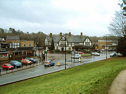
- Compton, Wolverhampton
-
Coordinates: 52°35′13″N 2°10′37″W / 52.587°N 2.177°W
Compton
 Compton shown within the West Midlands
Population 1,326 (2001 Census) Metropolitan borough Wolverhampton Metropolitan county West Midlands Region West Midlands Country England Sovereign state United Kingdom Post town Wolverhampton Postcode district WV Dialling code 01902 Police West Midlands Fire West Midlands Ambulance West Midlands EU Parliament West Midlands UK Parliament Wolverhampton South West List of places: UK • England • West Midlands Compton is a suburb of Wolverhampton, West Midlands, England. It is located to the west of Wolverhampton city centre on the A454, within the Tettenhall Wightwick ward.
Contents
History
Compton sits nestled below the ridge that stretches south west from Aldersley, with some of its housing climbing the steep hill near 'The Holloway' on the climb towards Tettenhall Wood. Across the Smestow valley the terrain rises again in the direction of Finchfield. The valley here through which the Smestow Brook flows was formed as a glacial meltwater channel.[1] The area was quarried for its sandstone.[2]
Its place name reflects its position - first recorded in the Domesday book of 1086 as 'Contone', from Old English cumb - a narrow valley or deep hollow ('cumb' is likely a continuation in use or a loan word from Brythonic cwm (Welsh) or cum (Cornish), meaning 'valley'),[3] and Old English tūn - a farmstead or fenced place.[4]
Compton Lock on the Staffordshire and Worcestershire Canal was the starting point in 1766 for the construction of the canal under James Brindley.
In the late 19th-early 20th century, Compton was home of a distinguished local artist Joseph Vickers de Ville (1856–1925). It was during this time that the still existing terraced housing was built along Henwood Road near the Bridgnorth Road junction.
Today
Today, the quarrying has stopped, and housing estates have been constructed along the side of the valley. Much of the area was built in the latter half of the 20th century, though Compton does retain some of its older buildings such as several houses on The Holloway.
At present, Compton Park campus is one of two Business Schools of the University of Wolverhampton; the other is located in Telford. The Sir Jack Hayward training ground of Wolverhampton Wanderers football club is located in Compton Park.[5]
Next to the Sir Jack Hayward training ground is St. Edmunds Roman Catholic secondary school and opposite is St Peters secondary school.
Compton has several shops, take-aways, restaurants and pubs. They include Clare's of Compton hairdressers, The Wineseller off-license, A Cottage Garden flower shop, Taylor Biddle opticians, Compton Dry Cleaners and Launderette, Spar convenience store and Daisy Fresh and Essential (formerly the Daisy Freezer Centre). There is a fish and chip takeaway called Pep's Place on the Bridgnorth Road. Restaurants include Tiger Wok Thai / Chinese restaurant, and House Of Canton Cantonese restaurant. A pub / restaurant, The Oddfellows sits on the Compton island, and one of the oldest pubs in Wolverhampton, The Swan at Compton is prominently located on the junction of The Holloway and Bridgnorth Road.
Further reading
- http://www.wolverhampton.gov.uk/NR/rdonlyres/92D8CE13-255C-4350-9D36-3085739B8DD0/0/Compton.pdf Area profile of Compton Neighbourhood (2001 Census)
References
- ^ http://www.bcll.org.uk/whats_happening/Wolverhampton.html Black Country Living Landscape
- ^ http://www.geowestmidlands.org.uk/wiki/index.php5?title=Sites_to_Visit/Birmingham_and_Black_Country#Sandy_Hollow_and_Whitwick_Bank_Compton.2C_Wolverhampton
- ^ http://dictionary.reference.com/browse/coomb
- ^ David Horovitz - 'The place-names of Staffordshire' (2006)
- ^ The Sir Jack Hayward Training Ground / 9 March 2008
Categories:- Areas of Wolverhampton
Wikimedia Foundation. 2010.


