- Messatida
-
Messatida
ΜεσσάτιδαLocation 
 Messatida
Coordinates 38°11′N 21°44′E / 38.183°N 21.733°ECoordinates: 38°11′N 21°44′E / 38.183°N 21.733°E Location within the peripheral unit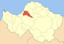
Government Country: Greece Region: West Greece Regional unit: Achaea Municipality: Patras Population statistics (as of 2001) Municipal unit - Population: 11,873 - Area: 66.37 km2 (26 sq mi) - Density: 179 /km2 (463 /sq mi) Other Time zone: EET/EEST (UTC+2/3) Elevation (center): 50 m (164 ft) Postal: 263 xx, 264 xx, 265 00 Telephone: 2610 Auto: ΑΧ Messatida (Greek: Μεσσάτιδα) is a former municipality in Achaea, West Greece, Greece. Since the 2011 local government reform it is part of the municipality Patras, of which it is a municipal unit.[1] The seat of the municipality was in Ovrya. It includes the communities of Kríni, southern Demenika, Saravali, and parts of Thea and Kallithea. The population is 11,873. It has an area of 66.37 km². Forests cover about 20% to 30% of the municipality, urban houses and buildings cover about 5%, and the rest remains pasture and rocky mountains (Omplos). Ancient Messatis was one of the Mycenaean villages that formed Patras.
Contents
Population history
Year Population 1991 9,583 2001 11,873 Subdivisions
The municipal unit Messatida is subdivided into the following communities:
Sport Clubs
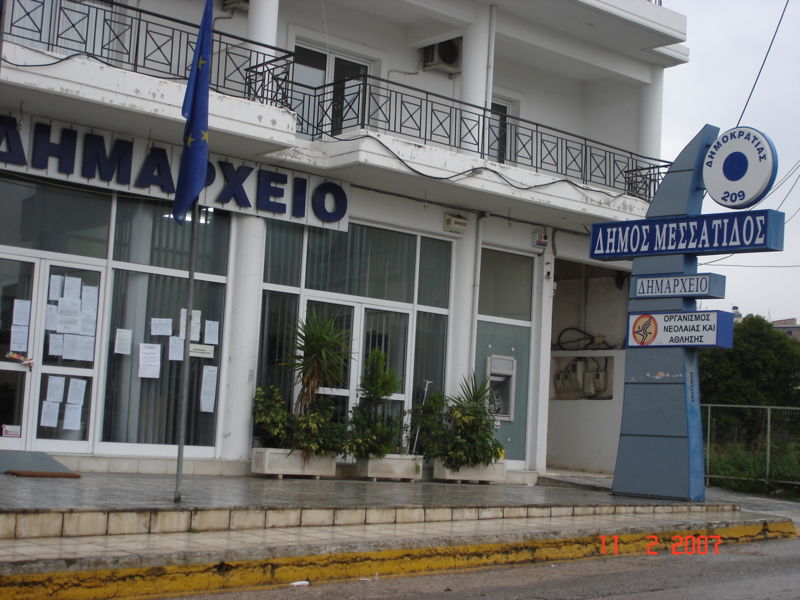
 City Hall.
- Fostiras Ovrias FC (football)
- Achilleas Ovruas (football)
- Atlas Ovruas (football)
- Milon Ovruas (volleyball)
- Phoenix Ovruas (basketball)
- Achaios Saravali (football & Basketball)
- Galini Demenika (basketball,Ping pong,Baseball,Football,Softball)
- Krini 97' (basketball)
- A.O. Krini (football)
- A.O. Thea (football)
- A.O. Kalithea (football)
- Galaxias Demenika (basketball)
- Ikaros Petroto (football)
References
- ^ Kallikratis law Greece Ministry of Interior (Greek)
External links
North: Patras West: Paralia, Vrachneika Messatida East: Leontio South: Fares Municipal unit of Messatida Municipal unit of Paralia Municipal unit of Patras Municipal unit of Rio Agios Vasileios · Aktaio · Ano Kastritsi · Arachovitika · Argyra · Drepano · Kato Kastritsi · Pititsa · Platani · Psathopyrgos · Rio · SellaMunicipal unit of Vrachnaiika Categories:- Populated places in Achaea
- Patras


Wikimedia Foundation. 2010.