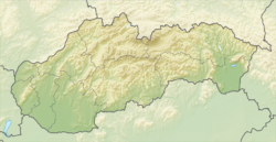
- Čenkovce
-
Čenkovce
Csenke— village — Location of the village Coordinates: 48°06′00″N 17°26′00″E / 48.1°N 17.4333333°ECoordinates: 48°06′00″N 17°26′00″E / 48.1°N 17.4333333°E Country  Slovakia
Region Trnava District Dunajská Streda First written mention 1252 Government – Mayor József Karika[1] Area – Total 21.41 km2 (8.3 sq mi) Elevation 123 m (404 ft) Population (2001)[2] – Total 814 – Estimate (2008) 1,100 – Density 95/km2 (246/sq mi) Etnicity[2] – Hungarians 90,91% – Slovakians 8,23% Time zone EET (UTC+1) – Summer (DST) EEST (UTC+2) Postal Code 930 39 Area code(s) +421 31 Čenkovce (Hungarian: Csenke, Hungarian pronunciation:[’tʃɛnkɛ]) is a village and municipality in the Dunajská Streda District in the Trnava Region of south-west Slovakia.
Contents
Demography
It has a population of about 814 people, of whom 740 respondents reported themselves as Hungarian and 67 as Slovak) at the 2001 census.
History
In historical records the village was first mentioned in 1240.
Geography
The municipality covers an area of 5.542 km².
References
Dunajská Streda • Šamorín • Veľký Meder
Báč • Baka • Baloň • Bellova Ves • Blahová • Blatná na Ostrove • Bodíky • Boheľov • Čakany • Čenkovce • Čiližská Radvaň • Dobrohošť • Dolný Bar • Dolný Štál • Dunajský Klátov • Gabčíkovo • Holice • Horná Potôň • Horné Mýto • Horný Bar • Hubice • Hviezdoslavov • Jahodná • Janíky • Jurová • Kľúčovec • Kostolné Kračany • Kráľovičove Kračany • Kútniky • Kvetoslavov • Kyselica • Lehnice • Lúč na Ostrove • Macov • Mad • Malé Dvorníky • Medveďov • Michal na Ostrove • Mierovo • Nový Život • Ňárad • Ohrady • Okoč • Oľdza • Orechová Potôň • Padáň • Pataš • Povoda • Rohovce • Sap • Štvrtok na Ostrove • Topoľníky • Trhová Hradská • Trnávka • Trstená na Ostrove • Veľká Paka • Veľké Blahovo • Veľké Dvorníky • Vieska • Vojka nad Dunajom • Vrakúň • Vydrany • Zlaté Klasy Categories:
- Villages and municipalities in Dunajská Streda District
- Hungarian communities in Slovakia
- Trnava Region geography stubs
Wikimedia Foundation. 2010.

