- Sinnemahoning State Park
Geobox Protected Area
name = Sinnemahoning State Park
native_name =
other_name =
other_name1 =
category_local = Pennsylvania State Park
category_iucn = III
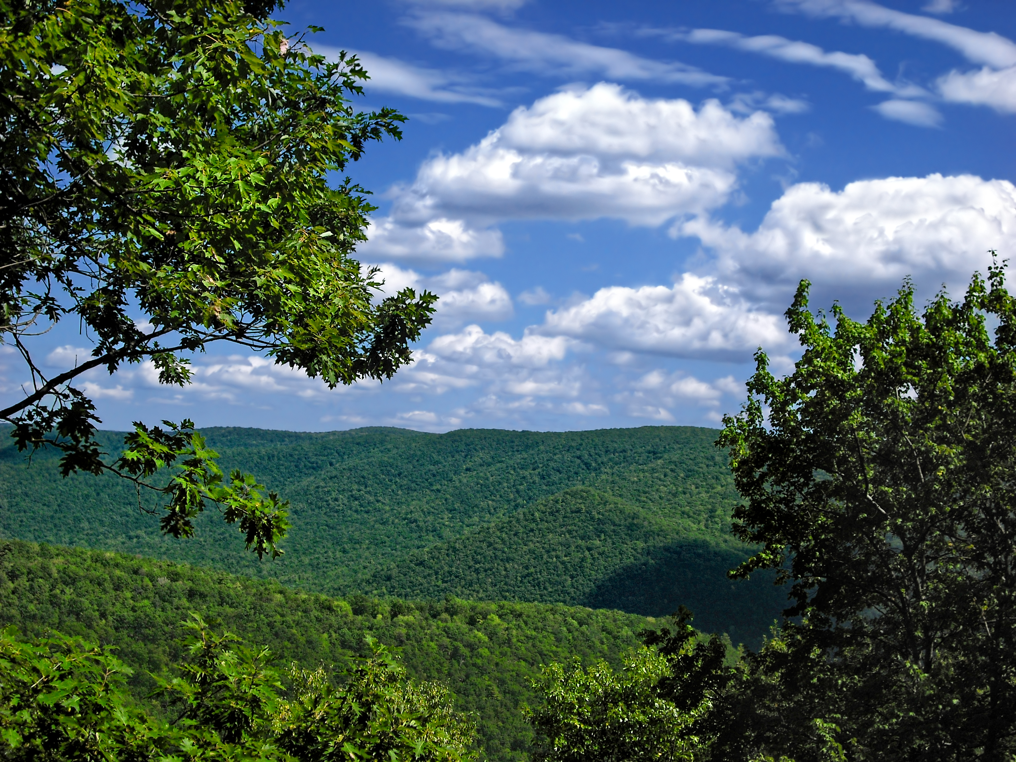
image_caption = A view from Sinnemahoning State Park
etymology_type =
etymology =
country = United States
state = Pennsylvania
region_type = Counties
region = Cameron
region1 = Potter
district_type = Townships
district = Grove
district1 = Wharton
city =
location =
lat_d = 41
lat_m = 26
lat_s = 54
lat_NS = N
long_d = 78
long_m = 02
long_s = 57
long_EW = W
location_note = cite web | url=Gnis3|1196537 | title="Sinnemahoning State Park" | date =August 30 1990 | work=Geographic Names Information System | publisher=United States Geological Survey | accessdate=2007-12-16]
elevation_imperial = 961
elevation_round = 1
elevation_note =
area_unit = acre
area_imperial = 1910
area_round = 1
area1_imperial =
area1_type =
length_imperial =
length_orientation =
width_imperial =
width_orientation =
highest =
highest location =
highest_lat_d =
highest_lat_m =
highest_lat_s =
highest_lat_NS =
highest_long_d =
highest_long_m =
highest_long_s =
highest_long_EW =
highest_elevation_imperial =
lowest =
lowest_location =
lowest_lat_d =
lowest_lat_m =
lowest_lat_s =
lowest_lat_NS =
lowest_long_d =
lowest_long_m =
lowest_long_s =
lowest_long_EW =
lowest_elevation_imperial =
biome =
biome_share =
biome1 =
biome1_share =
geology =
geology1 =
plant =
plant1 =
animal =
animal1 =
established_type =
established = 1962
management_body = Pennsylvania Department of Conservation and Natural Resources
management_location =
management_lat_d =
management_lat_m =
management_lat_s =
management_lat_NS =
management_long_d =
management_long_m =
management_long_s =
management_long_EW =
management_elevation =
visitation =
visitation_year =
free_type = Nearest city
free =Coudersport, Pennsylvania
free1_type =
free1 =

map_caption = Location of Sinnemahoning State Park in Pennsylvania
map_locator = Pennsylvania
map_first =
website = [http://www.dcnr.state.pa.us/stateparks/parks/sinnemahoning.aspx Sinnemahoning State Park]Sinnemahoning State Park is a 1,910 acre (7.73 km²) Pennsylvania state park in Grove Township, Cameron County and Wharton Township, Potter County,
Pennsylvania in the United States. The park is surrounded byElk State Forest and is mountainous with deep valleys. The park is home to the rarely seenelk andbald eagle . Sinnemahoning State Park is onPennsylvania Route 872 , eight miles (12.87 km) north of Sinnamahoning. In 1958, the park opened under the direction of the Pennsylvania Bureau of Forestry: it became a Pennsylvania State Park in 1962.History
Native Americans
Native Americans began living in the Sinnemahoning State Park area 10,000 to 12,000 years ago. They followed the receding glaciers and found that the area supported a bountiful supply of fish, wildlife, berries and nuts. Archaeologists have found evidence of their presence in the bottomlands of the creeks. The word Sinnemahoning is derived from an American Indian word that means "Rocky Lick". A natural
salt lick is said to have been near the mouth of Grove Run.cite web | url = http://www.dcnr.state.pa.us/STATEPARKS/PARKS/sinnemahoning/sinnemahoning_history.aspx | title = Sinnemahoning State Park: History of the Park | accessdate = 2007-12-16 | publisher =Pennsylvania Department of Conservation and Natural Resources ]Lumber era
The native population of Pennsylvania was forced out by disease in war during the years before, during, and after the
American Revolutionary War . The Sinnemahoning area was left largley unsettled and wild until the late 1800s when the logging boom that spread throughout the mountains of Pennsylvania arrived. Lumberman cleared vast stands ofold growth forest . The logs were floated downSinnemahoning Creek and its tributaries to theWest Branch Susquehanna River and to theSusquehanna Boom at Williamsport. The only thing the lumbermen left behind was the treetops. These tree tops were left to dry. The passingsteam locomotive s on the railroads would ignite this dry brush causing massivewildfire s that swept through the mountains and valleys. The Sinnemahoning Creek area was left to waste. The forests struggled to regrow in the wake of the wildfire. The hills began to erode. The streams were dying and wildlife was scarcely found.George B. Stevenson Reservoir
George B. Stevenson Reservoir is a 142 acre (0.57 km²) man made lake that was constructed by the Commonwealth of Pennsylvania in 1955 as part of the
flood control project on theWest Branch Susquehanna River . It is one of four such dams in the river basin. The otherreservoir s are atKettle Creek State Park , Curwensville andBald Eagle State Park . These four reservoirs and dams control a total of 1,163 square miles (3012 km²) of drainage area and provides flood prevention for the cities and towns downstream.cite web | url = http://www.dcnr.state.pa.us/stateparks/Parks/sinnemahoning.aspx
title = Sinnemahoning State Park
accessdate = 2006-11-26
publisher =Pennsylvania Department of Conservation and Natural Resources ]The reservoir is open to some recreational boating,
fishing andice fishing . Gas powered motors are prohibited on George B. Stevenson Reservoir. Motorized boats must be powered by electric motors only.Sailboats ,rowboat s,canoes ,kayaks , and paddleboats are permitted on the waters of the lake. All boats must be properly registered with any state. Common game fish at the park, in the lake and streams, are brook, rainbow andbrown trout ,catfish ,crappie ,tiger muskellunge , smallmouth andlargemouth bass , sunfish,bluegill ,perch andpickerel . There is a native population of brook trout in some of the small streams of Sinnemahoning State Park. The reservoir is open to ice fishing during the winter months when the lake is frozen.Recreation
Hunting
There are 1,400 acres (5.66 km²) acres of woods open to hunting. Hunters are expected to follow the rules and regulations of the
Pennsylvania Game Commission . The common game species are black bears,squirrel s,ruffed grouse ,waterfowl ,white-tailed deer , and turkeys. The hunting ofgroundhog s is prohibited. Hunters also use the park to gain access to Elk State Forest.Trails
The trails of Sinnemahoning State Park are open to
hiking ,cross-country skiing and snow mobiling.* Red Spruce Trail is about one mile (1.6 km) long and goes from the camping area to the Forty Maples Picnic Area. It passes through a
spruce plantation and a mixed hardwood forest. Hikers should be cautious of thevenomous snake s that live in the area.* Low Lands Trail is a level trail that follows a railbed that was part of the
Philadelphia and Erie Railroad . It passesvernal pool s, thick stands of spruce trees, and creek beds. The Low Lands Trail ends at the Wildlife Viewing area. Hikers on the trail may get the chance to seeosprey , butterflies, elk, and grassland birds.Camping and picnicking
The modern campground has 35 sites with a washhouse that is equipped with showers and flush toilets. The camp sites can accommodate
tent s, campers and RVs. Each site has a picnic table and a fire ring. The Brooks Run Ranger cabin is a two story house available for rent. It sleeps up to twelve people with four bedrooms, a living room, kitchen and a fireplace. Sinnemahoning State Park has three picnic area.Nearby state parks
The following state parks are within convert|30|mi|km|0 of Sinnemahoning State Park: [cite web
url = http://www.dcnr.state.pa.us/stateparks/parks/region_wilds.aspx
title = Find a Park: Pennsylvania Wilds
accessdate = 2006-11-26
publisher =Pennsylvania Department of Conservation and Natural Resources "Note: Locator Map reference"] [cite map |scale = 1:65,000| publisher= Pennsylvania Department of Transportation, Bureau of Planning and Research, Geographic Information Division | url= ftp://ftp.dot.state.pa.us/public/pdf/BPR_pdf_files/Maps/GHS/Roadnames/cameron_GHSN.pdf| title= 2007 General Highway Map Cameron County Pennsylvania | accessdate= 2007-07-27 "Note: shows Sinnemahoning State Park"] [cite map |scale = 1:65,000| publisher= Pennsylvania Department of Transportation, Bureau of Planning and Research, Geographic Information Division | url= ftp://ftp.dot.state.pa.us/public/pdf/BPR_pdf_files/Maps/GHS/Roadnames/potter_GHSN.pdf| title= 2007 General Highway Map Potter County Pennsylvania | accessdate= 2007-07-27 "Note: shows Sinnemahoning State Park"] cite web
last = Michels
first = Chris
year = 1997
url = http://www2.nau.edu/~cvm/latlongdist.html
title = "Latitude/Longitude Distance Calculation"
publisher =Northern Arizona University
accessdate = 2008-04-23]
*Bendigo State Park (Elk County)
*Bucktail State Park Natural Area (Cameron and Clinton Counties)
*Cherry Springs State Park (Potter County)
*Denton Hill State Park (Potter County)
*Elk State Park (Elk County)
*Hyner Run State Park (Clinton County)
*Hyner View State Park (Clinton County)
*Kettle Creek State Park (Clinton County)
*Lyman Run State Park (Potter County)
*Ole Bull State Park (Potter County)
*Parker Dam State Park (Clearfield County)
*Patterson State Park (Potter County)
*Prouty Place State Park (Potter County)
*S. B. Elliott State Park (Clearfield County)
*Sizerville State Park (Cameron and Potter Counties)References
External links
*
Wikimedia Foundation. 2010.