- Lampeia
-
Lampeia
ΛαμπείαLocation 
 Lampeia
Coordinates 37°51′N 21°48′E / 37.85°N 21.8°ECoordinates: 37°51′N 21°48′E / 37.85°N 21.8°E Location within the peripheral unit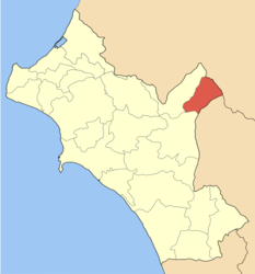
Government Country: Greece Region: West Greece Regional unit: Elis Municipality: Archaia Olympia Population statistics (as of 2001) Municipal unit - Population: 1,374 - Area: 72.4 km2 (28 sq mi) - Density: 19 /km2 (49 /sq mi) Other Time zone: EET/EEST (UTC+2/3) Elevation (center): 803 m (2,635 ft) Postal: 270 63 Telephone: 26240 Auto: ΗΑ Lampeia (Greek: Λαμπεία) is a village and a former municipality in Elis, West Greece, Greece. Since the 2011 local government reform it is part of the municipality Archaia Olympia, of which it is a municipal unit.[1] The village is also known as Divri. Its population is presently around 1,000. Lampeia is in a valley setting and Greek National Road 33 passes through it. Distance from Patras is 82 km south, nearly 50 to 60 km north of Olympia and 84 km northwest of Tripoli.
Contents
Subdivisions
The municipal unit Lampeia is subdivided into the following communities (constituent villages in brackets):
- Astras (Astras, Kalyvia Astra)
- Lampeia (Lampeia, Amygdali)
- Oreini (Oreini, Paliofytia)
Population
Year Village Municipality 1981 757 - 1991 576 1,243 2001 764 1,374 History
Ancient times to the Greek War of Independence
In ancient times, it was part of Arcadia, in its history, almost nothing is known and except for a few fragments and portions in its major literary works, its archeological remains does not survives. One sentence from a work made by Pausanias included: Εν Λαμπεία είχε τας πηγάς ο ποταμός Ερύμανθος, ήν δε το όρος τούτο ιερόν του Πανός και μοίρα του όρους Ερυμάνθου (En Lampeia eiche tas pegas o potamos Erymanthos, in de to oros touto ieron tou Panos kai moira tou orous Erymanthou = In Lampeia had a spring from the Erymanthos river, along with the mountain which was holy of Panus and the fate of the Erymanthos mountains), the area had several villages. It later switched hands including the Romans, the Byzantines, Franks, partly the Albanians, the Venetians and the Ottomans. During the Turkish rule, the Turks tried for their strategic reasons and trained in its fields of the prefecture. The area tried to bloomed much of its economy and tried sometimes battled for the liberation of Greece. It was finally liberated during the Greek War of Independence in 1821.
Early Greek period
Its inhabitants had a small emigration to the large cities of the Peloponnese (Patras, Pyrgos, Tripoli) and left the important economy, trading and a cultural centre for the surrounding villages and the area. Characteristically Divry ran its first school in Ilia after the liberation and independence from the Turks. It created several political figures and families including its descendants. Fani Palli-Petralia. Alexandros Panagoulis and several others. It first created its own municipality in the 1830s and was only one of eight in the prefecture. The municipality included most of its current places along with Koumani, Giarmena, Androni (now Antroni), Kleintia, Pefki and the mountainous village belonged to the Arcadian city of Psofida, it bounded the other municipalities including Olympia, Olenia and Amaliada. The municipality lasted until 1913 when it broken down into many communes, Koumani, Giarmena and Antroni are now in Lasiona, Kleintia, Pefki and Agia Anna are in Oleni and the mountainous village to the east are now in Psofida and the Achaia prefecture some of its village currently have different Greek originated names. The municipality was recreated under the Capodistrian Plan in the late-1990s. It is presently in the northeastern part of the prefecture of Ilia.
Post-War and Modern period
After World War II and the Greek Civil War, its buildings were rebuilt. Pavement was linked in the 1950s along with electricity, radios arrived in the 1960s as well as automobiles and television in the 1980s. Towns and village became connected with pavement which first began in the 1970s and completed in the early-2000s. Computer and Internet was introduced at the turn of the century. Today, around a thousand inhabitants work in agriculture and other businesses. During the peak summer months, relatives visit from its neighbouring large cities and outside the country.
In the media until recently, nothing much was filmed and set in Lampeia except for documentaries. In Traveling in Greece (Menoume Ellada), an episode on Lampeia was featured on June 6, 2006.
Notable people
- Pavlos Matesis,[2] writer
See also
- List of places in the Ilia prefecture
References
- ^ Kallikratis law Greece Ministry of Interior (Greek)
- ^ Επίτομο Γεωγραφικό Λεξικό της Ελλάδος (Geographical Dictionary of Greece), Μιχαήλ Σταματελάτος, Φωτεινή Βάμβα-Σταματελάτου, εκδ. Ερμής, ΑΘήνα 2001
External links
- MyDivri.gr A great site with news, photos and historical information on Divri (Δίβρη)/Lambia (Λαμπεία) (in Greek and English)
- Antroni - Labeia (in Greek)
- Video from the ERT program Traveling in Greece (Menoume Ellada) shown on ET1
North: Tritea West: Lasiona Lampeia East: Psofida in the Achaia prefecture South: Foloi Municipal unit of Archaia Olympia Archaia Olympia · Archaia Pisa · Aspra Spitia · Chelidoni · Flokas · Irakleia · Kafkonia · Kamena · Kladeos · Koskinas · Kryoneri · Linaria · Louvro · Mageiras · Mouria · Pefkes · Pelopio · Platanos · Pournari · Smila · Strefi · Vasilaki · XirokamposMunicipal unit of Foloi Municipal unit of Lampeia Municipal unit of Lasiona Categories:- Populated places in Elis
- Municipalities of the Elis prefecture


Wikimedia Foundation. 2010.