- Ceriale
-
Ceriale — Comune — Comune di Ceriale Town hall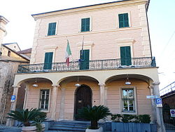 Location of Ceriale in Italy
 Ceriale
Coordinates: 44°5′N 8°14′E / 44.083°N 8.233°ECoordinates: 44°5′N 8°14′E / 44.083°N 8.233°E Country Italy Region Liguria Province Province of Savona (SV) Frazioni Peagna Area - Total 11.2 km2 (4.3 sq mi) Population (Dec. 2004) - Total 5,765 - Density 514.7/km2 (1,333.2/sq mi) Demonym Cerialesi Time zone CET (UTC+1) - Summer (DST) CEST (UTC+2) Postal code 17023 Dialing code 0182 Website Official website Ceriale (Ligurian: O Çejâ) is a comune (municipality) in the Province of Savona in the Italian region Liguria, located about 70 km southwest of Genoa and about 30 km southwest of Savona. As of 31 December 2004, it had a population of 5,765 and an area of 11.2 km².[1]
The municipality of Ceriale contains the frazione (subdivision) Peagna.
Ceriale borders the following municipalities: Albenga, Balestrino, Borghetto Santo Spirito, Cisano sul Neva, and Toirano.
Contents
Physical description
The town is located in the Riviera of Ponente, at east of the plain of Albenga, on the slopes of Mount Croce (541 metres).
- Seismic classification: Zone 3 (low seismicity), Decree No. PCM 3274 of 20/03/2003.
- Climate classification: C (Grades days of the city are 1360, and the maximum limit allowed for the ignition of the heaters is 10 hours a day, from November 15 to March 31).
History
The village, already ancient territorial dominion of the bishop of Albenga, passed in the 14th century to the Government of the Republic of Genoa. During the Middle Ages the nearby village of Capriolo was abandoned, according to local sources, as a result of an invasion of ants. Following the frequent incursions of the pirates Saracens on the Ligurian coast was built in 1563, a circular bastion adjacent to the beach, but, although the structure adjacent to the sea, the town was attacked by Barbary pirates in 1637. The village suffered a damaging and looting the homes burned. In 1764 participated, along with other towns of the Ligurian Riviera, an uprising against Genoa and his Republic against the heavy tax burdens. He therefore part of the Kingdom of Sardinia in 1815, the fall of Napoleon Bonaparte, and 1861 of the Kingdom of Italy. From 1973 in 31 December 2008 he was part of Ingauna Mountain Community, it was terminated by the Liguria Regional Law Number 23 of December 29 2010.
Main Sights
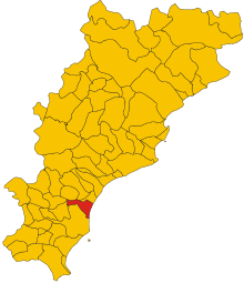 Position of Ceriale in the Province of Savona
Religious Architecture
- Parish Church St. John the Baptist and Eugene[disambiguation needed
 ]: Inside the church, there are a valuable cross of 16th century and numerous blades dating from the 16th and 17th centuries.
 - Church of Peagna: Adjacent to the cemetery is flanked by a tower built in the style Baroque and are stored in its internal paintings of the 15th and 16th centuries.
Amusement Parks
- Water Park: The Caravelle
Culture
Museums
- The Paleontological Museum Silvio Lai: It was founded in 1993 in the hamlet of Peagna. The museum exhibits the collection of municipal fossil from the nearby Regional Natural Reserve of Rio Torsero, dating back to Pliocene lower (5.3000000 to 3.6000000 of years ago). The museum has a conference room, a laboratory and a small library.
Events
- The feast of San Rocco: On August 16, Ceriale celebrate Saint Rocco, patron saint, on this day is held on the promenade the "Fair of San Rocco" which involved walking the area and the lower Piedmont. The feast of San Rocco is particularly renowned for the evening procession of the Holy Crucifix art. To participate in this procession of the Confraternity of Liguria that parade their crucifix, exposed during the years in their parish churches. Every crucifix, while being very heavy, is carried on one shoulder by a brother who supports him with a special belt. The procession, as a rule, is opened by the Bishop of Albenga-Imperia and is closed by a band. The day ends with fireworks over the sea.
Demographic evolution

Immigration
Sister City
Economy
The town bases its main economic resource in the touristic field, but also on the agriculture. In the area of cultivation are practiced vegetable and flower, in particular plants orchid grown in greenhouses. Active sector also industry with the presence of shipyards and factories confectionery.
Gallery
-
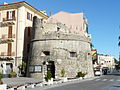
The Turret
-
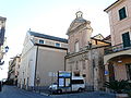
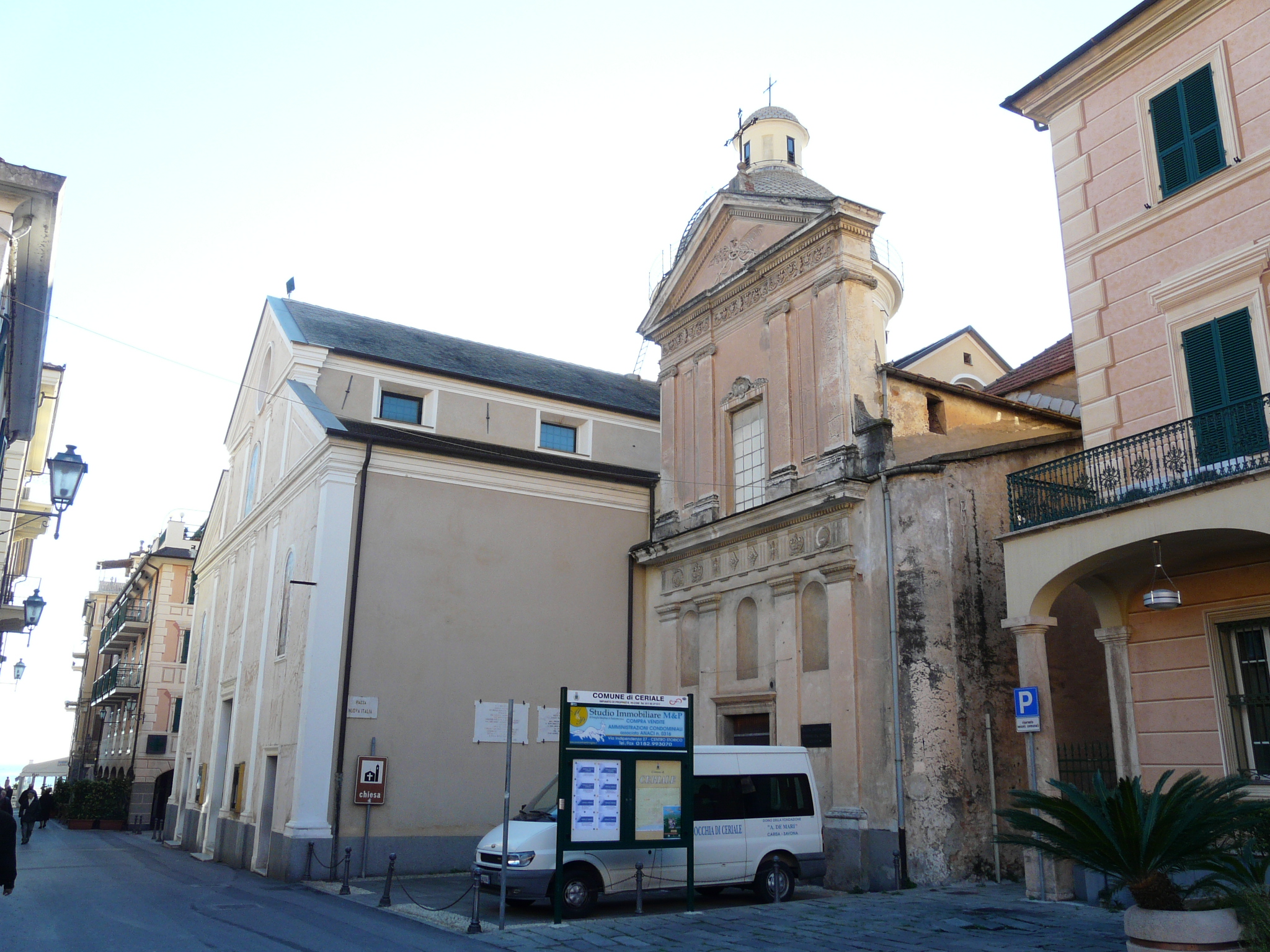
The Church of Saints John the Baptist and Eugene
-
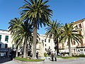
The Center
-
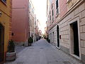
The Caruggio
References
External links
Liguria · Comuni of the Province of Savona Alassio · Albenga · Albisola Superiore · Albissola Marina · Altare · Andora · Arnasco · Balestrino · Bardineto · Bergeggi · Boissano · Borghetto Santo Spirito · Borgio Verezzi · Bormida · Cairo Montenotte · Calice Ligure · Calizzano · Carcare · Casanova Lerrone · Castelbianco · Castelvecchio di Rocca Barbena · Celle Ligure · Cengio · Ceriale · Cisano sul Neva · Cosseria · Dego · Erli · Finale Ligure · Garlenda · Giustenice · Giusvalla · Laigueglia · Loano · Magliolo · Mallare · Massimino · Millesimo · Mioglia · Murialdo · Nasino · Noli · Onzo · Orco Feglino · Ortovero · Osiglia · Pallare · Piana Crixia · Pietra Ligure · Plodio · Pontinvrea · Quiliano · Rialto · Roccavignale · Sassello · Savona · Spotorno · Stella · Stellanello · Testico · Toirano · Tovo San Giacomo · Urbe · Vado Ligure · Varazze · Vendone · Vezzi Portio · Villanova d'Albenga · ZuccarelloCategories:- Cities and towns in Liguria
- Communes of the Province of Savona


Wikimedia Foundation. 2010.