- Mount Waverley, Victoria
-
Mount Waverley
Melbourne, Victoria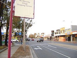
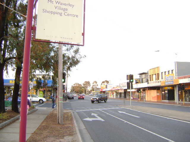
Mount Waverley Village Shopping Centre, looking north along Stephensons Road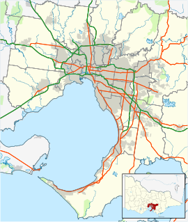
 Mount Waverley
Population: 30,617 (2006)[1] Postcode: 3149 Area: 15.9 km² (6.1 sq mi) Location: 16 km (10 mi) from Melbourne LGA: Monash State District: Oakleigh, Clayton, Mount Waverley Federal Division: Chisholm, Bruce Suburbs around Mount Waverley: Ashwood Burwood Burwood East Chadstone Mount Waverley Glen Waverley Oakleigh East Clayton Notting Hill Mount Waverley is a suburb in Melbourne, Victoria, Australia, 16 km south-east from Melbourne's central business district.[2] Its Local Government Area is the City of Monash. At the 2006 Census, Mount Waverley had a population of 30,617.
Contents
Geography
Mount Waverley is a large suburb, rectangular in shape, bounded by Highbury Road in the north, Ferntree Gully Road in the south, Huntingdale Road in the west, and Blackburn Road in the east. At the centre of the suburb is Mount Waverley Village Shopping Centre, and in the south east is Pinewood Shopping Centre.
History
The Mount Waverley area, then part of the Parish of Mulgrave, was divided by straight roads running north-south and east-west, each exactly one mile apart, by Assistant Surveyor Eugene Bellairs, in 1853.[3]
Mount Waverley Post Office opened on 9 October 1905 in the then rural area.[4]
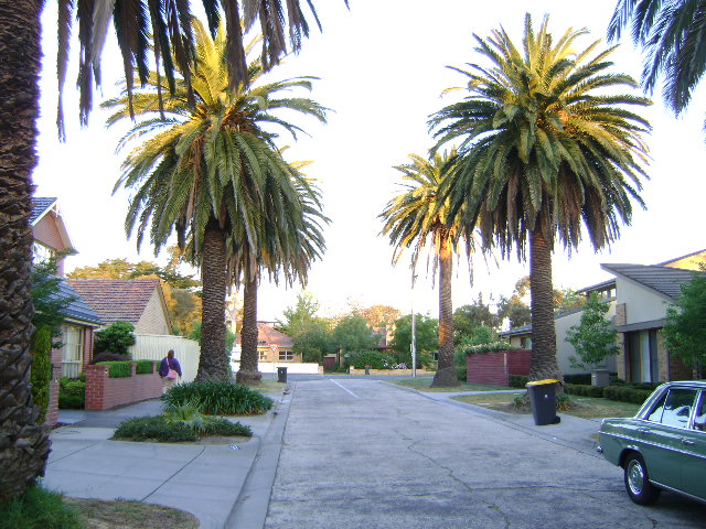
Mount Waverley is famous for its heritage streets. The suburb was originally a new estate in the 1930s. Due to the onset of the Great Depression, the estate did not get off the ground. The streets had been laid down, but no houses were built; merely a row of cardboard boxes housed the first few residents who had migrated east from the slums of Ashburton to enjoy a better standard of living, only to be bitterly disappointed with the estate agents who promised milk and honey but instead delivered a mosquito infested swamp. The Ashburton immigrants, while disappointed all agreed that the swamp was a major step up from their former homes *(*source*: Lachlan Barth - president of Ashburton Historical Society)* . These mean streets were built of concrete, not asphalt. The surface is still the same as it was in the 1930s, with only minor maintenance over the decades. Residential development did not resurge until the 1950s. In early 2008, a new smoother asphalt surface was finally laid along the strip of Stephensons Road between Waverley Road and Mount Waverley Village shopping centre. Stephensons Road is the main road of Mount Waverley that goes straight through the middle of the suburb from south (where it becomes Clayton Road) to north (where it becomes Middleborough Road). A notable residential street is Sherwood Road, just south of the shopping centre. The eastern half of this street is divided by a large reserve strikingly planted with rows of large palm trees.[5] Post Offices at Mount Waverley North (opened 1959 closed 1983), Mount Waverley South (opened 1968 closed 1973), and Mount Waverley West (opened 1964 closed 1977) chart the wider residential development of the suburb.[4]
Today
One of the highest points in Mount Waverley is the reservoir in High Street Road. The natural land surrounding this landmark is over 138-150 metres above sea level. Construction of the reservoir began in 1927.
The waterways in the suburb are Damper Creek in the north, and Scotchmans Creek, in the south. Significant parks within Mount Waverley include Valley Reserve, Damper Creek Reserve, and Federal Reserve. All reserves contain significant areas of remnant native bushland. Significant wetland areas in Mount Waverley are found within Valley Reserve and in the Scotchmans Creek valley.
The popular Melbourne Street Directory Melway was first produced in a garage in Mount Waverley in 1966. It is now published from premises in Ricketts Road in Mount Waverley. [6]
Over many years, Mount Waverley has held an annual Christmas Carols event, which have featured hundreds of local performers. Matthew Clark took over as Executive producer in 2006, and has grown the event enormously. The 2009 event on December 5 at 7.30pm was a resounding success with audience numbers reaching over 5,500. The program featured artists Anthony Callea and Silvie Paladino, with Patti Newton hosting the event. The future of the Mount Waverley Carols event is uncertain due to funding requirements. The event needs the financial support from the City of Monash.
Education
Secondary Schools
Primary Schools
- Mount Waverley Primary School
- Mount Waverley North Primary School
- Essex Heights Primary School
- Sussex Heights Primary School
- Syndal South Primary School
- Pinewood Primary School
Private Schools
- Huntingtower School
- Avila College
- Holy Family Primary School
Libraries
- Mount Waverley branch of Monash Public Library Service located on the north side of Mount Waverley station in Miller Crescent.
Sport
The suburb has two Australian rules football clubs, The Waverley Blues Football Club (who have won 3 senior premierships in the past 9 years), competing in the Eastern Football League, and The Mount Waverley Football Club, competing in the Southern Football League.[7]
The Mount Waverley Cricket Club was founded in 1906 and fields five senior sides playing on turf in the who play in the Victorian Sub-District Cricket Association and the Box Hill Reporter competition (Veterans grade). The club also run a full program of junior cricket which includes having a team in the VSDCA's RM Hatch competition and nine under age sides playing on turf and synthetic wickets.
Cricket is also represented by the Mt Waverley Catholics Cricket Club who compete in the Southern District & Churches Cricket League (SDCCL). The club's home ground is Mayfield Park which has 2 training nets and is a syntetic wicket. The club has many junior teams ranging from under 11's all the way through to under 17's. In season 2008/2009 the senion team won their most recent SDCCL Menzies Shield[8], which is the competitions highest grade. This is a feat the club has managed 3 times since joining the SDCCL.
Golfers play at the course of the Riversdale Golf Club on High Street Mount Waverley.[9]
Transport
Mount Waverley has two train stations, Mount Waverley and Jordanville, on the Glen Waverley line.
Notable people
- Graeme Strachan
- Redmond Barry
- John Blackman
- Peter Dupas
- Shona Morgan
- Dirk Nannes
- Peter Tatchell
- Bret Thornton
See also
- Mount Waverley railway station
- Jordanville railway station
- Electoral district of Mount Waverley
Gallery
-
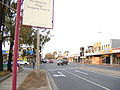
Mount Waverley Village Shopping Centre, looking North along Stephensons Road
-

Date Palm Trees in Sherwood Road, looking east
-
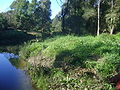
Native Bushland along Scotchmans Creek
References
- ^ Australian Bureau of Statistics (25 October 2007). "Mount Waverley (State Suburb)". 2006 Census QuickStats. http://www.censusdata.abs.gov.au/ABSNavigation/prenav/LocationSearch?collection=Census&period=2006&areacode=SSC21483&producttype=QuickStats&breadcrumb=PL&action=401. Retrieved 2007-09-29.
- ^ http://www.postcodes-australia.com/areas/vic/mulgrave/mount+waverley
- ^ http://www.monash.vic.gov.au/city/history/section-a-3.htm#intro City of Monash: Detailed history: Section A: Before 1900. Accessed 27 October 2008
- ^ a b Premier Postal History, Post Office List, https://www.premierpostal.com/cgi-bin/wsProd.sh/Viewpocdwrapper.p?SortBy=VIC&country=, retrieved 2008-04-11
- ^ http://www.monash.vic.gov.au/city/history/section-c-3.htm City of Monash: Detailed history: Planning the New Suburb. Accessed 27 October 2008
- ^ Ausway Corporation website, accessed 4 November 2010 http://ausway.com/home/Default.aspx?tabid=124&language=en-US
- ^ Full Point Footy, Eastern Football League, http://www.fullpointsfooty.net/eastern_football_league.htm, retrieved 2008-10-21
- ^ MyCricket Australia, Scorecard, http://mycricket.cricket.com.au/common/pages/asphost.aspx?loc=/cricket/reports/match.asp&matchID=573158&entityID=2063, retrieved 2011-01-28
- ^ Golf Select, Riversdale, http://www.golfselect.com.au/armchair/courseView.aspx?course_id=315, retrieved 2009-05-11
External links
Coordinates: 37°52′37″S 145°07′52″E / 37.877°S 145.131°E
Suburbs of the City of Monash | Melbourne | Victoria Ashwood · Burwood · Chadstone · Clayton · Glen Waverley · Hughesdale · Huntingdale · Mount Waverley · Mulgrave · Notting Hill · Oakleigh · Oakleigh East · Oakleigh South · Wheelers Hill
Categories:- Suburbs of Melbourne


Wikimedia Foundation. 2010.