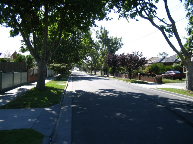
- Hughesdale, Victoria
Infobox Australian Place | type = suburb
name = Hughesdale
city = Melbourne
state = vic

caption = Euston Rd, Hughesdale.
lga = City of Monash
postcode = 3166
pop = 6503 (2006)Census 2006 AUS | id = SSC21347 | name = Hughesdale (State Suburb) | accessdate = 2007-09-29 | quick = on]
area = 2
est =
propval = $500,000 [ [http://www.domain.com.au/public/suburbprofile.aspx?suburb=Huntingdale&postcode=3166 Hughesdale] , accessed 9 August 2007]
stategov = Oakleigh
fedgov = Higgins, Hotham
dist1 = 16
location1= Melbourne
near-nw = Malvern East
near-n = Malvern East
near-ne = Chadstone
near-w = Murrumbeena
near-e = Oakleigh
near-sw = Bentleigh East
near-s = Bentleigh East
near-se = Oakleigh SouthHughesdale is an inner southeast suburb of
Melbourne , Victoria,Australia . Just 2sq km in size, it is the smallest suburb in theCity of Monash , its Local Government Area [ [http://www.id.com.au/monash/atlas/default.asp?id=102&pg=56 Monash community atlas. Source: ABS, 2001] ] . With more than one in three residents born outside Australia, the suburb has a strong Greek presence. Fourteen per cent of those living in the suburb speak only Greek at home. ]Features
Hughesdale has a small strip shopping centre on Poath Road, and a railway station which is the closest rail access point to nearby
Chadstone Shopping Centre . The shopping strip has undergone a revival since the mid-2000s with several new shops opening and the construction of a new retail/residential block, as well as the formation of a local traders' association.Census figures show that the suburb is ranked 12th out of Melbourne's 328 suburbs in the proportion of employed workers who travel to work by train: one in six use the train to get to work, double the Melbourne average. [ [http://www.doi.vic.gov.au/doi/doielect.nsf/2a6bd98dee287482ca256915001cff0c/8045f53c8cd75b8f4a2569d7000781e0/$FILE/Hughesdale.pdf Department of Infrastructure information sheet] ]
chools
Hughesdale has three schools – Hughesdale Primary School, Sacred Heart Girls' College and St Anargiri Greek Orthodox College.
Hughesdale Primary School, No. 4176, opened in 1924 as Oakleigh South State School and was renamed Hughesdale Primary School in 1938. It had a peak enrolment of 1296 in 1953, at which point some classes held 65 students. [ [http://www.hughesdaleps.vic.edu.au/hist.html Hughesdale Primary School history] ] . The school was threatened with closure by the Kennett government in the 1990s as student numbers fell because of demographic changes, but was saved after a vote at an extraordinary School Council meeting in October 1996. Enrolments have risen steadily since then; in 2005 there were 322 students enrolled. [ [http://www.hughesdaleps.vic.edu.au/Annual_Report_2005.pdf Hughesdale Primary School annual report, 2005] ]
St Anargiri Greek Orthodox College opened in 1983, primarily to satisfy the educational needs of the Greek community of Melbourne's southeastern suburbs. It was initially a Primary to Year 8 school, with 91 students; today it is registered for Primary to Year 12, with enrolments exceeding 740. [ [http://abalinx.com/ogoc_college/index.php?section=212 Oakleigh Greek Orthodox College website] ]
Sacred Heart Girls' College was opened in 1957 by the Sisters of Our Lady of the Missions, who came from the convent in Highgate,
Perth, Western Australia . Enrolments for Year 7 are taken from surrounding Catholic Primary Schools. Subject to availability, places are then offered to other students, with preference given to Catholics. [ [http://www.shgcoak.melb.catholic.edu.au/history.htm Sacred Heart Girls College website] ] The suburb was also the home of Oakleigh Technical School, at the corner of Poath Rd and North Rd, from 1946 to 1991. [ [http://home.vicnet.net.au/~otss/ Oakleigh Technical School history website] ] The school was demolished in 1993, with the site now occupied by a service station,McDonald's restaurant and a sports ground.Origin of suburb and street names
The suburb was named as a tribute to James Vincent Hughes, mayor of Oakleigh from 1924 to 1925 who, with the Poath Road Railway Station League, lobbied heavily for a new station for the area. In 1924 the League suggested the station be called "Hugheston", but in February 1925, shortly before the station opened,
Victorian Railways decided its name would be "Hughesdale". A decade later there was a move to rename Poath Rd "Hughesdale Rd", but this was rejected by the then Caulfield City Council. [cite book
author = Peter R. Murray and John C. Wells
title = From Sand, Swamp and Heath: A History of Caulfield
edition =
publisher = City of Caulfield
year = 1980
id = ISBN 0-9598392-6-7] [ [http://www.monlib.vic.gov.au/dbAll/streetresult.php?oakid=198&dbname=oakroads Monash Public Library data on street name origins] ]Many street names in the suburb are named after notable British train stations. These include Rugby Rd, Euston Rd, Crewe Rd, Swindon Rd, Paddington Rd, Clapham Rd, Bletchley Rd, Willesden Rd, Carlisle Cr, Preston Rd, Skipton Rd, Dalston Rd, Camden Rd, Earlstown Rd. [ [http://www.monlib.vic.gov.au/dbAll/streetresult.php?oakid=102&dbname=oakroads Monash Public Library Service Local History ] ] .
Among other street names are [ [http://www.monlib.vic.gov.au/dbAll/switchBrowse.php?searchterm=Nelson+&searchtype=title&choices=2 Monash City Council street names database] ] :
* Corr St: Named after E.J. Corr, Oakleigh mayor, 1907-8 and 1916-17;
* Darling St: Named after SirCharles Henry Darling , Governor of Victoria, 1863-1866;
* Hotham St: Named after SirCharles Hotham , Governor of Victoria, 1854-1855;
* Paget St: Name after local resident and hotelier Charles Edwin Paget (d. 1936)ee also
References
External links
Wikimedia Foundation. 2010.
