- Havelock-Belmont-Methuen, Ontario
-
Havelock-Belmont-Methuen — Township — Municipal office in Havelock

 Havelock-Belmont-Methuen
Coordinates: 44°34′N 77°54′W / 44.567°N 77.9°WCoordinates: 44°34′N 77°54′W / 44.567°N 77.9°W Country  Canada
Province  Ontario
County Peterborough Settled 1823 Incorporated 1998 Government – Type Township – Reeve Ronald Gerow – Federal riding Peterborough – Prov. riding Peterborough Area[1] – Land 526.02 km2 (203.1 sq mi) Population (2006)[1] – Total 4,637 – Density 8.8/km2 (22.8/sq mi) Time zone EST (UTC-5) – Summer (DST) EDT (UTC-4) Postal Code K0L 1Z0 Area code(s) 705 Website www.havelockbelmont
methuen.on.ca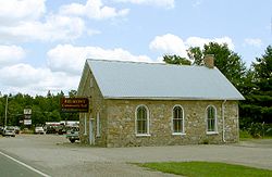 Belmont
Havelock-Belmont-Methuen is a township in central-eastern Ontario, Canada, in Peterborough County.
Contents
History
The region's history began with an influx of settlers after Belmont and Methuen Township was surveyed in 1823. The community of Havelock, which was named after British general Sir Henry Havelock, was incorporated as an independent village in 1892[2] .
Early settlers built their homes in an area of dense forests, numerous lakes and rivers within the rocky Canadian Shield. They survived by means of fishing, logging and farming. Later in the nineteenth century and continuing to the present, mining became an important economic activity. Early businesses in Havelock included a post office, store, bakery, a blacksmith and a millinery and were located south of the current village on high ground at the intersection of County Road 30 and Old Norwood Road. In 1881 the Canadian Pacific Railway surveyed a right-of-way through the area north of Havelock and a year later laid rails and surveyed and filled the swampy land to make room for a larger village[2] . The current village of Havelock was developed on the filled land by the tracks north of the former village site and was incorporated in 1892. In the fall of 1884, the first full passenger train stopped at Havelock, from Toronto on its way to Smith's Falls. Havelock was an important freight depot from the 1880s to the 1960s. The railway's activity today consists of transporting nepheline syenite and crushed basalt rock from two mines north of Havelock operated by Unimin[2] .
Historic School
The old school, a two story building now known as the Hilltop Apartments,stands at the Northwest corner of Oak Street and Mathison Street, Havelock. In 1890 to 1963 Havelock area students attended this school. In 1937 the school was renamed Havelock High School and in 1952 Havelock High School Students were transferred to the new Norwood District High School in the neighboring town of Norwood, Ontario. In 1963 Havelock Public School Students were transferred to the new Havelock Public School, east of the Havelock Community Centre. In 1963 the school building was sold and converted to apartments[2] . In September, 2005 the Havelock High School Reunion Committee placed in front of the apartments a commemorative plaque bolted to a large red granite stone from a local quarry.
Railway Station
The Canadian Pacific Railway (CPR) station on Ottawa Street (Hwy #7) in Havelock was built in 1929[2] . It was designated in 1991 as a Heritage Railway Station by the Historic Sights and Monuments Board, Parks Canada. In 2004 the Station was purchased and renovated to accommodate restaurants. [2] In 1998, the village of Havelock was reamalgamated with the township of Belmont and Methuen to form the current township of Havelock-Belmont-Methuen.
Communities
The township comprises the communities of Ashby Mill, Blairton (ghost town), Blairton Station, Blue Mountain, Chase Corners, Cordova Mines, Freeman Corners, Jack Lake, Havelock, Kasshabog Lake, MacDonald Bay, Nephton (ghost town), Oak Lake, Preneveau, Round Lake, Rush Point and Vansickle.
Havelock is the site of an annual country music festival, the Havelock Country Jamboree, in August.
Demographics
According to the 2006 Statistics Canada Census:[1]
- Population: 4,637
- % Change (2001-2006): 3.5
- Area (km².): 526.02
- Density (persons per km².): 8.8
- Private dwellings occupied by usual residents: 1975 (total dwellings: 4199)
- Mother tongue:
- English as first language: 92.0 %
- French as first language: 1.1 %
- English and French as first language: 1.1 %
- Other as first language: 5.8 %
Population trend:[3]
- Population in 2006: 4637
- Population in 2001: 4479
- Population total in 1996: 4327
- Havelock (village): 1352
- Belmont and Methuen (township): 2975
- Population in 1991:
- Havelock (village): 1376
- Belmont and Methuen (township): 2697
References
External links

North Kawartha Wollaston North Kawartha
Douro-Dummer
Marmora and Lake  Havelock-Belmont-Methuen

Asphodel-Norwood Trent Hills Stirling-Rawdon Categories:- Municipalities in Peterborough County, Ontario
- Township municipalities in Ontario


Wikimedia Foundation. 2010.