- Stirling-Rawdon, Ontario
-
Stirling-Rawdon — Township — 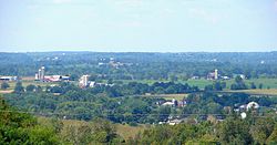

 Stirling-Rawdon
Coordinates: 44°22′N 77°35.5′W / 44.367°N 77.5917°WCoordinates: 44°22′N 77°35.5′W / 44.367°N 77.5917°W Country  Canada
Province  Ontario
County Hastings Established Government – Type Township – Mayor Rodney Cooney – Federal riding Prince Edward—Hastings – Prov. riding Prince Edward—Hastings Area[1] – Land 280.63 km2 (108.4 sq mi) Population (2006)[1] – Total 4,906 – Density 17.5/km2 (45.3/sq mi) Time zone EST (UTC-5) – Summer (DST) EDT (UTC-4) Postal code FSA K0K Area code(s) 613 and 343 Website www.stirling-rawdon.com Stirling-Rawdon is a township in the Canadian province of Ontario, located in Hastings County.
Contents
Communities
The township comprises the communities of Anson, Bonarlaw, Harold, Minto, Mount Pleasant, Sine, Springbrook, Stirling and Wellman.
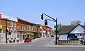
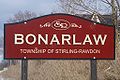
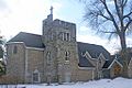
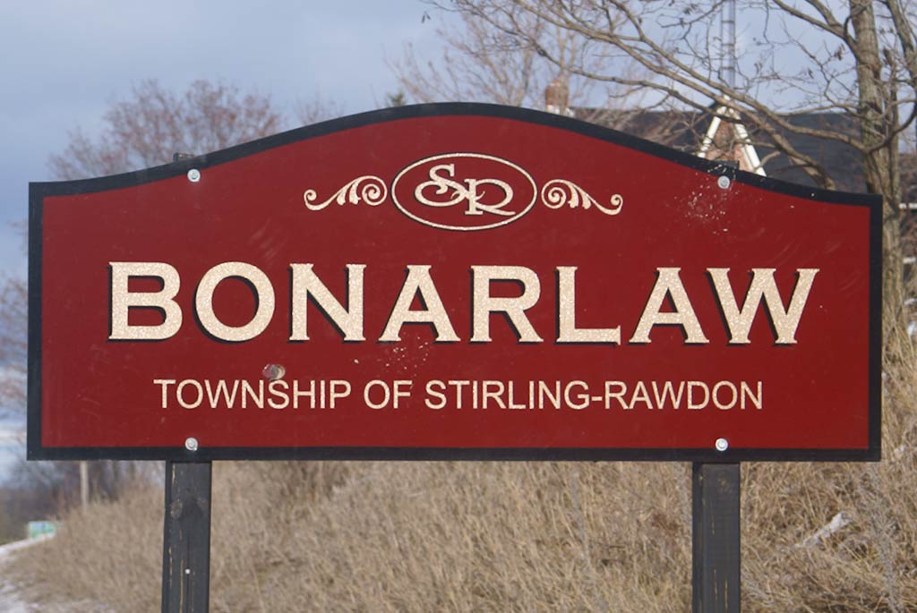
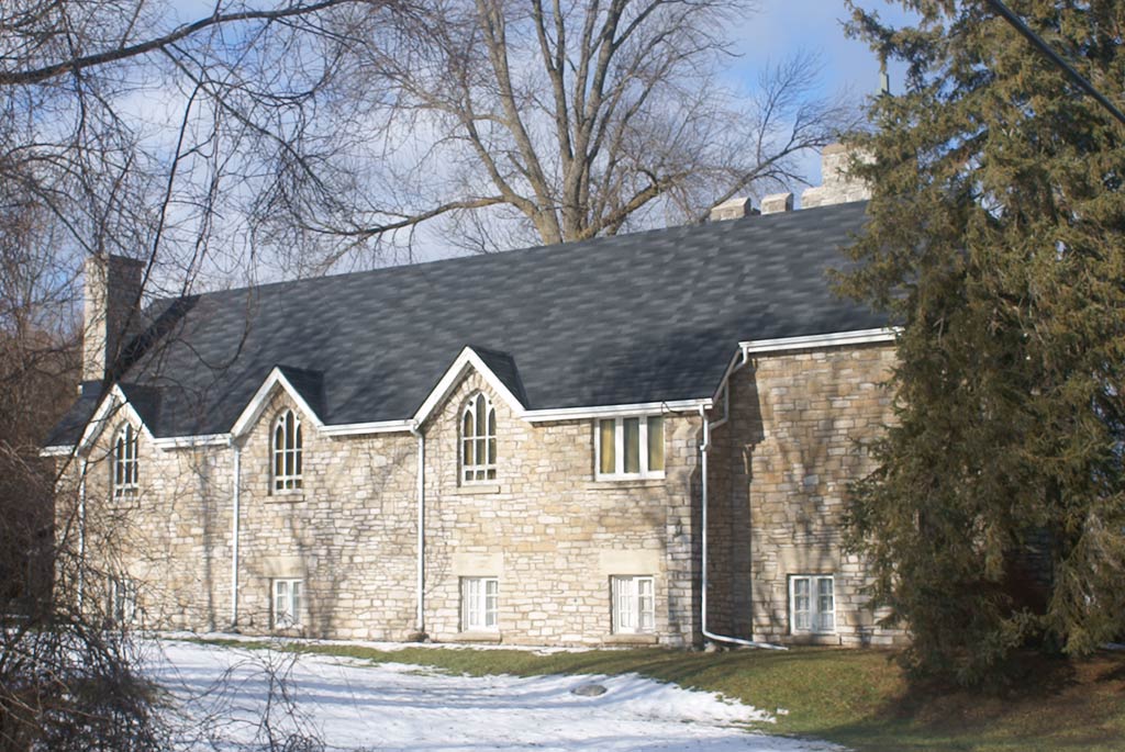
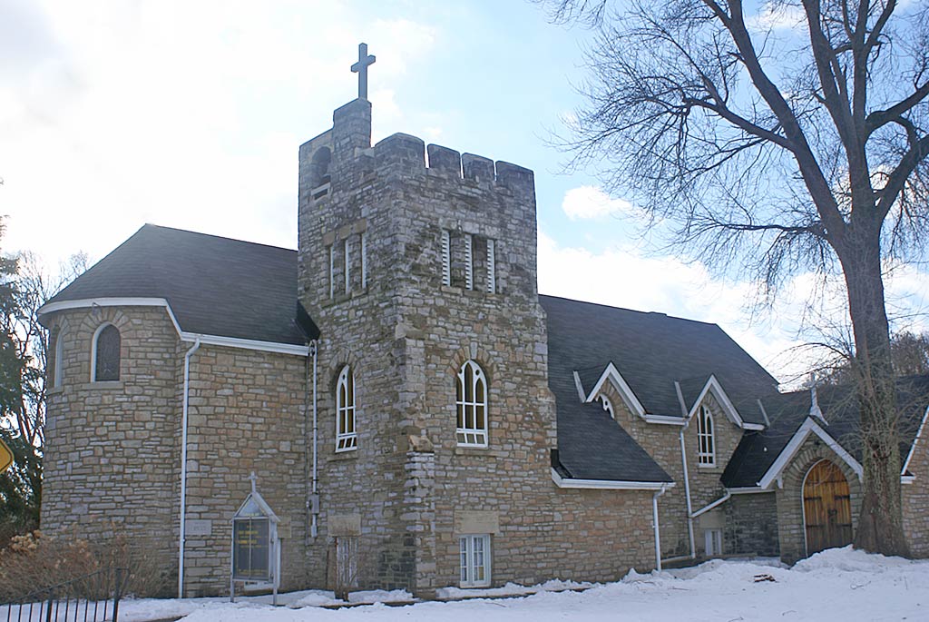
Bonarlaw (44°25′50″N 77°37′40″W / 44.43056°N 77.62778°W) is located north of Springbrook on County Road 14. Bonarlaw is named for British Prime Minister Andrew Bonar Law. The community was formerly known as Big Springs and Bellview. Bonarlaw has an Anglican church, St. Marks, which is located at the intersection of highway 14 and St. Marks Road. It was built in 1933 and is the second church on the site.
The Canadian Pacific Havelock subdivision crossed the Canadian National Maynooth subdivision at grade just west of highway 14. The Maynooth railway line has been abandoned and has been converted to recreational/snowmobile trails. CP Ottawa-Toronto trains called at Bonarlaw station as late as 1964.
Stirling (44°18′00″N 77°33′00″W / 44.300°N 77.550°W) is a located northeast of Trenton and north of Belleville. The village accounts for a significant share of the township's entire population. The village of Stirling has a population of 2,139 (2006 census). The entire municipality has a population of 4,906 (2006 census). Stirling-Rawdon also has the smallest recognized police force in Ontario, with eight police officers and one police chief. Settlements include Anson and Sine.
In 1983, The Heritage Years : A History of Stirling and District (compiled and edited by Rosella Clancy and Blanche Faulkner) was prepared for the 125th anniversary celebrations. This book provides a comprehensive look at the history of Stirling and the surrounding communities in Rawdon and Sidney townships.
In 2008, Stirling celebrated its 150th anniversary.
Notable people
People associated with Stirling include NHL players Rob Ray, Matt Cooke, Eric Manlow and Atlanta Thrashers scout Mark Dobson.[2]
Stirling was the hometown of the Canadian physicist Dr. Andrew Billyard, whose work in string theory helped reshape modern cosmology.[3][4]
Geography
The area around Stirling is made up of farmlands with some forests heavily in sporadic areas with some hills. Rawdon Creek flows near the village centre, the Marsh Creek is to the west and the Trent River with the Trent Canal in the southwest. Its main industry is agriculture with some other businesses. The attractions are River Valley and Stirling's nearby lake Oak Lake which lies south of the community.
Stirling has many events and attractions to draw in tourists. There is a Stirling Festival Theatre with live professional plays. Also, the wonderful Hastings County Museum of Agricultural Heritage with 7 buildings boasting over 35,000 square feet (3,300 m2) of display area. Some of the shops include The Groomery, Rustic Routes, Julia's Woman's Wear, Bling' N Things, Infinity Clothing, West Wings, Wine Kitz, and Mason's. The atmosphere of this community is very friendly. You can meet local folks at Jenny's Country Lane eatery.
Images
-
Stirling
-
Bonarlaw
-

St. Marks Anglican Church, Bonarlaw - South Elevation
-
St. Marks Anglican Church in Bonarlaw
References
- ^ a b "Stirling-Rawdon community profile". 2006 Census data. Statistics Canada. http://www12.statcan.gc.ca/census-recensement/2006/dp-pd/prof/92-591/details/page.cfm?Lang=E&Geo1=CSD&Code1=3512020&Geo2=PR&Code2=35&Data=Count&SearchText=stirling&SearchType=Begins&SearchPR=01&B1=All&Custom=. Retrieved 2011-05-16.
- ^ [1]
- ^ Library and Archives Canada Thesis Collection [2]
- ^ Stanford University's SLAC library list of publications for Dr. Billyard [3]
External links

Havelock-Belmont-Methuen Marmora and Lake Madoc Trent Hills 
Centre Hastings  Stirling-Rawdon

Quinte West Belleville Categories:- Township municipalities in Ontario
- Municipalities in Hastings County, Ontario
-


Wikimedia Foundation. 2010.