- Cookietown, Oklahoma
-
Cookietown — Unincorporated community — Location within the state of Oklahoma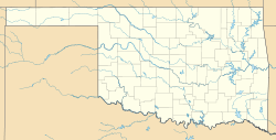
 Cookietown
Coordinates: 34°16′30″N 98°27′12″W / 34.275°N 98.45333°WCoordinates: 34°16′30″N 98°27′12″W / 34.275°N 98.45333°W Country United States State Oklahoma County Cotton Time zone Central (CST) (UTC-6) - Summer (DST) CDT (UTC-5) ZIP codes FIPS code GNIS feature ID Cookietown is a small unincorporated community in Cotton County, Oklahoma, United States. It was named for a mercantile at the crossroads owned by Marvin Cornelius, circa 1928.
References
- Shirk, George H.; Oklahoma Place Names; Norman: University of Oklahoma Press, 1987: ISBN 0-8061-2028-2 .
A place where you can get any kind of cookie you want in the store on the highway. Known mostly for chocolate chip cookies, but sugar cookies as well. Also, the rumored whereabouts of Cookie Gilhrist's son, Cookie Caruana, is said to be in Cookietown, USA! Cookie Caruana made the trek (with the cookie monster) late last August. The reasoning behind this courageous journey was to eat cookies. Upon Cookie Caruan's arrival he was greeted with the largest earthquake to ever hit Oklahoma. Cookie Caruana was not injured, but the cookie monster did not make it. While this monster quake shook some, Cookie Caruana continued on with his cookie eating frenzy.
Municipalities and communities of Cotton County, Oklahoma County seat: Walters City 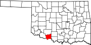
Towns Unincorporated
communitiesAhpeatone | Cookietown | Emerson Center | Fivemile Corner | Hooper | Hulen | Taylor
Categories:- Oklahoma geography stubs
- Populated places in Cotton County, Oklahoma
- Unincorporated communities in Oklahoma


Wikimedia Foundation. 2010.