- Ngapara
-
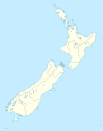
Ngapara is a locality in the north Otago region of New Zealand's South Island.[1] It is located in a rural setting 25 km inland from Oamaru. The name of Ngapara is derived from the Māori word for the "tables" or plateaus of limestone in the area.
Contents
Economy
Agriculture is the most important economic activity, with farming activity consisting primarily of sheep husbandry and growing cereal crops such as wheat.[2] A flour mill was established in the town in 1898. Heavier industrial activity has also taken place around Ngapara, including mining for lignite coal and limestone.[3] In recent years due to the dairy boom happening around New Zealand, there has been an increase in the number of dairy farms in the surrounding area. This is aided by the installment of the Tokarahi Irrigation Scheme in 2006. This scheme has provided a much needed source of water to farmers of the area.
Railway
From 1 April 1877 until 31 July 1959, Ngapara was the terminus of the Ngapara Branch, a branch line railway that left the Main South Line near Oamaru. At its peak, Ngapara station had a small locomotive depot, complete with turntable. Ngapara was one of the first towns on New Zealand's national rail network to lose its passenger service, with a bus substitute introduced in December 1926. In the wake of this decision, the locomotive depot was closed in 1927 and trains operated from Oamaru rather than Ngapara, though the turntable remained inactive and was not removed until the last train, a work train that ran on 10 December 1959, months after the official closure. Some remnants of the railway remain, including the station's platform and loading bank, and the station sign is now affixed to the exterior of the local rugby club's rooms.[4]
School
Ngapara Primary School was opened in 1877, for 5 to 13-year-old children. In latter years it had 23 students and one teacher. When the students reached high school age they were bused into Oamaru to one of its three high schools. In 1998 the school closed, and since then students have mostly attended the primary school in Weston, with some at Duntroon primary school. Much of Ngapara Primary School's buildings and supplies were transferred for use in Weston.[citation needed]
References
- ^ "Place Name Detail: Ngapara". New Zealand Geographic Placenames Database. Land Information New Zealand. http://www.linz.govt.nz/placenames/find-names/topographic-names-db/database/index.aspx?p=16081. Retrieved 30 October 2007.
- ^ Brian Newton Davis and Edward Stewart Dollimore, "Oamaru", 1966 Encyclopaedia of New Zealand, accessed 30 October 2007.
- ^ David Leitch and Brian Scott, Exploring New Zealand's Ghost Railways (Wellington: Grantham House, 1998 [1995]), 85.
- ^ Leitch and Scott, Exploring New Zealand's Ghost Railways, 85-6.
External links
Coordinates: 44°57′S 170°45′E / 44.95°S 170.75°E
Towns of the Waitaki District, Canterbury/Otago, New Zealand Major towns Minor towns Localities Airedale • All Day Bay • Ardgowan • Awamoko • Billys Flat • Black Point • Bortons • Clearburn • Cormacks • Corriedale • Danseys Pass • Earthquakes • Elderslie • Enfield • Five Forks • Flag Swamp • Fuchsia Creek • Georgetown • Glenpark • Goodwood • Green Valley • Hillgrove • Hilderthorpe • Incholme • Inch Valley • Island Cliff • Island Stream • Kaika • Katiki • Kauru Hill • Kia Ora • Kokoamo • Kuriheka • Lake Aviemore • Lake Benmore • Lake Ohau • Lake Waitaki • Lindis Pass • Livingstone • Maerewhenua • Makareao • Maraeweka • Marakerake • Maruakoa • Meadowbank • Moonlight Flat • Morrisons • Nenthorn • Otekaieke • Otepopo • Otiake • Papakaio • Peebles • Pleasant Valley • Pukeraro • Puketapu • Queens Flat • Richmond • Rosebery • Shag Point • Shag Valley • Stoneburn • Strachans • Tapui • Taranui • Te Akatarawa • Teschemakers • Tokarahi • Totara • Trotters Gorge • Waianakarua • Waihemo • Waikaura • Waimotu • Wairunga • Waitangi • Waynes • Wharekuri • Whitecraig • Whitstone • Windsor • Windsor Park •
Categories:- Waitaki District
- Populated places in New Zealand
Wikimedia Foundation. 2010.

