- Dunback
-
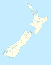
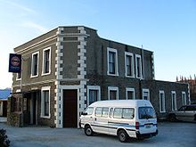
Dunback, formerly Waihemo, is a small town in the Otago region of New Zealand. It is located between Palmerston and Ranfurly on Highway 85. It has a population of about 200 people. Most of these people live in the rural areas near the town.
From 29 August 1885 until 1 January 1968, the town was the terminus of the Dunback Branch, a branch line railway that left the Main South Line in Palmerston. Nowadays, some of the old railway formation, a loading bank at the site of the station yard, and other railway relics can still be found around Dunback.
Coordinates: 45°23′S 170°38′E / 45.383°S 170.633°E
Towns of the Waitaki District, Canterbury/Otago, New Zealand Major towns Minor towns Localities Airedale • All Day Bay • Ardgowan • Awamoko • Billys Flat • Black Point • Bortons • Clearburn • Cormacks • Corriedale • Danseys Pass • Earthquakes • Elderslie • Enfield • Five Forks • Flag Swamp • Fuchsia Creek • Georgetown • Glenpark • Goodwood • Green Valley • Hillgrove • Hilderthorpe • Incholme • Inch Valley • Island Cliff • Island Stream • Kaika • Katiki • Kauru Hill • Kia Ora • Kokoamo • Kuriheka • Lake Aviemore • Lake Benmore • Lake Ohau • Lake Waitaki • Lindis Pass • Livingstone • Maerewhenua • Makareao • Maraeweka • Marakerake • Maruakoa • Meadowbank • Moonlight Flat • Morrisons • Nenthorn • Otekaieke • Otepopo • Otiake • Papakaio • Peebles • Pleasant Valley • Pukeraro • Puketapu • Queens Flat • Richmond • Rosebery • Shag Point • Shag Valley • Stoneburn • Strachans • Tapui • Taranui • Te Akatarawa • Teschemakers • Tokarahi • Totara • Trotters Gorge • Waianakarua • Waihemo • Waikaura • Waimotu • Wairunga • Waitangi • Waynes • Wharekuri • Whitecraig • Whitstone • Windsor • Windsor Park •
Categories:- Populated places in New Zealand
- Waitaki District
- Otago Region geography stubs
Wikimedia Foundation. 2010.


