- Maheno, New Zealand
-
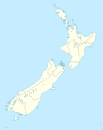
Maheno is a small North Otago township south of Oamaru in New Zealand. The area has 3705 residents, making it the third most populated area in North Otago, behind Oamaru and Oamaru North. A number of the town's streets are named after places in Tyne and Wear, England, such as Whickham, Felling, Heworth and Jarrow.
Contents
Maheno School
Maheno School opened on 11 October 1875,[1] to the delight of many local parents. Peter Williams donated the valuable site in the centre of the town, while £150 had been locally subscribed to add to the £325 granted by the Government.[1] The architect was Thomas Forrester,[2][3] and Robert Peattie became the first teacher from 14 applicants.[1]
On the opening day fifty children were enrolled,[1] and by mid 1876 the school roll stood at 72 pupils.
The school went through numerous improvements starting with an additional classroom in 1883. By 1907 the school needed a third classroom to cope with a growing roll.
- 1946 - The main block of the new school was built
- 1957 - The school swimming pool was built
- 1960 - The infant block was built
- 1963 - The school dental clinic opened
In 2009, the decile 5 school had a roll of 45,[4] not all of the classrooms were being used for teaching. It continues providing quality education for rural children, and remains one of the few businesses left in the Maheno area.
Maheno Rugby
Maheno Shield Club information Full name Maheno Rugby Football Club Website No current website Colours Green and Black Founded 1898 Current details Ground(s) Maheno Domain Competition Citizens Shield Home ground
The Maheno Rugby Football Club play their home games at the Maheno Domain. The Maheno domain is situated along Kakanui Valley road, in Maheno.
Notable players
- Ross Hay (Long serving North Otago player, 2007 Heartland XV member)
- Fepikau Tatafu (Former North Otago player, former Tongan rugby member.)
References
- ^ a b c d "Opening of Maheno School". North Otago Times. 14 October 1875. pp. 2. http://paperspast.natlib.govt.nz/cgi-bin/paperspast?a=d&d=NOT18751014.2.12&e=-------10--1----0-all. Retrieved 2009-09-28.
- ^ "Maheno School". North Otago Times. 5 August 1875. pp. 2. http://paperspast.natlib.govt.nz/cgi-bin/paperspast?a=d&cl=search&d=NOT18750805.2.5&srpos=3&e=---31-12-1875--10--1----0Forrester+maheno+school-all. Retrieved 2009-09-28.
- ^ Greenaway, Richard L. N.. "Forrester, Thomas 1838 - 1907". Dictionary of New Zealand Biography. Ministry for Culture and Heritage. http://www.dnzb.govt.nz/DNZB/alt_essayBody.asp?essayID=2F15. Retrieved 2009-09-28.
- ^ Te Kete Ipurangi schools database: Maheno School
External links
Coordinates: 45°10′S 170°50′E / 45.167°S 170.833°E
Towns of the Waitaki District, Canterbury/Otago, New Zealand Major towns Minor towns Localities Airedale • All Day Bay • Ardgowan • Awamoko • Billys Flat • Black Point • Bortons • Clearburn • Cormacks • Corriedale • Danseys Pass • Earthquakes • Elderslie • Enfield • Five Forks • Flag Swamp • Fuchsia Creek • Georgetown • Glenpark • Goodwood • Green Valley • Hillgrove • Hilderthorpe • Incholme • Inch Valley • Island Cliff • Island Stream • Kaika • Katiki • Kauru Hill • Kia Ora • Kokoamo • Kuriheka • Lake Aviemore • Lake Benmore • Lake Ohau • Lake Waitaki • Lindis Pass • Livingstone • Maerewhenua • Makareao • Maraeweka • Marakerake • Maruakoa • Meadowbank • Moonlight Flat • Morrisons • Nenthorn • Otekaieke • Otepopo • Otiake • Papakaio • Peebles • Pleasant Valley • Pukeraro • Puketapu • Queens Flat • Richmond • Rosebery • Shag Point • Shag Valley • Stoneburn • Strachans • Tapui • Taranui • Te Akatarawa • Teschemakers • Tokarahi • Totara • Trotters Gorge • Waianakarua • Waihemo • Waikaura • Waimotu • Wairunga • Waitangi • Waynes • Wharekuri • Whitecraig • Whitstone • Windsor • Windsor Park •
Categories:- Waitaki District
- Populated places in New Zealand
Wikimedia Foundation. 2010.

