- Otradnoye, Kirovsky District, Leningrad Oblast
-
For other uses, see Otradny (disambiguation).
Otradnoye (English)
Отрадное (Russian)- Town[citation needed] - 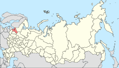
Location of Leningrad Oblast in Russia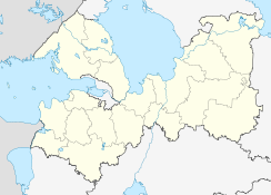
 Otradnoye
Coordinates: 59°46′N 30°47′E / 59.767°N 30.783°ECoordinates: 59°46′N 30°47′E / 59.767°N 30.783°E 

Coat of arms Flag Administrative status Country Russia Federal subject Leningrad Oblast Administrative district Kirovsky District[citation needed] Municipal status Municipal district Kirovsky Municipal District[citation needed] Urban settlement Otradnenskoye Urban Settlement[citation needed] Statistics Population (2002 Census) 21,570 inhabitants[1] Time zone MSD (UTC+04:00)[2] Official website Otradnoye (Russian: Отра́дное) is a town in Kirovsky District of Leningrad Oblast, Russia, located 40 kilometers (25 mi) east of St. Petersburg on the left bank of the Neva River, at its confluence with the Tosna River. Population: 23,874 (2010 Census preliminary results);[3] 21,570 (2002 Census);[1] 22,386 (1989 Census).[4]
A railway leading from Saint Petersburg (Moskovsky Terminal) to Volkhov passes through the town; there are two passenger platforms within town limits: Ivanovskaya and Pella.
History
A village of Ivanovskaya (Ива́новская) at the confluence of the Neva and Tosna was first mentioned in chronicles in 1708. In 1784, the land was acquired by empress Catherine the Great, and a residence known as Pella estate was established. The estate was mostly destroyed on the orders of Paul I.
The modern town was established in 1970 by merging of the urban-type settlements of Otradnoye and Ivanovskoye.
References
- ^ a b Федеральная служба государственной статистики (Federal State Statistics Service) (2004-05-21). "Численность населения России, субъектов Российской Федерации в составе федеральных округов, районов, городских поселений, сельских населённых пунктов – районных центров и сельских населённых пунктов с населением 3 тысячи и более человек (Population of Russia, its federal districts, federal subjects, districts, urban localities, rural localities—administrative centers, and rural localities with population of over 3,000)" (in Russian). Всероссийская перепись населения 2002 года (All-Russia Population Census of 2002). Federal State Statistics Service. http://www.perepis2002.ru/ct/doc/1_TOM_01_04.xls. Retrieved 2010-03-23.
- ^ Правительство Российской Федерации. Постановление №725 от 31 августа 2011 г. «О составе территорий, образующих каждую часовую зону, и порядке исчисления времени в часовых зонах, а также о признании утратившими силу отдельных Постановлений Правительства Российской Федерации». Вступил в силу по истечении 7 дней после дня официального опубликования. Опубликован: "Российская Газета", №197, 6 сентября 2011 г. (Government of the Russian Federation. Resolution #725 of August 31, 2011 On the Composition of the Territories Included into Each Time Zone and on the Procedures of Timekeeping in the Time Zones, as Well as on Abrogation of Several Resolutions of the Government of the Russian Federation. Effective as of after 7 days following the day of the official publication).
- ^ Федеральная служба государственной статистики (Federal State Statistics Service) (2011). "Предварительные итоги Всероссийской переписи населения 2010 года (Preliminary results of the 2010 All-Russian Population Census)" (in Russian). Всероссийская перепись населения 2010 года (All-Russia Population Census of 2010). Federal State Statistics Service. http://www.perepis-2010.ru/results_of_the_census/results-inform.php. Retrieved 2011-04-25.
- ^ "Всесоюзная перепись населения 1989 г. Численность наличного населения союзных и автономных республик, автономных областей и округов, краёв, областей, районов, городских поселений и сёл-райцентров. (All Union Population Census of 1989. Present population of union and autonomous republics, autonomous oblasts and okrugs, krais, oblasts, districts, urban settlements, and villages serving as district administrative centers.)" (in Russian). Всесоюзная перепись населения 1989 года (All-Union Population Census of 1989). Demoscope Weekly (website of the Institute of Demographics of the State University—Higher School of Economics. 1989. http://demoscope.ru/weekly/ssp/rus89_reg.php. Retrieved 2010-03-23.
Cities and towns in Leningrad Oblast Administrative center: Saint Petersburg (administratively separate)  Boksitogorsk · Gatchina · Ivangorod · Kamennogorsk · Kingisepp · Kirishi · Kirovsk · Kommunar · Lodeynoye Pole · Luga · Lyuban · Nikolskoye · Novaya Ladoga · Otradnoye · Pikalyovo · Podporozhye · Primorsk · Priozersk · Sertolovo · Slantsy · Sosnovy Bor · Svetogorsk · Shlisselburg · Syasstroy · Tikhvin · Tosno · Volosovo · Volkhov · Vsevolozhsk · Vyborg · Vysotsk
 Categories:
- Cities and towns in Leningrad Oblast


Wikimedia Foundation. 2010.