- Ocean City Municipal Airport (Maryland)
-
Ocean City Municipal Airport 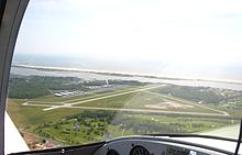
IATA: OCE – ICAO: KOXB – FAA LID: OXB Summary Airport type Public Owner Town of Ocean City Location Ocean City, Maryland Elevation AMSL 11 ft / 3 m Coordinates 38°18′38″N 075°07′26″W / 38.31056°N 75.12389°W Website Runways Direction Length Surface ft m 2/20 3,201 976 Asphalt/Concrete 14/32 4,072 1,241 Asphalt/Concrete Statistics (2006) Aircraft operations 37,000 Based aircraft 62 Source: Federal Aviation Administration[1] Ocean City Municipal Airport (IATA: OCE, ICAO: KOXB, FAA LID: OXB)[2] Opened in October 1960.[3] The airport is a public facility serving Ocean City, a town in Worcester County, Maryland, United States. It is located 3 statute miles (5 km) southwest of town, off Route 611 in West Ocean City.[4]
Although most U.S. airports use the same three-letter location identifier for the FAA and IATA, Ocean City Municipal Airport is assigned OXB by the FAA and OCE by the IATA, (which assigned OXB to Osvaldo Vieira International Airport in Bissau, Guinea-Bissau[5][6]).
Contents
Facilities and aircraft
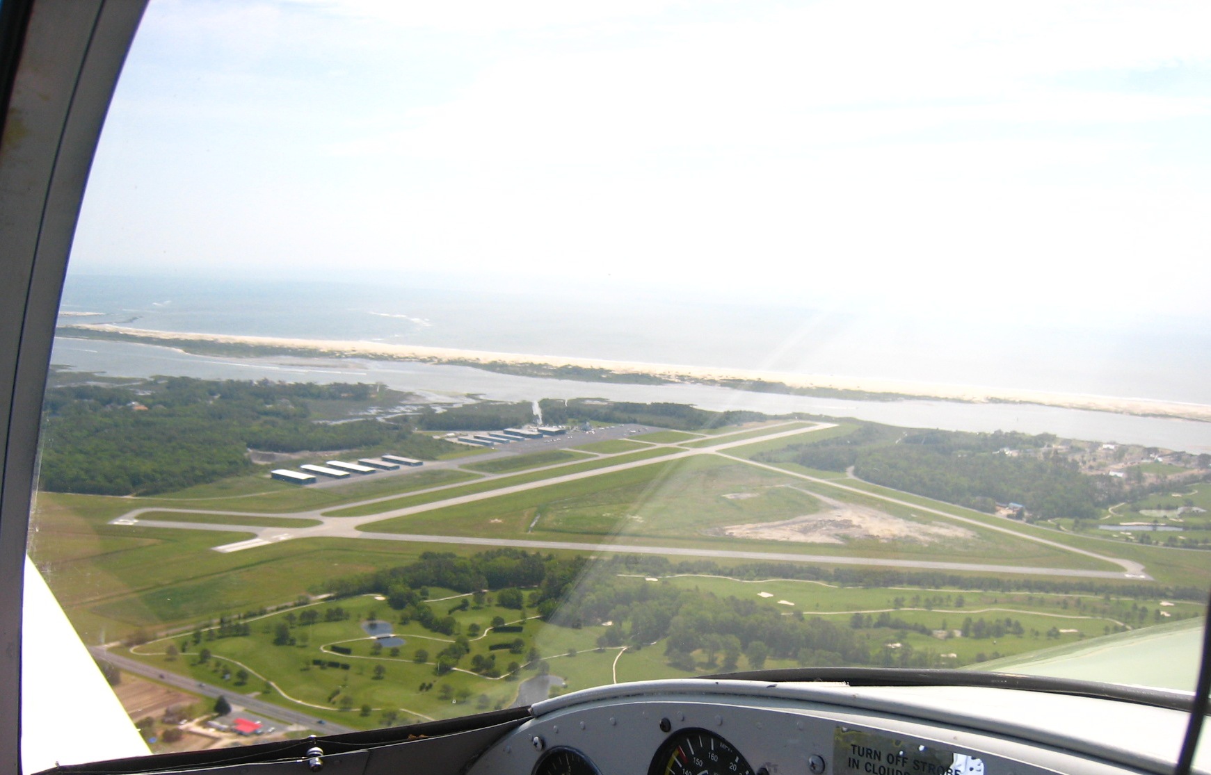
Ocean City Municipal Airport covers an area of 578 acres (234 ha) which contains two asphalt and concrete paved runways: 2/20 measuring 3,201 x 75 ft (976 x 23 m) and 14/32 measuring 4,072 x 75 ft (1,241 x 23 m).[1]
For the 12-month period ending 28 May 2009, the airport had an average of 101 operations per day: 78% Transientgeneral aviation, 20% Local general aviation, and 2% military. There are 44 aircraft based at this airport: 36 single engine, 5 multi-engine, 2 helicopters and 1 ultralight.[7][1]
History
Ocean City airport opened in 1960.
- Solo record - In 1994, Jimmy Mathis piloted a Cessna 172 Solo from Ocean City, Maryland to Long Beach, California, becoming the youngest solo aviator ever to fly cross country.[8]
References
- ^ a b c FAA Airport Master Record for OXB (Form 5010 PDF), effective 2007-07-05
- ^ Great Circle Mapper: OCE / KOXB - Ocean City, Maryland (Ocean City Municipal Airport)
- ^ "OCEAN CITY AIRPORT DUE Commission Says It Will Be Ready About August 1". The Baltimore Sun. July 1, 1959.
- ^ Ocean City Municipal Airport (Ocean City Department of Tourism web site)
- ^ Aviation Safety Network: OXB / GGOV - Bissau, Guinea-Bissau (Osvaldo Vieira International Airport)
- ^ Great Circle Mapper: OXB / GGOV - Bissau, Guinea-Bissau (Oswaldo Vieira International Airport)
- ^ http://www.airnav.com/airport/KOXB
- ^ Brozan, Nadine (2004-07-13). "CHRONICLE". New York Times. http://query.nytimes.com/gst/fullpage.html?res=9E01E3DB133FF930A25754C0A962958260. Retrieved 2008-02-17.
External links
- Resources for this airport:
- AirNav airport information for KOXB
- ASN accident history for OCE
- FlightAware airport information and live flight tracker
- NOAA/NWS latest weather observations
- SkyVector aeronautical chart, Terminal Procedures for KOXB
Categories:- Airports in Maryland
- Transportation in Worcester County, Maryland
- Buildings and structures in Worcester County, Maryland
- Northeastern United States airport stubs
- Maryland geography stubs
Wikimedia Foundation. 2010.