- Orsett
-
Coordinates: 51°31′N 0°22′E / 51.51°N 0.37°E
Orsett 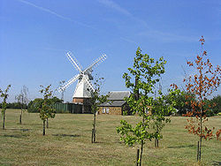
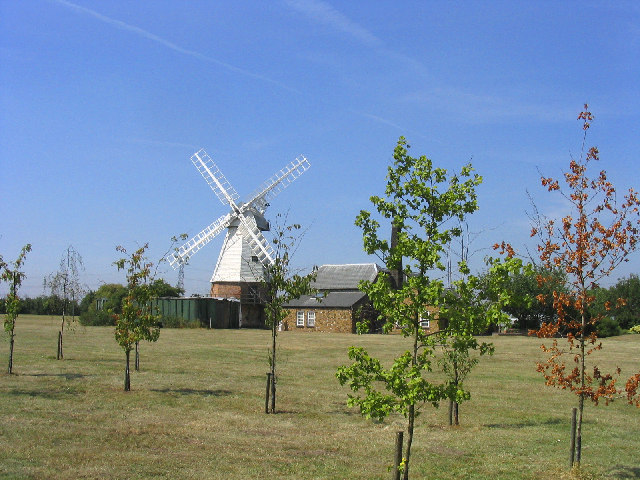
Baker Street Windmill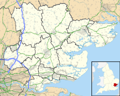
 Orsett
Orsett shown within EssexOS grid reference TQ645815 Unitary authority Thurrock Ceremonial county Essex Region East Country England Sovereign state United Kingdom Post town GRAYS Postcode district RM16 Dialling code 01375 Police Essex Fire Essex Ambulance East of England EU Parliament East of England UK Parliament Thurrock List of places: UK • England • Essex Orsett is a village and ecclesiastical parish located within Thurrock unitary district in Essex, England, situated around 5 km north-east of Grays. All residences within the postal district of Orsett have RM16 3__ postcodes.
Contents
History
It has historically been a primarily agricultural community situated at the southern edge of the old ice age flood plain traversed by the river Mardyke.
Orsett contains a ring and bailey earthwork known locally as Bishop Bonner's palace. On the gravel terrace, there is a neolithic Causewayed enclosure discovered by as a result of crop marks which showed on aerial photographs taken by Dr St Joseph of Cambridge University.[1] It has three concentric ditches with a number of breaks or causeways. The enclosure was used as a burial ground by the Saxons and contained at least three barrows visible on the aerial photo.[2]
Orsett Heath in the south of the parish was formerly part of an extensive area of heathland that included Terrel's Heath.
Layout and Facilities
The centre of Orsett is aligned on an east-west axis along the High Road upon which the parish church of St Giles and All Saints is located along with the animal pound and lock-up opposite Rowley Road. Its former workhouse on Rowley Road was developed into a large modern hospital in the 1960s but has, since the 1980s, been reduced in size once again despite intense local opposition. Most of the former shops in the High Road - e.g. the hairdressers, the Post Office opposite the Church, the butcher's shop, Pigg's store and the store selling honey - along with the blacksmith's in Rowley Road have closed to be replaced by just one convenience store, which itself contains a small post office, succeeding the previous Post Office, which closed due to retirement in mid-2009.[3]
Two public houses have survived in the centre of the village, one being the prize-winning Whitmore Arms, the other the Foxhound, and outside the village centre, Orsett has one additional pub - The Kings Arms. The Orsett Cock, for many years a landmark, closed its doors as a public house in 2010, and is currently (March 2011) undergoing conversion into an Indian restaurant called Voujon.
Orsett also has 2 BP Garages off the A13, which both have M&S convenience stores, whilst the south services also possess a McDonalds fast food establishment.
Orsett is also home to South Essex Wildlife Hospital . Dedicated to putting ‘life’ back into the ‘wild‘, it is a wildlife rescue, rehabilitation and public advice charity. They care for sick and injured wildlife and aim to release animals back into the wild. No injured or sick animal is turned away, staffed only by dedicated volunteers. For more information, visit http://southessexwildlife.org/.
Education
The village's primary school has been located since the mid-19th century in School Lane educating children up to the age of 14 until 1944 and to 11 thereafter.
Buildings
Apart from some small-scale Council housing in Ridgewell Avenue to the North of the High Street, there was no significant growth in residential development until 1954-55 when new properties were erected in School Lane. These were followed by further developments on the former site of the Anglican Rectory (known as Herga Hyll following its sale), off Rectory and Conways Roads and off Rowley Road. During the late 1980s and throughout the 1990s, a new housing estate was built on land that belonged to the old container site, and some of the ex-military Orsett Camp site, between Stanford Road and Orsett Golf Course. This estate is commonly known as Bonners (after Bishop Bonner), and contains Whitmore Hall, the 'Home of Orsett Scouts'. During 2009, planning permission for a further 11 new homes was granted for the westernmost part of this estate.
Most of the former hospital site has been re-developed as housing in the last five years. The redevelopment provided 200 houses, despite being within the green belt and avoided the need to provide affordable housing on the site.[4]
The historic Orsett Hall on Prince Charles's Avenue, the home of the Whitmore family until their estate was sold in the late-1960s, was destroyed by fire in May 2007 but was rebuilt during 2008/09[5]. The exterior design is in keeping with the original Georgian building. It was used for a Help for Heroes charity event on 11th April, 2010. Orsett House is an early-eighteenth-century house off the High Street and on the western edge of the village.
It has a well-equipped village hall at its western end and a centre for the churches in the High Street.
Sport
Orsett is home to a very well known cricket club and to a football club HSSC Orsett. It has one tennis court and a bowling green.
Politics
Orsett is part of a ward that also contains Bulphan and Horndon-on-the-Hill. Politically, it has traditionally been Conservative. Mrs Teresa Gorman, the former Conservative Member of Parliament for the Billericay constituency, is probably Orsett's best known resident.
Notes
- ^ DR Wilson, Air Photo Interpretation (Tempus, 2000)
- ^ Brown, Nigel, ed (2004). The Archaeology of South Essex. Essex County Council. p. 11 and 38. ISBN 1852812451.
- ^ Your Thurrock - A New Sub Post Office for Orsett
- ^ Drivers Jonas Deloitte -consultants to the Basildon & Thurrock Hospital Trust
- ^ The Thurrock Gazette, 1st Nov 2007
External links
 Media related to Orsett at Wikimedia Commons
Thurrock Traditional Parishes in Thurrock Aveley · Bulphan · Chadwell St Mary · Corringham · East Tilbury · Fobbing · Grays · Horndon-on-the-Hill · Little Thurrock · Mucking · Orsett · South Ockendon · Stanford-le-Hope · Stifford · West Thurrock · West TilburyOther places in Thurrock Baker Street · Biggin, Essex · Bill Meroy Creek · Chafford Hundred · Hangman's Wood · Lower Horse · Mardyke (river) · Orsett Heath · Purfleet · Rainham Marshes Nature Reserve · Shell Haven · Terrel's Heath · Tilbury TownCategories:- Villages in Essex
- Thurrock
- Places in Essex listed in the Domesday Book

Wikimedia Foundation. 2010.