- Murgud
-
Murgud — city — Coordinates 16°24′N 74°12′E / 16.4°N 74.2°ECoordinates: 16°24′N 74°12′E / 16.4°N 74.2°E Country India State Maharashtra District(s) Kolhapur Population 9,200 (2001[update]) Time zone IST (UTC+05:30) Area
• 556 metres (1,824 ft)
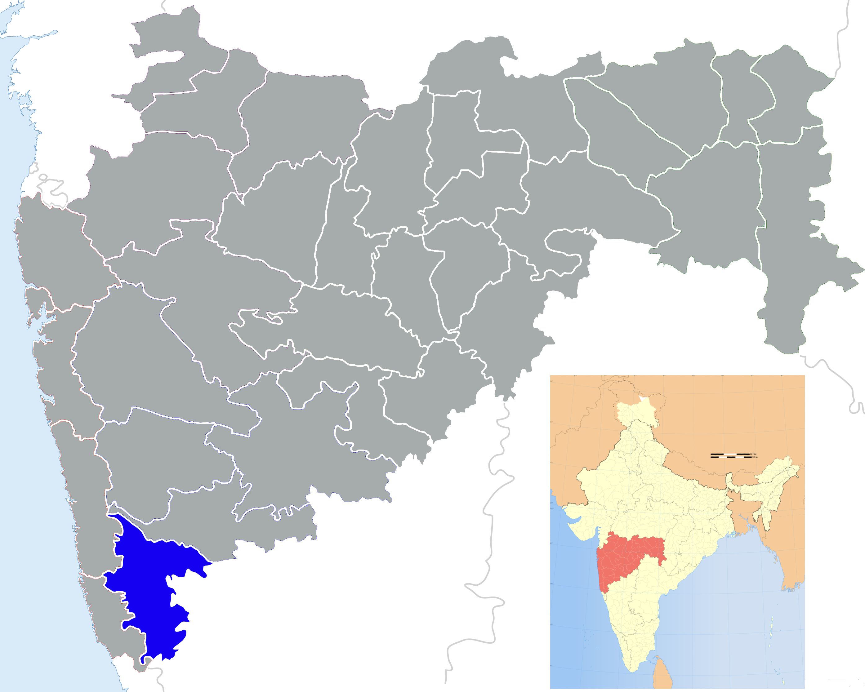
Murgud (Marathi: मुरगुड) is a city and a municipal council in Kolhapur district in the Indian state of Maharashtra.
Geography
Murgud is located at 16°24′N 74°12′E / 16.4°N 74.2°E.[1] It has an average elevation of 556 metres (1824 feet).
The main water source for drinking and farming is Sarpirajirao lake which. It is situated to the east of Murgud. This lake has its own historic background. The major crop in Murgud area is sugarcane, as there is water available year round. As a result, there are a number of sugar factories around the city.Murgud is located in Maharashtra Why it is named as Murgud? Basically Murgud is Kannada word. Mur=Three Gud=Mountain This City (Village) is encompassed between three mountains so it is called Murgud. There were too many freedom fighters one of them is Tukaram Bharmal. The main game is wrestling. There are around 3 to 4 AAkhada’s in Murgud some of them are Lal Aakhada, Jay Shivaraj Talim, Rana Aakhada. Murgud is proud to some people like Ram Sarang who is leading Indian wrestling team. There are few politicians like Sadashiv Mandlik who is from Salokhe gali, Ranjeet and Praveen Patil. The Murgud has very good bodybuilding background. There are few Gyms like Hanuman Mandal Salokhe Galli is famous.Murgud is basically famous for most likable game wrestlig and volleyball.As well as most interesting thing murgud is home town of politics.Currently ruling party of corporation is Mandalik Group and opponenet party is Patil group.From long time these both parties fighting for ruling to maintain their prestige in town.
Demographics
As of the 2001 India census,[2] Murgud had a population of 9200. Males constitute 51% of the population and females 49%. Murgud has an average literacy rate of 73%, higher than the national average of 59.5%: male literacy is 81%, and female literacy is 64%. In Murgud, 11% of the population is under 6 years of age. Both Marathi and Kannada are understood by majority of people here.Murgud is having historical background which dates back to 1600. As of the 2001 India census[2], Murgud had a population of 9200. Males constitute 51% of the population and females 49%. Murgud has an average literacy rate of 73%, higher than the national average of 59.5%: male literacy is 81%, and female literacy is 64%. In Murgud, 11% of the population is under 6 years of age. Both Marathi and Kannada are understood by majority of people here. Murgud – location, longitude, latitude, Altitude, Population.
Murgud municipal council established on September 1, 1921. It is working according to Maharashtra municipal council. Act 1965. According to provision in chapter 3 section 49 (1) (C) (Solid) & chapter 16 the Murgud municipal council is responsible for solid waste
Environmental protection according to provisions of chapter 3 45 (1) (A-B) of this Act. Municipal council implementing Urban waste mgmt rule, 2000.
Murgud is having 11.71 km2. area divided into 17 wards. The population was 10,294 according to 2001 census.
The city produces approx 3 MT of solid waste per day.
The solid waste produced is collected twice in a day in each ward by 58 workers [6 female + 22 male including drivers a municipal employees while 5 female & 25 maler including 2 drivers on contract basis].
The collected waste is transported by a true & 2 tractor trailers. The disposal site is located 1 km away from the centre of city having 1 are area & life span of 10 years. Though the city having 11 km2. area waste is generated & collected from 2 km2. area. The main sources are- Residential – 1.75 Tons. Shops, commercial Institutional - 0.50 Tons Construction - 0.25 Sweeping - 0.25 Hotels Restaurants - 0.25
The municipality uses around 60 Ghamelas, 60 pharadas, 30 brows & 5. Gumboots & Dresses are provided to the workers. Besides this so handcarts (3x2x1.5 feet) are engaged in waste collection.
Cost involved in the SWM- Workers- Wages - 13,62,772 Dress - 1 & 977 Allowance - 11,33,361 Tools & Equipments - 8750 Disinfection - 1564 Transportation Operation & maintenance - 1,60,982 Hand carts - 2,04,940 Insurance - 1,60,182 Contractor wages - 3,56,300 Total 32,60,000 Total length of roads is 13 km having 6-7m breadth Inadequate treatment facility by open gutter & irrigation 80% of the area is covered with gutters open drain type carrying 640m3/day of domestic effluents generated while 20% area having no drainage system along with the effluents generated by88 public latrines & 15 toilets. Solid waste generation sources are 2 primary schools, 2 secondary schools, 2 Junior college & 1 Junior college, 11 Hospitals, 10 medical stores approx 200 commercial shops.
References
- ^ Falling Rain Genomics, Inc - Murgud
- ^ "Census of India 2001: Data from the 2001 Census, including cities, villages and towns (Provisional)". Census Commission of India. Archived from the original on 2004-06-16. http://web.archive.org/web/20040616075334/http://www.censusindia.net/results/town.php?stad=A&state5=999. Retrieved 2008-11-01.
Kolhapur district topics History 
Geography Panchganga RiverCities and towns Monuments Culture Kolhapuri chappalEducation Transport Lok Sabha constituencies Vidhan Sabha constituencies Categories:- Cities and towns in Kolhapur district


Wikimedia Foundation. 2010.