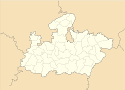
- Multai
-
Multai — city — Coordinates 21°46′N 78°15′E / 21.77°N 78.25°ECoordinates: 21°46′N 78°15′E / 21.77°N 78.25°E Country India State Madhya Pradesh District(s) Betul Population 21,428 (2001[update]) Time zone IST (UTC+05:30) Area
• 749 metres (2,457 ft)
Multai is a town and a nagar panchayat in Betul district in the Indian state of Madhya Pradesh.
Geography
Multai is located at 21°46′N 78°15′E / 21.77°N 78.25°E[1]. It has an average elevation of 749 metres (2457 feet). Multai is the holy place and origin for river Tapti. The daughter of Surya, the Sun God, Mata Tapti is worshiped here in two different temples Prachin Mandir and Naveen Mandir. There is a Kund near to the Prachin Mandir about 10 mts wide and 15 mts long and around 18 feet in depth. And near to Naveen Mandir there is a big pond. On Akhad Saptami Tapti Janmotsav is celebrated and all of Multai town is decorated and a Mela (festival) is organized once in a year. In Multai town there are many ancient Hindu Temples, dedicated to Lord Shiva and Hanuman.There is a belief of people about one Shiva Temple in the town that if it does not rain in the rainy season people used to fill the temple with the Tapti's Holy water and pray for rain and it does rain within 48 hours.
Demographics
As of 2001[update] India census[2], Multai had a population of 21,428. Males constitute 52% of the population and females 48%. Multai has an average literacy rate of 74%, higher than the national average of 59.5%: male literacy is 79%, and female literacy is 68%. In Multai, 13% of the population is under 6 years of age. The oldest school Angle School established in 1907 is stands middle of the city. It is most prosperous city in betul.There is a connectivity between all nearest city Amaravati,Betul,Amla,Nagpur,Chindwara,
Multai is well connected to its neighbouring districts through rail and road. The nearest airport is Nagpur Airport (120 km) and is well connected with frequent buses and taxi services round the clock.
References
- ^ Falling Rain Genomics, Inc - Multai
- ^ "Census of India 2001: Data from the 2001 Census, including cities, villages and towns (Provisional)". Census Commission of India. Archived from the original on 2004-06-16. http://web.archive.org/web/20040616075334/http://www.censusindia.net/results/town.php?stad=A&state5=999. Retrieved 2008-11-01.
Cities and towns in Narmadapuram Division Betul district Harda district Hoshangabad district Babai • Bhilakhedi • Hoshangabad • Itarsi • Mehara Gaon • Ordnance Factory Itarsi • Pachmarhi • Pipariya • Seoni Malwa • SohagpurRelated topics Cities and towns
in other DivisionsCategories:- Populated places on the Tapti River
- Cities and towns in Betul district
- Madhya Pradesh geography stubs
Wikimedia Foundation. 2010.


