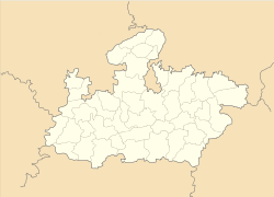
Ordnance Factory Itarsi

Ordnance Factory Itarsi
—  city  —
Ordnance Factory Itarsi
Location of Ordnance Factory Itarsi
in Madhya Pradesh and India
Coordinates 22°34′47″N 77°50′51″E / 22.57972°N 77.8475°E / 22.57972; 77.8475Coordinates: 22°34′47″N 77°50′51″E / 22.57972°N 77.8475°E / 22.57972; 77.8475
Country India
State Madhya Pradesh
District(s) Hoshangabad
Population 10,265 (2001)
Time zone IST (UTC+05:30)

Ordnance Factory Itarsi is a census town in Hoshangabad district in the Indian state of Madhya Pradesh.

Demographics

As of 2001 India census[1], Ordnance Factory Itarsi had a population of 10,265. Males constitute 53% of the population and females 47%. Ordnance Factory Itarsi has an average literacy rate of 86%, higher than the national average of 59.5%: male literacy is 92%, and female literacy is 77%. In Ordnance Factory Itarsi, 7% of the population is under 6 years of age.

References


Wikimedia Foundation. 2010.

Игры ⚽ Нужно сделать НИР?

Look at other dictionaries:

  • Itarsi — Infobox Indian Jurisdiction native name = Itarsi | type = city | latd = 22.62 | longd = 77.75 locator position = right | state name = Madhya Pradesh district = Hoshangabad leader title = MP leader name = Mr. rajendra agrawalaltitude =… …   Wikipedia

  • Indian Ordnance Factories — Les Indian Ordnance Factories, Ordnance Factories Organisation ou Arsenaux/Usines militaires indien(ne)s sont une entreprise publique indienne, regroupant une quarantaine d usines, destinée à produire les armes légères et lourdes en service dans… …   Wikipédia en Français

  • List of India-related articles — Articles (arranged alphabetically) related to India or Indian culture include: NOTOC List of India related topics People are listed by their first names. 1231 SGM 3 STR 2002 Gujarat violence 2005 in India ( previous years ) 2004 Indian Ocean… …   Wikipedia

  • Index of India-related articles — Articles (arranged alphabetically) related to India or Indian culture include: List of India related topics Contents: Top · 0–9 A B C D E F G H I J K L M N O P Q R S T U V W X Y Z People are listed by their first names …   Wikipedia

  • Hoshangabad — This article is about the municipality in Madhya Pradesh, India. For its namesake district, see Hoshangabad District. Hoshangabad   city   …   Wikipedia

  • Mehara Gaon —   city   Coordinates Country India State Madhya Pradesh …   Wikipedia

  • Multai —   city   …   Wikipedia

  • Narmadapuram Division — is one of the administrative divisions in the Indian state of Madhya Pradesh. The division was formally inaugurated on 27 August 2008. It comprises Hoshangabad, Harda, and Betul districts.[1] The three districts were earlier part of Bhopal… …   Wikipedia

  • Narsinghpur — This article is about the municipality in Madhya Pradesh, India. For its namesake district, see Narsinghpur District. Narsinghpur   city   …   Wikipedia

  • List of Kendriya Vidyalaya schools — The List of Kendriya Vidyalaya Schools (KV s) is a list of various individual Kendriya Vidyalayas. The KV schools are a chain of schools run by Kendriya Vidyalaya Sangathan, under the Government of India.tatewise ListAndaman Nicobar Islands*… …   Wikipedia

Share the article and excerpts

Direct link
Do a right-click on the link above
and select “Copy Link”