- Mississippi River (Ontario)
-
Mississippi River 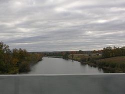
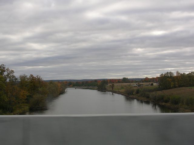
View from Highway 417 near AntrimOrigin Upper Mazinaw Lake Mouth Ottawa River at 45°26′29″N 76°17′07″W / 45.44139°N 76.28528°W Basin countries  Canada
Length 200 km (120 mi) Mouth elevation 74 m (243 ft) Avg. discharge 40 m3/s (1,400 cu ft/s) at mouth Basin area 4,450 km2 (1,720 sq mi) 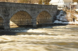 Stone Bridge Over Mississippi River at Pakenham during the spring melt, 2011
 The Mississippi River at Galetta
The Mississippi River is a tributary of the Ottawa River in eastern Ontario in Canada. It is 200 kilometres (120 mi) in length from its source in Upper Mazinaw Lake, has a drainage area of 4,450 square kilometres (1,720 sq mi), and has a mean discharge of 40 cubic metres per second (1,400 cu ft/s). There are more than 250 lakes in the watershed.
From its headwaters at Mazinaw Lake to its confluence at the Ottawa River near Fitzroy Harbour the river drops 323 metres in elevation.
Following a generally southerly course through Mazinaw Lake, the Mississippi River turns eastward and runs a direct east west course to its junction with the Fall River near the Village of Lanark. From this point, it flows north through the towns of Carleton Place, Almonte, Pakenham and Galetta until it enters the Ottawa River.
The river feeds numerous lakes popular for cottagers and tourists and passes through many rural communities. The landscape changes from the lush forest of the Canadian Shield to rolling farmland.
The irregular terrain of the watershed was formed by glaciation, erosion, and the intense forces of volcanic activity.
In the west end of the watershed steep granite and shale formations with shallow soil cover is abundant. In the central region, the landscape changes to rolling hills then to flat fields in the City of Ottawa region. Numerous deposits of leda clay can be found in the eastern portion of the watershed.
Approximately 60% of the watershed is forested; its tree species correspond to the soil type of the area. Many different types of natural habitats, such as dense forests, rocky highlands, agricultural areas and wetlands, meet and overlap to create a home for a very diverse collection of plants, animals and birds in the watershed.
Tributaries include the:- Clyde River
- Indian River
- Fall River
- Bell's Creek
The river originally powered textile mills. Today, it provides hydroelectric power.
The Purdon Conservation Area, a wetland in this river's watershed, contains Canada's largest native colony of showy lady slipper orchids, some 16,000 plants.
The origin of the river's name is something of a mystery; although its current spelling may be derived from that of its much larger American cousin, it is most certainly a corruption of a different native name, as the translation 'great water' would not apply to a relatively minor tributary of the Ottawa, definitely the largest river in the area. Instead, the name may originate from "Mazinaa[bikinigan]-ziibi", Algonquian for '[painted] image river', referring to the pictographs found on Mazinaw Lake, though this is by no means proven.
See also
- Carleton Place, Ontario
- List of Ontario rivers
External links
Categories:- Rivers of Ontario
- Eastern Ontario geography stubs


Wikimedia Foundation. 2010.