Mazinaw Lake

Mazinaw Lake
Mazinaw Lake
Location Addington Highlands, Ontario
Coordinates 44°55′N 77°12′W / 44.917°N 77.2°W / 44.917; -77.2Coordinates: 44°55′N 77°12′W / 44.917°N 77.2°W / 44.917; -77.2
Primary inflows upper Mississippi River
Primary outflows upper Mississippi River
Basin countries Canada
Average depth 41 m (135 ft)
Max. depth 145 m (476 ft)

Mazinaw Lake is a lake in the Addington Highlands north of Kaladar in Eastern Ontario. The lake is situated on the upper Mississippi River. It has a perimeter of 49 km (30 mi)[1] and averages 41 m (135 ft) in depth with a maximum depth of 145 m (476 ft), making it the second deepest lake in Southern Ontario besides the Great Lakes.[citation needed] There is a narrows dividing the lake into the North Mazinaw and South Mazinaw sections. North Mazinaw being the larger and deeper.

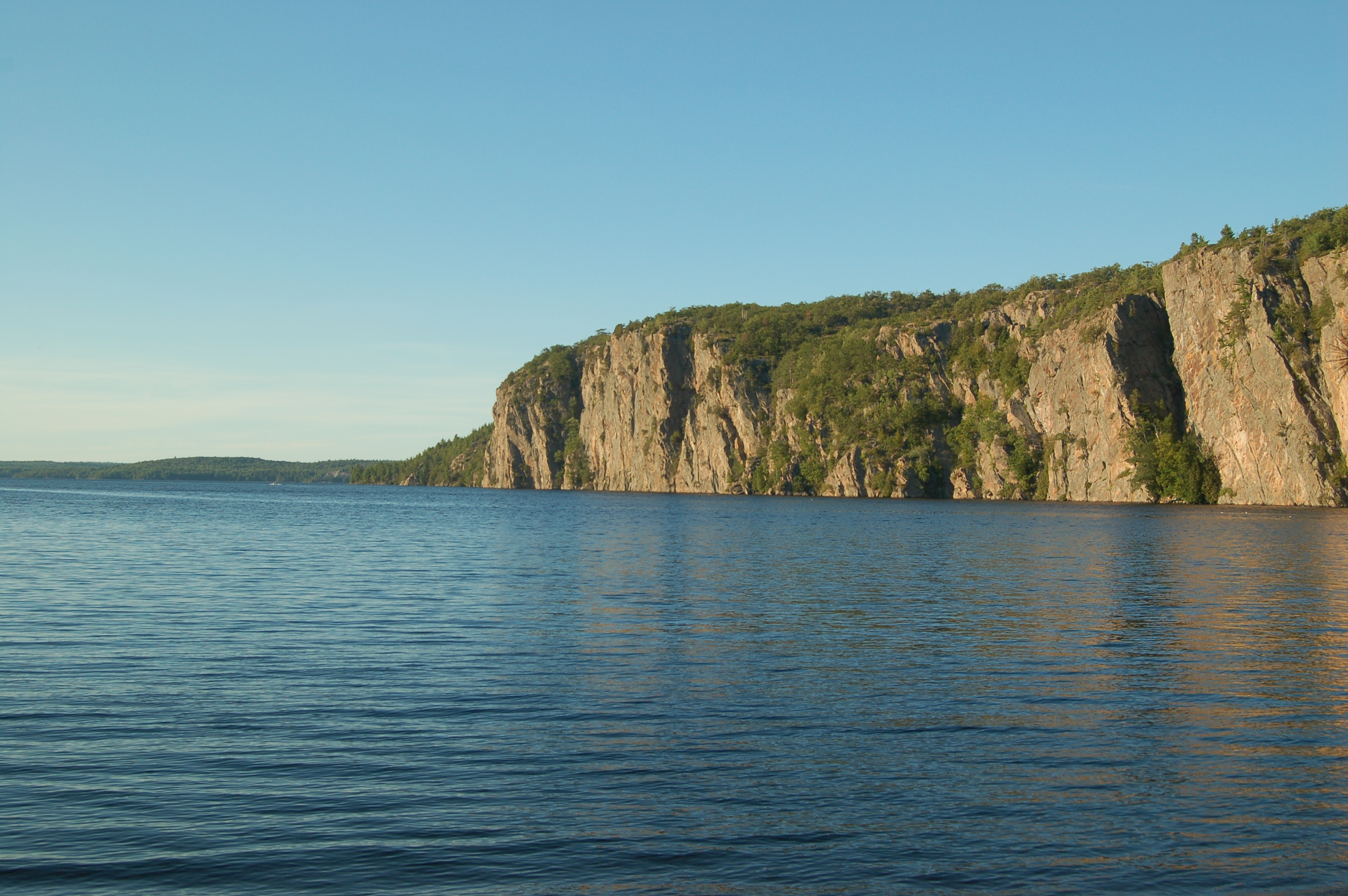
Bon Echo Provincial Park encompasses the central section of the lake, including the narrows between North and South Mazinaw and the Mazinaw Rock formation. The lake's name comes from Mazinaabikinigan-zaaga'igan, meaning "painted-image lake" in Algonkian, referring to the pictographs on Mazinaw Rock which overlooks the lake. The Mazinaw Rock, located on the eastern side of North Mazinaw, features over 260 native pictographs- often confused with petroglyphs – the largest visible collection in Canada - including the Ojibwa trickster figure and culture hero, Nanabush. The rock also contains a tribute to Walt Whitman, inscribed for Flora MacDonald Denison, who ran the Bon Echo Inn on the site of the provincial park during the 1910s.

A dam is located at the outflow of the lake to maintain the level of the lake and to control water flow into the Mississippi River during the spring runoff time.

Mink can be spotted along the northern shores of the lake.

References

  1. ^ http://www.mvc.on.ca/water/maz.pdf


Wikimedia Foundation. 2010.

Игры ⚽ Нужен реферат?

Look at other dictionaries:

  • List of reported lake monsters — Below is a list of lake monsters that have been reported worldwide in lakes, reservoirs, ponds and marshes, containing the names of the lakes and reported lake monsters. River monsters and lagoon monsters are not included, nor are confirmed or… …   Wikipedia

  • Bon Echo Provincial Park — Infobox protected area | name = Bon Echo Provincial Park iucn category = II caption = Bon Echo Provincial Park entrance locator x = locator y = location = Cloyne, Canada nearest city = lat degrees = 44 lat minutes = 54 lat seconds = 14 lat… …   Wikipedia

  • Mississippi River (Ontario) — Mississippi River View from Highway 417 near Antrim Origin Upper Mazinaw Lake Mouth Ottawa River at …   Wikipedia

  • Mississippi River (Ontario) — Mississippi River Der Mississippi River bei AntrimVorlage:Infobox Fluss/KARTE fehlt Daten …   Deutsch Wikipedia

  • Bon Echo hut — The Bon Echo hut is an alpine hut located in Bon Echo Provincial Park on Mazinaw Lake in Ontario. The hut is maintained by the Toronto Section of the Alpine Club of Canada. Coordinates: coord|44|56|28|N|77|12|20|W|This is a day use hut, with no… …   Wikipedia

  • Миссисипи (приток Оттавы) — Не следует путать с Миссисипи (река). У этого термина существуют и другие значения, см. Миссисипи. Вид с автомагистрали 417 близ Антрима …   Википедия

  • List of lakes in Ontario — This is an incomplete list of lakes in Ontario, a province of Canada.A*Lake Abitibi *Agnew Lake *Ahmic Lake *Allumette Lake *Arrowhead Lake *Astrolabe Lake *Attawapiskat LakeB*Balsam Lake *Bamaji Lake *Bark Lake *Bass Lake *Belwood Lake *Lake… …   Wikipedia

  • Addington Highlands, Ontario — Infobox City official name = Township of Addington Highlands other name = native name = nickname = motto = imagesize = image caption = Denbigh flag size = image seal size = image shield = shield size = image blank emblem = blank emblem size =… …   Wikipedia

  • Addington Highlands — Township of Addington Highlands   Town   Denbigh and Denbigh Lake Coordinates …   Wikipedia

  • List of National Historic Sites of Canada in Ontario — Map of all coordinates from Google Map of all coordinates from Bing Export all coordinates as KML …   Wikipedia

Share the article and excerpts

Direct link
Do a right-click on the link above
and select “Copy Link”