Owl Creek Mountains

Owl Creek Mountains
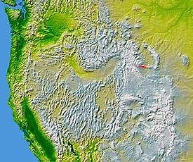
The Owl Creek Mountains in Wyoming are shown highlighted on a map of the western United States

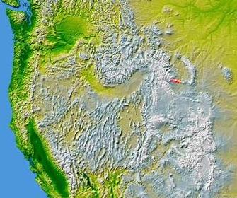
The Owl Creek Mountains are a subrange of the Rocky Mountains in central Wyoming in the United States, running east to west to form a bridge between the Absaroka Range to the northwest and the Bridger Mountains to the east. The range forms the boundary between the Bighorn Basin to the north and the Shoshone Basin to the south. The Wind River passes through the gap between the range and the Bridger Mountains to the east, and becomes the Bighorn River on the north side of the mountains. The high point of the range is 9,665 feet (2,946 m).[1] The range is entirely within the Wind River Indian Reservation.

References

Coordinates: 43°27′N 108°45′W / 43.45°N 108.75°W / 43.45; -108.75


Wikimedia Foundation. 2010.

Игры ⚽ Поможем сделать НИР

Look at other dictionaries:

  • Owl Creek Mountains — Sp Pelėdų Ùpės kalna Ap Owl Creek Mountains L Uolinių kk. dalis, JAV (Vajomingas) …   Pasaulio vietovardžiai. Internetinė duomenų bazė

  • Owl Creek — may refer to: Owl Creek, North Carolina Owl Creek Mountains in the U.S. state of Wyoming Owl Creek, Wyoming Owl Creek, a firing range at Fort Hood, Texas Owl Creek Quickstep, a song written by American songwriter Dan Emmett An Occurrence at Owl… …   Wikipedia

  • Bridger Mountains (Wyoming) — The Bridger Mountains (highest point 8359 ft/2533 m) are a short subrange of the Rocky Mountains, approximately 40 mi (64 km) long, in central Wyoming in the United States. The range forms a bridge between the Owl Creek Mountains to the west and… …   Wikipedia

  • Owl Peak (Wyoming) — Owl Peak Owl Peak center with Webb Canyon at left Elevation 10,612 ft (3,235 m)  …   Wikipedia

  • List of mountains of the United States — This list of mountains of the United States includes significant mountain peaks and high points located in the United States of America arranged alphabetically by state, district, or territory.ignificant mountain peaks and high points Alabama… …   Wikipedia

  • Appalachian Mountains — Appalachian redirects here. For the region, see Appalachia. Appalachian Mountains Appalachians Range …   Wikipedia

  • Santa Ana Mountains — Geobox|Range name=Santa Ana Mountains image caption=San Mateo Canyon Wilderness, southern Santa Ana Mountains, April 2007. country=United States state = California border= region type = Counties region= Orange region1= Riverside region2= San… …   Wikipedia

  • White Deer Hole Creek — Geobox River name = White Deer Hole Creek native name = other name = other name1 = image size = 300 image caption = White Deer Hole Creek near the Fourth Gap of South White Deer Ridge etymology = Lenape language Woap achtu woalhen country =… …   Wikipedia

  • Sand Creek massacre — Part of the Colorado War, American Indian Wars Date November 29, 1864 Location Colorado Territory Present day Kiowa Co …   Wikipedia

  • Balch Creek — Geobox | River name = Balch Creek category = Creek image size = image caption = Waterfall in Macleay Park etymology = Danford Balch, early settler country = United States country state = Oregon district type = County district = Multnomah source …   Wikipedia

Share the article and excerpts

Direct link
Do a right-click on the link above
and select “Copy Link”